Trail On foot Feistritz am Wechsel - Wanderweg Hasleiten - Photo

Tous les sentiers balisés d’Europe PRO

© OpenStreetMap contributors
Length
Length
19.8 km
Max alt
Max alt
907 m
Uphill gradient
Uphill gradient
662 m
Km-Effort
Km-Effort  
29 km
Min alt
Min alt
504 m
Downhill gradient
Downhill gradient
814 m
Boucle
Boucle
No
Signpost
Signpost
Creation date :
2022-02-16 16:46:22.03
Updated on :
2022-03-03 11:50:38.594

(0 Reviews)

On foot
On foot
6h37
Difficulty : Medium

Scan this QR Code to open this trail in the SityTrail application

FREE GPS app for hiking

Logo SityTrail SityTrail

IGN / Geographical institutes

Download SityTrail from the App Store Download SityTrail from Google Play

Logo SityTrail SityTrail World

The world is yours!

Download SityTrail from the App Store Download SityTrail from Google Play Download SityTrail on Huawei AppGallery

About

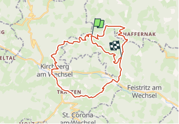
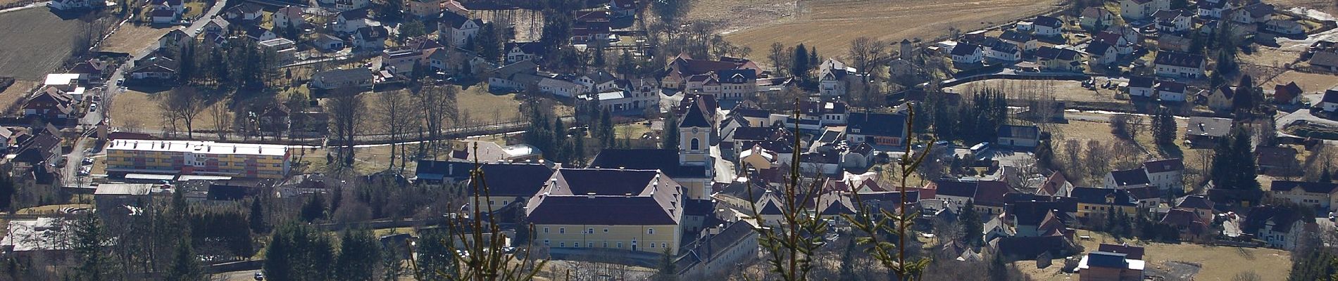
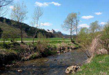
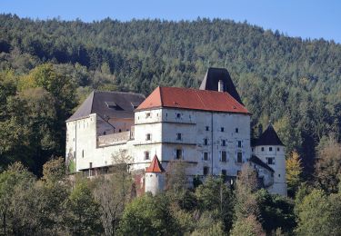
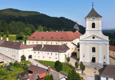
Trail On foot of 19.8 km to be discovered at Lower Austria, Bezirk Neunkirchen, Feistritz am Wechsel. This trail is proposed by SityTrail - itinéraires balisés pédestres.

Description

Trail created by Tourismusverein Kirchberg am Wechsel.

Symbol: blauer Punkt auf weißem Grund

Photos

Positioning

Country:
Austria
Region :
Lower Austria
Department/Province :
Bezirk Neunkirchen
Municipality :
Feistritz am Wechsel
Location:
Unknown
Start:(UTM)
576495 ; 5275299 (33T) N.

Trails nearby

Trail On foot Feistritz am Wechsel - Rundwanderweg 10 (Urban-Kapelle - Feistritz - Grottendorf - Hollabrunn - Urban-Kapelle) - Photo
On foot
PRO

On foot

Easy
Feistritz am Wechsel, Lower Austria, Bezirk Neunkirchen, Austria
11.2 km | 16.6 km-effort
3h 45min
No
Trail On foot Feistritz am Wechsel - Feistritz am Wechsel - Hollabrunn über Steinbichel - Photo
On foot
PRO

On foot

Easy
Feistritz am Wechsel, Lower Austria, Bezirk Neunkirchen, Austria
4.7 km | 7.9 km-effort
1h 47min
No
Trail On foot Gemeinde Kirchberg am Wechsel - Spazierweg 10 - Photo
On foot
PRO

On foot

Easy
Gemeinde Kirchberg am Wechsel, Lower Austria, Bezirk Neunkirchen, Austria
3.5 km | 5.5 km-effort
1h 14min
Yes
Trail On foot Gemeinde Kirchberg am Wechsel - Kirchberg a.W. - Karlhöhe - Photo
On foot
PRO

On foot

Easy
Gemeinde Kirchberg am Wechsel, Lower Austria, Bezirk Neunkirchen, Austria
3.7 km | 7.7 km-effort
1h 44min
No
Trail On foot Gemeinde Kirchberg am Wechsel - Hochwechsel Wanderweg (Kirchberg a.W. - Steyersberger Schwaig - Photo
On foot
PRO

On foot

Difficult
Gemeinde Kirchberg am Wechsel, Lower Austria, Bezirk Neunkirchen, Austria
24 km | 38 km-effort
8h 34min
Yes
Trail On foot Gemeinde St. Corona am Wechsel - Orthof - Herrgottschnitzerhütte - St. Peter - Photo
On foot
PRO

On foot

Easy
Gemeinde St. Corona am Wechsel, Lower Austria, Bezirk Neunkirchen, Austria
5.5 km | 10.7 km-effort
2h 26min
No
Trail On foot Gemeinde Kirchberg am Wechsel - Wanderweg Saurücken - Photo
On foot
PRO

On foot

Easy
Gemeinde Kirchberg am Wechsel, Lower Austria, Bezirk Neunkirchen, Austria
9 km | 13.6 km-effort
3h 5min
Yes
Trail On foot Gemeinde Kirchberg am Wechsel - Kirchberg - Steyersberger Schwaig - Hochwechsel - Photo
On foot
PRO

On foot

Easy
Gemeinde Kirchberg am Wechsel, Lower Austria, Bezirk Neunkirchen, Austria
8.2 km | 16.5 km-effort
3h 44min
No
Trail On foot Gemeinde Kirchberg am Wechsel - Spazierweg 5 - Photo
On foot
PRO

On foot

Easy
Gemeinde Kirchberg am Wechsel, Lower Austria, Bezirk Neunkirchen, Austria
3.4 km | 4.4 km-effort
59min
No


Close
My subscriptions