![](/images/other/stat-length.png)
![Trail On foot Aschau im Chiemgau - Öko-Kultur-Weg - Photo](https://media.geolcdn.com/t/1900/400/f9e0c46c-713d-4420-8056-2cdeb226aa8f.jpeg&format=pjpeg&maxdim=2)
Öko-Kultur-Weg
SityTrail - itinéraires balisés pédestres
Tous les sentiers balisés d’Europe GUIDE+
![Length](/images/other/stat-length.png)
Length
5.4 km
![Max alt](https://static1.geolcdn.com/siteimages/upload/files/1508320355ic_sort_altitude_max_24dp.png)
Max alt
797 m
![Uphill gradient](https://static1.geolcdn.com/siteimages/upload/files/1508320355ic_sort_den_pos_24dp.png)
Uphill gradient
186 m
![Km-Effort](/images/other/stat-length.png)
Km-Effort
7.8 km
![Min alt](https://static1.geolcdn.com/siteimages/upload/files/1508320355ic_sort_altitude_min_24dp.png)
Min alt
702 m
![Downhill gradient](https://static1.geolcdn.com/siteimages/upload/files/1508320355ic_sort_den_neg_24dp.png)
Downhill gradient
175 m
![Boucle](https://static1.geolcdn.com/siteimages/upload/files/16400158638029165_repeat_loop_refresh_sync_direction_icon.png)
Boucle
No
Signpost
Creation date :
2022-02-16 16:26:16.855
Updated on :
2022-02-16 16:26:16.855
![On foot](https://static1.geolcdn.com/sitytour/trail-icons/100.png)
1h46
Difficulty : Easy
![Scan this QR Code to open this trail in the SityTrail application](https://capi.geolives.com/qq0zvz2zws4bq2lad0pu/sitytour/trails/3127132/qr.png?size=200)
FREE GPS app for hiking
About
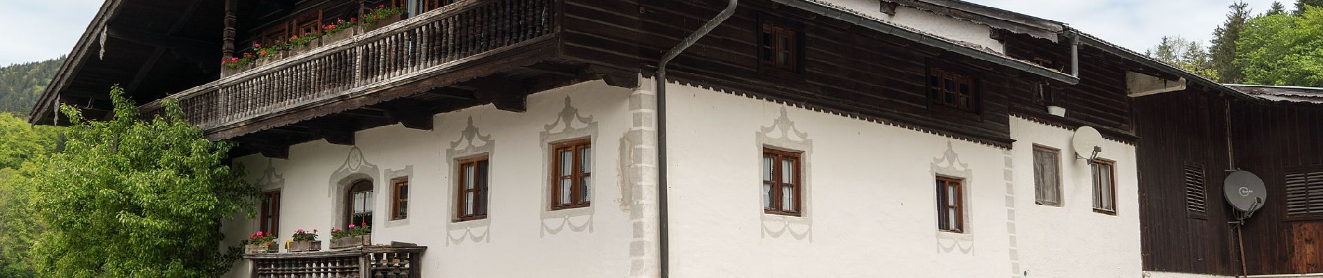
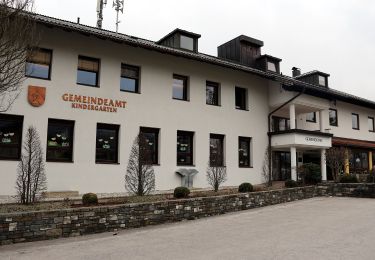
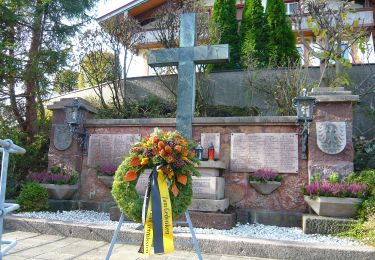
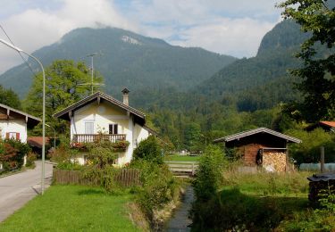
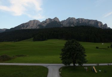
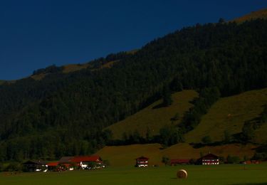
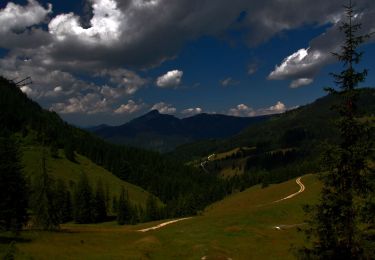
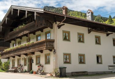
Trail On foot of 5.4 km to be discovered at Bavaria, Landkreis Rosenheim, Aschau im Chiemgau. This trail is proposed by SityTrail - itinéraires balisés pédestres.
Description
Symbol: Holzschilder mit der Aufschrift "Öko-Kultur-Weg" oder hellblaue Blechschilder mit weißen Silouetten von Kirchen, Bäumen und einer Kuh
Positioning
Country:
Germany
Region :
Bavaria
Department/Province :
Landkreis Rosenheim
Municipality :
Aschau im Chiemgau
Location:
Unknown
Start:(Dec)
Start:(UTM)
294117 ; 5284581 (33T) N.
Comments
Trails nearby
![Trail On foot Gemeinde Ebbs - Inn Rundweg - Photo](https://media.geolcdn.com/t/375/260/daaecc59-bccf-4b5e-b34b-e9247f0a0214.jpeg&format=jpg&maxdim=2)
![On foot On foot](https://static1.geolcdn.com/sitytour/trail-icons/100.png)
Inn Rundweg
On foot
Easy
Gemeinde Ebbs,
Tyrol,
Bezirk Kufstein,
Austria
![](/images/other/stat-length.png)
4.1 km | 4.4 km-effort
1h 0min
![](https://static1.geolcdn.com/siteimages/upload/files/16400158638029165_repeat_loop_refresh_sync_direction_icon.png)
Yes
![Trail On foot Gemeinde Ebbs - Fohlenhof-Runde - Photo](https://media.geolcdn.com/t/375/260/7bfaa8d7-3efe-4f72-977e-6085ad17dacd.jpeg&format=jpg&maxdim=2)
![On foot On foot](https://static1.geolcdn.com/sitytour/trail-icons/100.png)
Fohlenhof-Runde
On foot
Easy
Gemeinde Ebbs,
Tyrol,
Bezirk Kufstein,
Austria
![](/images/other/stat-length.png)
7 km | 7.8 km-effort
1h 46min
![](https://static1.geolcdn.com/siteimages/upload/files/16400158638029165_repeat_loop_refresh_sync_direction_icon.png)
Yes
![Trail On foot Gemeinde Niederndorf - Dorf-Runde - Photo](https://media.geolcdn.com/t/375/260/03e886ce-5826-4b05-85ce-81e181092c50.jpeg&format=jpg&maxdim=2)
![On foot On foot](https://static1.geolcdn.com/sitytour/trail-icons/100.png)
Dorf-Runde
On foot
Easy
Gemeinde Niederndorf,
Tyrol,
Bezirk Kufstein,
Austria
![](/images/other/stat-length.png)
3.9 km | 4.4 km-effort
59min
![](https://static1.geolcdn.com/siteimages/upload/files/16400158638029165_repeat_loop_refresh_sync_direction_icon.png)
Yes
![Trail On foot Aschau im Chiemgau - Wanderweg 1 - Von Sachrang nach Walchsee - Photo](https://media.geolcdn.com/t/375/260/d0aba310-1364-491c-a5a9-de0387879306.jpeg&format=jpg&maxdim=2)
![On foot On foot](https://static1.geolcdn.com/sitytour/trail-icons/100.png)
Wanderweg 1 - Von Sachrang nach Walchsee
On foot
Easy
Aschau im Chiemgau,
Bavaria,
Landkreis Rosenheim,
Germany
![](/images/other/stat-length.png)
10 km | 12.7 km-effort
2h 53min
![](https://static1.geolcdn.com/siteimages/upload/files/16400158638029165_repeat_loop_refresh_sync_direction_icon.png)
No
![Trail On foot Gemeinde Walchsee - Wanderweg 35 - Kaiserwinkl - Photo](https://media.geolcdn.com/t/375/260/891aa428-8471-4ed4-a34b-052063f23cb9.jpeg&format=jpg&maxdim=2)
![On foot On foot](https://static1.geolcdn.com/sitytour/trail-icons/100.png)
Wanderweg 35 - Kaiserwinkl
On foot
Easy
Gemeinde Walchsee,
Tyrol,
Bezirk Kufstein,
Austria
![](/images/other/stat-length.png)
4.2 km | 5 km-effort
1h 8min
![](https://static1.geolcdn.com/siteimages/upload/files/16400158638029165_repeat_loop_refresh_sync_direction_icon.png)
No
![Trail On foot Gemeinde Walchsee - Wanderweg 57 - Kaiserwinkl - Photo](https://media.geolcdn.com/t/375/260/3bbf62e6-59dd-48d0-b34a-f3554f0e2cdb.jpeg&format=jpg&maxdim=2)
![On foot On foot](https://static1.geolcdn.com/sitytour/trail-icons/100.png)
Wanderweg 57 - Kaiserwinkl
On foot
Easy
Gemeinde Walchsee,
Tyrol,
Bezirk Kufstein,
Austria
![](/images/other/stat-length.png)
7.6 km | 14.9 km-effort
3h 23min
![](https://static1.geolcdn.com/siteimages/upload/files/16400158638029165_repeat_loop_refresh_sync_direction_icon.png)
No
![Trail On foot Gemeinde Walchsee - Wanderweg 55 - Kaiserwinkl - Photo](https://media.geolcdn.com/t/375/260/4c6e586c-1a0d-4267-9eb4-83ed998b2d2d.jpeg&format=jpg&maxdim=2)
![On foot On foot](https://static1.geolcdn.com/sitytour/trail-icons/100.png)
Wanderweg 55 - Kaiserwinkl
On foot
Easy
Gemeinde Walchsee,
Tyrol,
Bezirk Kufstein,
Austria
![](/images/other/stat-length.png)
4.8 km | 10.2 km-effort
2h 19min
![](https://static1.geolcdn.com/siteimages/upload/files/16400158638029165_repeat_loop_refresh_sync_direction_icon.png)
No
![Trail On foot Gemeinde Walchsee - Wanderweg 53 - Kaiserwinkl - Photo](https://media.geolcdn.com/t/375/260/7bc8affb-edd2-402d-95d0-af7a83c1e0aa.jpeg&format=jpg&maxdim=2)
![On foot On foot](https://static1.geolcdn.com/sitytour/trail-icons/100.png)
Wanderweg 53 - Kaiserwinkl
On foot
Easy
Gemeinde Walchsee,
Tyrol,
Bezirk Kufstein,
Austria
![](/images/other/stat-length.png)
6.1 km | 13.6 km-effort
3h 5min
![](https://static1.geolcdn.com/siteimages/upload/files/16400158638029165_repeat_loop_refresh_sync_direction_icon.png)
No
![Trail On foot Aschau im Chiemgau - Wanderweg 8 - Von Innerwald zum Spitzsteinhaus bzw. Klausenhütte - Photo](https://media.geolcdn.com/t/375/260/7065dbec-1bfa-44b5-81e5-053df54127dd.jpeg&format=jpg&maxdim=2)
![On foot On foot](https://static1.geolcdn.com/sitytour/trail-icons/100.png)
Wanderweg 8 - Von Innerwald zum Spitzsteinhaus bzw. Klausenhütte
On foot
Easy
Aschau im Chiemgau,
Bavaria,
Landkreis Rosenheim,
Germany
![](/images/other/stat-length.png)
4.4 km | 12 km-effort
2h 43min
![](https://static1.geolcdn.com/siteimages/upload/files/16400158638029165_repeat_loop_refresh_sync_direction_icon.png)
No