![](/images/other/stat-length.png)
![Trail On foot Unknown - St. Valentin - Penk - Photo](https://media.geolcdn.com/t/1900/400/29256745-6c6a-445c-8d0a-80210e4c8ec7.jpeg&format=pjpeg&maxdim=2)
St. Valentin - Penk
SityTrail - itinéraires balisés pédestres
Tous les sentiers balisés d’Europe GUIDE+
![Length](/images/other/stat-length.png)
Length
3.2 km
![Max alt](https://static1.geolcdn.com/siteimages/upload/files/1508320355ic_sort_altitude_max_24dp.png)
Max alt
633 m
![Uphill gradient](https://static1.geolcdn.com/siteimages/upload/files/1508320355ic_sort_den_pos_24dp.png)
Uphill gradient
225 m
![Km-Effort](/images/other/stat-length.png)
Km-Effort
5.5 km
![Min alt](https://static1.geolcdn.com/siteimages/upload/files/1508320355ic_sort_altitude_min_24dp.png)
Min alt
419 m
![Downhill gradient](https://static1.geolcdn.com/siteimages/upload/files/1508320355ic_sort_den_neg_24dp.png)
Downhill gradient
14 m
![Boucle](https://static1.geolcdn.com/siteimages/upload/files/16400158638029165_repeat_loop_refresh_sync_direction_icon.png)
Boucle
No
Signpost
Creation date :
2022-02-16 16:22:56.679
Updated on :
2022-03-03 06:58:44.662
![On foot](https://static1.geolcdn.com/sitytour/trail-icons/100.png)
1h14
Difficulty : Easy
![Scan this QR Code to open this trail in the SityTrail application](https://capi.geolives.com/qq0zvz2zws4bq2lad0pu/sitytour/trails/3126842/qr.png?size=200)
FREE GPS app for hiking
About
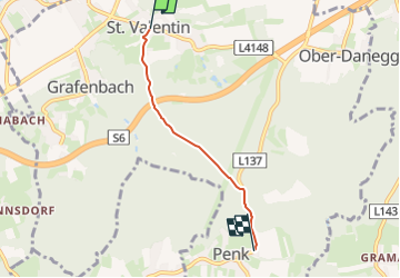
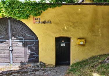
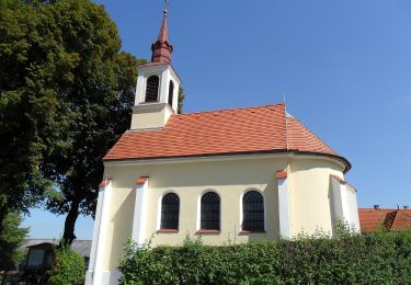
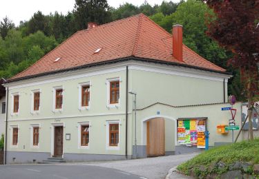
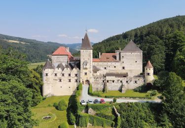
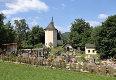
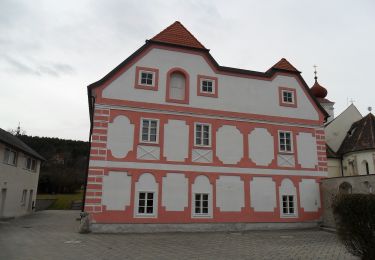
Trail On foot of 3.2 km to be discovered at Lower Austria, Bezirk Neunkirchen. This trail is proposed by SityTrail - itinéraires balisés pédestres.
Description
Trail created by Österreichischer Touristenklub, Sektion Ternitz.
Symbol: gelber, waagerechter Balken
Positioning
Country:
Austria
Region :
Lower Austria
Department/Province :
Bezirk Neunkirchen
Municipality :
Unknown
Location:
Unknown
Start:(Dec)
Start:(UTM)
576325 ; 5281953 (33T) N.
Comments
Trails nearby
![Trail On foot Gemeinde Ternitz - Runnersfun Runde](https://media.geolcdn.com/t/375/260/0ff9c439-8eff-48b2-97d3-d65799d7dcaf.jpeg&format=jpg&maxdim=2)
![On foot On foot](https://static1.geolcdn.com/sitytour/trail-icons/100.png)
Runnersfun Runde "Gfieder Runde" (bei Ternitz)
On foot
Easy
Gemeinde Ternitz,
Lower Austria,
Bezirk Neunkirchen,
Austria
![](/images/other/stat-length.png)
10.5 km | 13.4 km-effort
3h 3min
![](https://static1.geolcdn.com/siteimages/upload/files/16400158638029165_repeat_loop_refresh_sync_direction_icon.png)
No
![Trail On foot Gemeinde Ternitz - Löffler Runde](https://media.geolcdn.com/t/375/260/34e880bc-6d26-46ab-9337-6a350da743eb.jpeg&format=jpg&maxdim=2)
![On foot On foot](https://static1.geolcdn.com/sitytour/trail-icons/100.png)
Löffler Runde "Kalvarienberg Runde" (bei Ternitz)
On foot
Easy
Gemeinde Ternitz,
Lower Austria,
Bezirk Neunkirchen,
Austria
![](/images/other/stat-length.png)
3.9 km | 5.1 km-effort
1h 9min
![](https://static1.geolcdn.com/siteimages/upload/files/16400158638029165_repeat_loop_refresh_sync_direction_icon.png)
Yes
![Trail On foot Gemeinde Enzenreith - Nemec Runde (Gloggnitz) - Photo](https://media.geolcdn.com/t/375/260/b59b1221-cf9e-4aa2-9247-ce58e3d52666.jpeg&format=jpg&maxdim=2)
![On foot On foot](https://static1.geolcdn.com/sitytour/trail-icons/100.png)
Nemec Runde (Gloggnitz)
On foot
Easy
Gemeinde Enzenreith,
Lower Austria,
Bezirk Neunkirchen,
Austria
![](/images/other/stat-length.png)
6.4 km | 7.1 km-effort
1h 36min
![](https://static1.geolcdn.com/siteimages/upload/files/16400158638029165_repeat_loop_refresh_sync_direction_icon.png)
Yes
![Trail On foot Gemeinde Kirchberg am Wechsel - Kranichberg Schloß - Egg - Raach - Photo](https://media.geolcdn.com/t/375/260/8cb61248-f720-4028-a202-b65a40f0f104.jpeg&format=jpg&maxdim=2)
![On foot On foot](https://static1.geolcdn.com/sitytour/trail-icons/100.png)
Kranichberg Schloß - Egg - Raach
On foot
Easy
Gemeinde Kirchberg am Wechsel,
Lower Austria,
Bezirk Neunkirchen,
Austria
![](/images/other/stat-length.png)
4.5 km | 7.1 km-effort
1h 36min
![](https://static1.geolcdn.com/siteimages/upload/files/16400158638029165_repeat_loop_refresh_sync_direction_icon.png)
No
![Trail On foot Gemeinde Enzenreith - Schwarzaweg (Wörth) - Photo](https://media.geolcdn.com/t/375/260/bde41f7d-6625-4e03-8ea1-62ff7742e099.jpeg&format=jpg&maxdim=2)
![On foot On foot](https://static1.geolcdn.com/sitytour/trail-icons/100.png)
Schwarzaweg (Wörth)
On foot
Easy
Gemeinde Enzenreith,
Lower Austria,
Bezirk Neunkirchen,
Austria
![](/images/other/stat-length.png)
3.5 km | 3.8 km-effort
52min
![](https://static1.geolcdn.com/siteimages/upload/files/16400158638029165_repeat_loop_refresh_sync_direction_icon.png)
No
![Trail On foot Gemeinde Warth - Haßbach - Ödenkirchen - Photo](https://media.geolcdn.com/t/375/260/f3dac0c1-1617-42b2-b198-f8316af0fe29.jpeg&format=jpg&maxdim=2)
![On foot On foot](https://static1.geolcdn.com/sitytour/trail-icons/100.png)
Haßbach - Ödenkirchen
On foot
Easy
Gemeinde Warth,
Lower Austria,
Bezirk Neunkirchen,
Austria
![](/images/other/stat-length.png)
4 km | 7.8 km-effort
1h 47min
![](https://static1.geolcdn.com/siteimages/upload/files/16400158638029165_repeat_loop_refresh_sync_direction_icon.png)
No
![Trail On foot Gemeinde Warth - Haßbach - Urbankapelle - Feistritz - Photo](https://media.geolcdn.com/t/375/260/4a86f957-fcc5-402a-917f-df6cd752d245.jpeg&format=jpg&maxdim=2)
![On foot On foot](https://static1.geolcdn.com/sitytour/trail-icons/100.png)
Haßbach - Urbankapelle - Feistritz
On foot
Easy
Gemeinde Warth,
Lower Austria,
Bezirk Neunkirchen,
Austria
![](/images/other/stat-length.png)
8.5 km | 13.5 km-effort
3h 3min
![](https://static1.geolcdn.com/siteimages/upload/files/16400158638029165_repeat_loop_refresh_sync_direction_icon.png)
No
![Trail On foot Gemeinde Warth - Haßbach - Talarhof - Photo](https://media.geolcdn.com/t/375/260/cc6cca82-35a2-4996-bd5c-f49be613b184.jpeg&format=jpg&maxdim=2)
![On foot On foot](https://static1.geolcdn.com/sitytour/trail-icons/100.png)
Haßbach - Talarhof
On foot
Easy
Gemeinde Warth,
Lower Austria,
Bezirk Neunkirchen,
Austria
![](/images/other/stat-length.png)
5.8 km | 8.7 km-effort
1h 58min
![](https://static1.geolcdn.com/siteimages/upload/files/16400158638029165_repeat_loop_refresh_sync_direction_icon.png)
No
![Trail On foot - Rundweg Gemeinde (Penk) - Photo](https://media.geolcdn.com/t/375/260/29256745-6c6a-445c-8d0a-80210e4c8ec7.jpeg&format=jpg&maxdim=2)
![On foot On foot](https://static1.geolcdn.com/sitytour/trail-icons/100.png)
Rundweg Gemeinde (Penk)
On foot
Easy
,
Lower Austria,
Bezirk Neunkirchen,
Austria
![](/images/other/stat-length.png)
11.2 km | 15.2 km-effort
3h 27min
![](https://static1.geolcdn.com/siteimages/upload/files/16400158638029165_repeat_loop_refresh_sync_direction_icon.png)
No