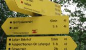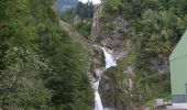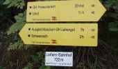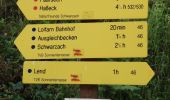

St. Veit Schattseitweg
SityTrail - itinéraires balisés pédestres
Tous les sentiers balisés d’Europe GUIDE+

Length
8.8 km

Max alt
768 m

Uphill gradient
158 m

Km-Effort
11.4 km

Min alt
595 m

Downhill gradient
302 m
Boucle
No
Signpost
Creation date :
2022-02-16 16:21:57.784
Updated on :
2022-03-03 06:27:32.789
2h34
Difficulty : Easy

FREE GPS app for hiking
About
Trail On foot of 8.8 km to be discovered at Salzburg, Bezirk Zell am See, Lend. This trail is proposed by SityTrail - itinéraires balisés pédestres.
Description
Trail created by TVB St. Veit - Schwarzach.
Symbol: rot-weiss-rot 45
Positioning
Country:
Austria
Region :
Salzburg
Department/Province :
Bezirk Zell am See
Municipality :
Lend
Location:
Unknown
Start:(Dec)
Start:(UTM)
353106 ; 5239634 (33T) N.
Comments
Trails nearby
Feroli-Moaralm


On foot
Easy
Dienten am Hochkönig,
Salzburg,
Bezirk Zell am See,
Austria

9.1 km | 17 km-effort
3h 52min
No
Goldegg-Schwarzach über Buchenkopf


On foot
Easy
Goldegg,
Salzburg,
Bezirk St. Johann im Pongau,
Austria

4.3 km | 6.2 km-effort
1h 24min
No
Urpass-Stötzlbergalm-Hochegg


On foot
Easy
Sankt Veit im Pongau,
Salzburg,
Bezirk St. Johann im Pongau,
Austria

8.9 km | 19.6 km-effort
4h 26min
No

Urpass-Gamskögerl-Hochegg


On foot
Easy
Sankt Veit im Pongau,
Salzburg,
Bezirk St. Johann im Pongau,
Austria

7.4 km | 16.6 km-effort
3h 46min
No
Meiselsteinalm-Gamskögerl


On foot
Easy
Goldegg,
Salzburg,
Bezirk St. Johann im Pongau,
Austria

4.2 km | 9.1 km-effort
2h 3min
No
Meiselsteinalm


On foot
Easy
Goldegg,
Salzburg,
Bezirk St. Johann im Pongau,
Austria

8.1 km | 13.9 km-effort
3h 10min
No
Goldegg-St. Veit über Urpass


On foot
Easy
Goldegg,
Salzburg,
Bezirk St. Johann im Pongau,
Austria

5 km | 7.6 km-effort
1h 43min
No

Goldegg-Schwarzach über Schernberg


On foot
Easy
Goldegg,
Salzburg,
Bezirk St. Johann im Pongau,
Austria

4.5 km | 6.6 km-effort
1h 30min
No
Goldegg-St. Veit Stausee


On foot
Easy
Goldegg,
Salzburg,
Bezirk St. Johann im Pongau,
Austria

5.2 km | 7.7 km-effort
1h 44min
No


 SityTrail


