Trail On foot Gemeinde Kirchberg am Wechsel - Panorama Wanderweg (Kirchberg a.W.) - Photo

Tous les sentiers balisés d’Europe GUIDE+

© OpenStreetMap contributors
Length
Length
16 km
Max alt
Max alt
960 m
Uphill gradient
Uphill gradient
781 m
Km-Effort
Km-Effort  
26 km
Min alt
Min alt
559 m
Downhill gradient
Downhill gradient
796 m
Boucle
Boucle
Yes
Signpost
Signpost
Creation date :
2022-02-16 16:20:48.951
Updated on :
2022-03-03 05:41:42.215

(0 Reviews)

On foot
On foot
6h01
Difficulty : Medium

Scan this QR Code to open this trail in the SityTrail application

FREE GPS app for hiking

Logo SityTrail SityTrail

IGN / Geographical institutes

Download SityTrail from the App Store Download SityTrail from Google Play

Logo SityTrail SityTrail World

The world is yours!

Download SityTrail from the App Store Download SityTrail from Google Play Download SityTrail on Huawei AppGallery

About

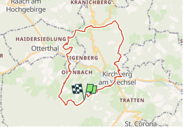
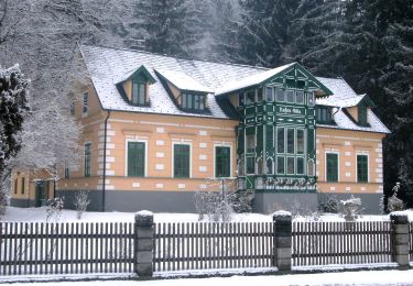
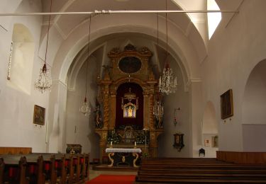
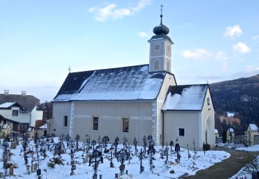
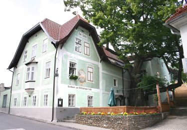
Trail On foot of 16 km to be discovered at Lower Austria, Bezirk Neunkirchen, Gemeinde Kirchberg am Wechsel. This trail is proposed by SityTrail - itinéraires balisés pédestres.

Description

Symbol: gelber Punkt

Elevation profile

Photos

Positioning

Country:
Austria
Region :
Lower Austria
Department/Province :
Bezirk Neunkirchen
Municipality :
Gemeinde Kirchberg am Wechsel
Location:
Unknown
Start:(UTM)
572900 ; 5272275 (33T) N.

Trails nearby

Trail On foot Gemeinde Kirchberg am Wechsel - Spazierweg 10 - Photo
On foot
GUIDE+

On foot

Easy
Gemeinde Kirchberg am Wechsel, Lower Austria, Bezirk Neunkirchen, Austria
3.5 km | 5.5 km-effort
1h 14min
Yes
Trail On foot Gemeinde Kirchberg am Wechsel - Kirchberg a.W. - Karlhöhe - Photo
On foot
GUIDE+

On foot

Easy
Gemeinde Kirchberg am Wechsel, Lower Austria, Bezirk Neunkirchen, Austria
3.7 km | 7.7 km-effort
1h 44min
No
Trail On foot Gemeinde Kirchberg am Wechsel - Hochwechsel Wanderweg (Kirchberg a.W. - Steyersberger Schwaig - Photo
On foot
GUIDE+

On foot

Difficult
Gemeinde Kirchberg am Wechsel, Lower Austria, Bezirk Neunkirchen, Austria
24 km | 38 km-effort
8h 34min
Yes
Trail On foot Gemeinde St. Corona am Wechsel - St. Corona - Almrauschhütte - Kampsteiner Schwaig - Herrgottschnitzerhütte - Simashütte - Orthof - Photo
On foot
GUIDE+

On foot

Easy
Gemeinde St. Corona am Wechsel, Lower Austria, Bezirk Neunkirchen, Austria
5.2 km | 9.8 km-effort
2h 13min
No
Trail On foot Gemeinde St. Corona am Wechsel - Unternberg - Gasthof Hansl am Oad - St. Peter - Photo
On foot
GUIDE+

On foot

Easy
Gemeinde St. Corona am Wechsel, Lower Austria, Bezirk Neunkirchen, Austria
4 km | 6.4 km-effort
1h 26min
No
Trail On foot Gemeinde St. Corona am Wechsel - Orthof - St. Peter - Photo
On foot
GUIDE+

On foot

Easy
Gemeinde St. Corona am Wechsel, Lower Austria, Bezirk Neunkirchen, Austria
3.7 km | 5.8 km-effort
1h 19min
No
Trail On foot Gemeinde St. Corona am Wechsel - Orthof - Herrgottschnitzerhütte - St. Peter - Photo
On foot
GUIDE+

On foot

Easy
Gemeinde St. Corona am Wechsel, Lower Austria, Bezirk Neunkirchen, Austria
5.5 km | 10.7 km-effort
2h 26min
No
Trail On foot Gemeinde Kirchberg am Wechsel - Wanderweg Saurücken - Photo
On foot
GUIDE+

On foot

Easy
Gemeinde Kirchberg am Wechsel, Lower Austria, Bezirk Neunkirchen, Austria
9 km | 13.6 km-effort
3h 5min
Yes
Trail On foot Gemeinde Kirchberg am Wechsel - Kirchberg - Steyersberger Schwaig - Hochwechsel - Photo
On foot
GUIDE+

On foot

Easy
Gemeinde Kirchberg am Wechsel, Lower Austria, Bezirk Neunkirchen, Austria
8.2 km | 16.5 km-effort
3h 44min
No


Close
My subscriptions