![](/images/other/stat-length.png)
![Trail On foot Unknown - Stadtwanderweg 2 - Hermannskogel - Photo](https://media.geolcdn.com/t/1900/400/1d1836b8-18c0-4125-b5e8-4ab3d228e642.jpeg&format=pjpeg&maxdim=2)
Stadtwanderweg 2 - Hermannskogel
SityTrail - itinéraires balisés pédestres
Tous les sentiers balisés d’Europe GUIDE+
![Length](/images/other/stat-length.png)
![Max alt](https://static1.geolcdn.com/siteimages/upload/files/1508320355ic_sort_altitude_max_24dp.png)
![Uphill gradient](https://static1.geolcdn.com/siteimages/upload/files/1508320355ic_sort_den_pos_24dp.png)
![Km-Effort](/images/other/stat-length.png)
![Min alt](https://static1.geolcdn.com/siteimages/upload/files/1508320355ic_sort_altitude_min_24dp.png)
![Downhill gradient](https://static1.geolcdn.com/siteimages/upload/files/1508320355ic_sort_den_neg_24dp.png)
![Boucle](https://static1.geolcdn.com/siteimages/upload/files/16400158638029165_repeat_loop_refresh_sync_direction_icon.png)
![On foot](https://static1.geolcdn.com/sitytour/trail-icons/100.png)
3h21
Difficulty : Easy
![Scan this QR Code to open this trail in the SityTrail application](https://capi.geolives.com/qq0zvz2zws4bq2lad0pu/sitytour/trails/3126420/qr.png?size=200)
FREE GPS app for hiking
About
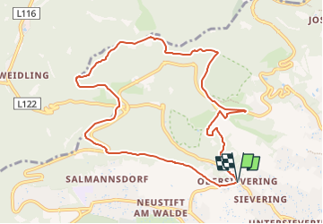
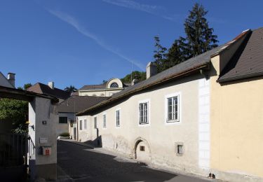
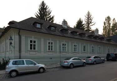
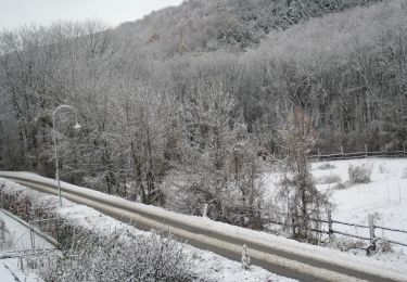
Trail On foot of 9.8 km to be discovered at Vienna, Unknown, Unknown. This trail is proposed by SityTrail - itinéraires balisés pédestres.
Description
Trail created by Stadt Wien (Forstamt).
http://wiki.openstreetmap.org/index.php?title=WikiProject_Austria/Wanderwege
Website: https://www.wien.gv.at/umwelt/wald/freizeit/wandern/wege/wanderweg2.html
Positioning
Comments
Trails nearby
![Trail On foot Gemeinde Klosterneuburg - Klosterneuburg - Hohenauer Wiese (Adolf Robl Weg) - Photo](https://media.geolcdn.com/t/375/260/0ad0fdf4-6d13-42e8-a837-bd5f989cca6c.jpeg&format=jpg&maxdim=2)
![On foot On foot](https://static1.geolcdn.com/sitytour/trail-icons/100.png)
On foot
![](/images/other/stat-length.png)
![](https://static1.geolcdn.com/siteimages/upload/files/16400158638029165_repeat_loop_refresh_sync_direction_icon.png)
![Trail On foot Gemeinde Klosterneuburg - Weidling - Kierling (Dr. Walter Brandstetter Weg) - Photo](https://media.geolcdn.com/t/375/260/4443d887-bb67-409e-9884-c1e7d6cd8438.jpeg&format=jpg&maxdim=2)
![On foot On foot](https://static1.geolcdn.com/sitytour/trail-icons/100.png)
On foot
![](/images/other/stat-length.png)
![](https://static1.geolcdn.com/siteimages/upload/files/16400158638029165_repeat_loop_refresh_sync_direction_icon.png)
![Trail On foot Gemeinde Klosterneuburg - Weidling - Hohenauer Wiese - Photo](https://media.geolcdn.com/t/375/260/a3fef88e-6ffd-425c-81bc-63c3658ae9d6.jpeg&format=jpg&maxdim=2)
![On foot On foot](https://static1.geolcdn.com/sitytour/trail-icons/100.png)
On foot
![](/images/other/stat-length.png)
![](https://static1.geolcdn.com/siteimages/upload/files/16400158638029165_repeat_loop_refresh_sync_direction_icon.png)
![Trail On foot Unknown - Kahlenbergerdorfer Weinrundwanderweg - Photo](https://media.geolcdn.com/t/375/260/e218559e-5d8c-463c-80d9-0b8152eec5ac.jpeg&format=jpg&maxdim=2)
![On foot On foot](https://static1.geolcdn.com/sitytour/trail-icons/100.png)
On foot
![](/images/other/stat-length.png)
![](https://static1.geolcdn.com/siteimages/upload/files/16400158638029165_repeat_loop_refresh_sync_direction_icon.png)
![Trail On foot Unknown - Grüß di a Gott Wirt - Cobenzl - Photo](https://media.geolcdn.com/t/375/260/0343ff54-7543-4905-afff-c2d6aabb810a.jpeg&format=jpg&maxdim=2)
![On foot On foot](https://static1.geolcdn.com/sitytour/trail-icons/100.png)
On foot
![](/images/other/stat-length.png)
![](https://static1.geolcdn.com/siteimages/upload/files/16400158638029165_repeat_loop_refresh_sync_direction_icon.png)
![Trail On foot Unknown - Sievering/Gspöttgraben - Habsburgwarte - Photo](https://media.geolcdn.com/t/375/260/a0373cb7-e5a7-4848-9c81-91f4b5c5255d.jpeg&format=jpg&maxdim=2)
![On foot On foot](https://static1.geolcdn.com/sitytour/trail-icons/100.png)
On foot
![](/images/other/stat-length.png)
![](https://static1.geolcdn.com/siteimages/upload/files/16400158638029165_repeat_loop_refresh_sync_direction_icon.png)
![Trail On foot Gemeinde Klosterneuburg - Klosterneuburg - Hinterweidling - Photo](https://media.geolcdn.com/t/375/260/f829833b-6801-4cba-96fc-04e334598f2f.jpeg&format=jpg&maxdim=2)
![On foot On foot](https://static1.geolcdn.com/sitytour/trail-icons/100.png)
On foot
![](/images/other/stat-length.png)
![](https://static1.geolcdn.com/siteimages/upload/files/16400158638029165_repeat_loop_refresh_sync_direction_icon.png)
![Trail On foot Unknown - Kahlenberg - Jägerwiese - Photo](https://media.geolcdn.com/t/375/260/65cfa7de-403f-4e92-a9d6-2de65948c5dc.jpeg&format=jpg&maxdim=2)
![On foot On foot](https://static1.geolcdn.com/sitytour/trail-icons/100.png)
On foot
![](/images/other/stat-length.png)
![](https://static1.geolcdn.com/siteimages/upload/files/16400158638029165_repeat_loop_refresh_sync_direction_icon.png)
![Trail On foot Unknown - Schwarzenbergpark/Allee - Sophienalpe (nördlicher Ast) - Photo](https://media.geolcdn.com/t/375/260/6ae32eae-51fe-43e8-b61f-8bce34d521bf.jpeg&format=jpg&maxdim=2)
![On foot On foot](https://static1.geolcdn.com/sitytour/trail-icons/100.png)
On foot
![](/images/other/stat-length.png)
![](https://static1.geolcdn.com/siteimages/upload/files/16400158638029165_repeat_loop_refresh_sync_direction_icon.png)