![](/images/other/stat-length.png)
![Trail On foot Sankt Johann am Wimberg - Petersberg-Rundwanderweg - Photo](https://media.geolcdn.com/t/1900/400/ca9bdbf9-78f1-4804-9809-da9b4659177c.jpeg&format=pjpeg&maxdim=2)
Petersberg-Rundwanderweg
SityTrail - itinéraires balisés pédestres
Tous les sentiers balisés d’Europe GUIDE+
![Length](/images/other/stat-length.png)
![Max alt](https://static1.geolcdn.com/siteimages/upload/files/1508320355ic_sort_altitude_max_24dp.png)
![Uphill gradient](https://static1.geolcdn.com/siteimages/upload/files/1508320355ic_sort_den_pos_24dp.png)
![Km-Effort](/images/other/stat-length.png)
![Min alt](https://static1.geolcdn.com/siteimages/upload/files/1508320355ic_sort_altitude_min_24dp.png)
![Downhill gradient](https://static1.geolcdn.com/siteimages/upload/files/1508320355ic_sort_den_neg_24dp.png)
![Boucle](https://static1.geolcdn.com/siteimages/upload/files/16400158638029165_repeat_loop_refresh_sync_direction_icon.png)
![On foot](https://static1.geolcdn.com/sitytour/trail-icons/100.png)
4h47
Difficulty : Medium
![Scan this QR Code to open this trail in the SityTrail application](https://capi.geolives.com/qq0zvz2zws4bq2lad0pu/sitytour/trails/3126138/qr.png?size=200)
FREE GPS app for hiking
About
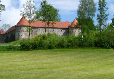
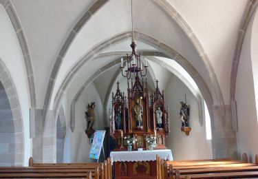
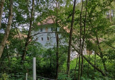
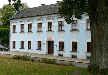
Trail On foot of 14.2 km to be discovered at Upper Austria, Bezirk Rohrbach, Sankt Johann am Wimberg. This trail is proposed by SityTrail - itinéraires balisés pédestres.
Description
Trail created by Gemeinde Sankt Johann am Wimberg.
http://wiki.openstreetmap.org/wiki/WikiProject_Austria/Wanderwege
Symbol: Blaues Schild mit weißer 31
Positioning
Comments
Trails nearby
![Trail On foot Helfenberg - Burgweg - Photo](https://media.geolcdn.com/t/375/260/c69cf79f-81b6-463e-9c47-49d9f59a25df.jpeg&format=jpg&maxdim=2)
![On foot On foot](https://static1.geolcdn.com/sitytour/trail-icons/100.png)
On foot
![](/images/other/stat-length.png)
![](https://static1.geolcdn.com/siteimages/upload/files/16400158638029165_repeat_loop_refresh_sync_direction_icon.png)
![Trail On foot Sankt Peter am Wimberg - Bachwanderweg - Photo](https://media.geolcdn.com/t/375/260/98b410ac-045a-4e12-a1bb-c89aa31eb48c.jpeg&format=jpg&maxdim=2)
![On foot On foot](https://static1.geolcdn.com/sitytour/trail-icons/100.png)
On foot
![](/images/other/stat-length.png)
![](https://static1.geolcdn.com/siteimages/upload/files/16400158638029165_repeat_loop_refresh_sync_direction_icon.png)
![Trail On foot Sankt Peter am Wimberg - Hunnenweg - Photo](https://media.geolcdn.com/t/375/260/98b410ac-045a-4e12-a1bb-c89aa31eb48c.jpeg&format=jpg&maxdim=2)
![On foot On foot](https://static1.geolcdn.com/sitytour/trail-icons/100.png)
On foot
![](/images/other/stat-length.png)
![](https://static1.geolcdn.com/siteimages/upload/files/16400158638029165_repeat_loop_refresh_sync_direction_icon.png)
![Trail On foot Sankt Johann am Wimberg - Entspannungsweg der Sinne - Photo](https://media.geolcdn.com/t/375/260/ca9bdbf9-78f1-4804-9809-da9b4659177c.jpeg&format=jpg&maxdim=2)
![On foot On foot](https://static1.geolcdn.com/sitytour/trail-icons/100.png)
On foot
![](/images/other/stat-length.png)
![](https://static1.geolcdn.com/siteimages/upload/files/16400158638029165_repeat_loop_refresh_sync_direction_icon.png)
![Trail On foot Niederwaldkirchen - Steinbach-Rundweg - Photo](https://media.geolcdn.com/t/375/260/ea46281a-afb9-4a8b-8d22-88ec5ecbb799.jpeg&format=jpg&maxdim=2)
![On foot On foot](https://static1.geolcdn.com/sitytour/trail-icons/100.png)
On foot
![](/images/other/stat-length.png)
![](https://static1.geolcdn.com/siteimages/upload/files/16400158638029165_repeat_loop_refresh_sync_direction_icon.png)
![Trail On foot Sankt Johann am Wimberg - Mühlenweg - Photo](https://media.geolcdn.com/t/375/260/52e65c21-fdcd-4dd7-a9c6-7179717e8d81.jpeg&format=jpg&maxdim=2)
![On foot On foot](https://static1.geolcdn.com/sitytour/trail-icons/100.png)
On foot
![](/images/other/stat-length.png)
![](https://static1.geolcdn.com/siteimages/upload/files/16400158638029165_repeat_loop_refresh_sync_direction_icon.png)
![Trail On foot Sankt Veit im Mühlkreis - Kapellen-Wanderweg - Photo](https://media.geolcdn.com/t/375/260/38424416-697d-4150-a4f4-4ea5afaecdd0.jpeg&format=jpg&maxdim=2)
![On foot On foot](https://static1.geolcdn.com/sitytour/trail-icons/100.png)
On foot
![](/images/other/stat-length.png)
![](https://static1.geolcdn.com/siteimages/upload/files/16400158638029165_repeat_loop_refresh_sync_direction_icon.png)
![Trail On foot Sankt Johann am Wimberg - Kapellen-Hansberg-Weg - Photo](https://media.geolcdn.com/t/375/260/ca9bdbf9-78f1-4804-9809-da9b4659177c.jpeg&format=jpg&maxdim=2)
![On foot On foot](https://static1.geolcdn.com/sitytour/trail-icons/100.png)
On foot
![](/images/other/stat-length.png)
![](https://static1.geolcdn.com/siteimages/upload/files/16400158638029165_repeat_loop_refresh_sync_direction_icon.png)
![Trail On foot Niederwaldkirchen - Pesenbach-Hansberg-Runde - Photo](https://media.geolcdn.com/t/375/260/52e65c21-fdcd-4dd7-a9c6-7179717e8d81.jpeg&format=jpg&maxdim=2)
![On foot On foot](https://static1.geolcdn.com/sitytour/trail-icons/100.png)
On foot
![](/images/other/stat-length.png)
![](https://static1.geolcdn.com/siteimages/upload/files/16400158638029165_repeat_loop_refresh_sync_direction_icon.png)