![](/images/other/stat-length.png)
![Trail On foot Oberneukirchen - Golfplatzrunde - Photo](https://media.geolcdn.com/t/1900/400/ext.pjpeg?maxdim=2&url=https%3A%2F%2Fmedia.geolcdn.com%2Ff%2F67971f06-8c12-4041-ac34-a44e41c465eb.jpeg)
Golfplatzrunde
SityTrail - itinéraires balisés pédestres
Tous les sentiers balisés d’Europe PRO
![Length](/images/other/stat-length.png)
Length
10.1 km
![Max alt](https://static1.geolcdn.com/siteimages/upload/files/1508320355ic_sort_altitude_max_24dp.png)
Max alt
782 m
![Uphill gradient](https://static1.geolcdn.com/siteimages/upload/files/1508320355ic_sort_den_pos_24dp.png)
Uphill gradient
285 m
![Km-Effort](/images/other/stat-length.png)
Km-Effort
13.9 km
![Min alt](https://static1.geolcdn.com/siteimages/upload/files/1508320355ic_sort_altitude_min_24dp.png)
Min alt
653 m
![Downhill gradient](https://static1.geolcdn.com/siteimages/upload/files/1508320355ic_sort_den_neg_24dp.png)
Downhill gradient
302 m
![Boucle](https://static1.geolcdn.com/siteimages/upload/files/16400158638029165_repeat_loop_refresh_sync_direction_icon.png)
Boucle
No
Signpost
Creation date :
2022-02-16 16:08:28.072
Updated on :
2022-03-03 02:13:14.411
![On foot](https://static1.geolcdn.com/sitytour/trail-icons/100.png)
3h10
Difficulty : Easy
![Scan this QR Code to open this trail in the SityTrail application](https://capi.geolives.com/qq0zvz2zws4bq2lad0pu/sitytour/trails/3126085/qr.png?size=200)
FREE GPS app for hiking
About
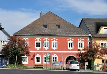
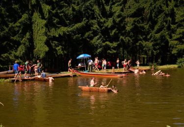
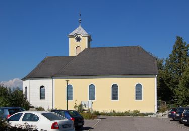
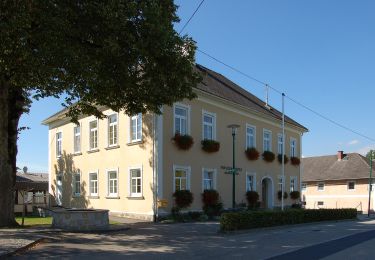
Trail On foot of 10.1 km to be discovered at Upper Austria, Bezirk Urfahr-Umgebung, Oberneukirchen. This trail is proposed by SityTrail - itinéraires balisés pédestres.
Description
Meta Beschreibung der Seite
Website: http://www.oberneukirchen.ooe.gv.at/system/web/GetDocument.ashx?fileid=730719
Positioning
Country:
Austria
Region :
Upper Austria
Department/Province :
Bezirk Urfahr-Umgebung
Municipality :
Oberneukirchen
Location:
Unknown
Start:(Dec)
Start:(UTM)
442897 ; 5368236 (33U) N.
Comments
Trails nearby
![Trail On foot Zwettl an der Rodl - Wanderweg 31 - Photo](https://media.geolcdn.com/t/375/260/ext.jpg?maxdim=2&url=https%3A%2F%2Fmedia.geolcdn.com%2Ff%2F61794fe5-6829-41e1-b091-04857efc6fea.jpeg)
![On foot On foot](https://static1.geolcdn.com/sitytour/trail-icons/100.png)
Wanderweg 31
On foot
Easy
Zwettl an der Rodl,
Upper Austria,
Bezirk Urfahr-Umgebung,
Austria
![](/images/other/stat-length.png)
10.2 km | 13.4 km-effort
3h 2min
![](https://static1.geolcdn.com/siteimages/upload/files/16400158638029165_repeat_loop_refresh_sync_direction_icon.png)
No
![Trail On foot Sonnberg im Mühlkreis - Mühlviertler Sterngartl Rundweg - Photo](https://media.geolcdn.com/t/375/260/ext.jpg?maxdim=2&url=https%3A%2F%2Fmedia.geolcdn.com%2Ff%2F5b99adca-b0b1-48c6-9f6c-32dc78115849.jpeg)
![On foot On foot](https://static1.geolcdn.com/sitytour/trail-icons/100.png)
Mühlviertler Sterngartl Rundweg
On foot
Medium
Sonnberg im Mühlkreis,
Upper Austria,
Bezirk Urfahr-Umgebung,
Austria
![](/images/other/stat-length.png)
15.7 km | 23 km-effort
5h 11min
![](https://static1.geolcdn.com/siteimages/upload/files/16400158638029165_repeat_loop_refresh_sync_direction_icon.png)
No
![Trail On foot Herzogsdorf - Hofing-Runde - Photo](https://media.geolcdn.com/t/375/260/ext.jpg?maxdim=2&url=https%3A%2F%2Fmedia.geolcdn.com%2Ff%2F3f8a6bba-01ad-4457-81fa-acec62f4a996.jpeg)
![On foot On foot](https://static1.geolcdn.com/sitytour/trail-icons/100.png)
Hofing-Runde
On foot
Easy
Herzogsdorf,
Upper Austria,
Bezirk Urfahr-Umgebung,
Austria
![](/images/other/stat-length.png)
4.8 km | 6 km-effort
1h 21min
![](https://static1.geolcdn.com/siteimages/upload/files/16400158638029165_repeat_loop_refresh_sync_direction_icon.png)
No
![Trail On foot Herzogsdorf - Panoramaweg Neudorf - Photo](https://media.geolcdn.com/t/375/260/ext.jpg?maxdim=2&url=https%3A%2F%2Fmedia.geolcdn.com%2Ff%2Fbcb09bcc-fadb-42e8-a43f-0f50c2de99b3.jpeg)
![On foot On foot](https://static1.geolcdn.com/sitytour/trail-icons/100.png)
Panoramaweg Neudorf
On foot
Easy
Herzogsdorf,
Upper Austria,
Bezirk Urfahr-Umgebung,
Austria
![](/images/other/stat-length.png)
7.7 km | 10.9 km-effort
2h 29min
![](https://static1.geolcdn.com/siteimages/upload/files/16400158638029165_repeat_loop_refresh_sync_direction_icon.png)
No
![Trail On foot Oberneukirchen - Lobensteiner Runde - Photo](https://media.geolcdn.com/t/375/260/ext.jpg?maxdim=2&url=https%3A%2F%2Fmedia.geolcdn.com%2Ff%2F6bc21aa0-4a28-4384-b4b8-2bc60eafb91d.jpeg)
![On foot On foot](https://static1.geolcdn.com/sitytour/trail-icons/100.png)
Lobensteiner Runde
On foot
Easy
Oberneukirchen,
Upper Austria,
Bezirk Urfahr-Umgebung,
Austria
![](/images/other/stat-length.png)
7.7 km | 10.7 km-effort
2h 25min
![](https://static1.geolcdn.com/siteimages/upload/files/16400158638029165_repeat_loop_refresh_sync_direction_icon.png)
No
![Trail On foot Eidenberg - Berndorfer Runde - Photo](https://media.geolcdn.com/t/375/260/ext.jpg?maxdim=2&url=https%3A%2F%2Fstatic1.geolcdn.com%2Fsiteimages%2Fupload%2Ffiles%2F1545311037marcheuse_200dpi.jpg)
![On foot On foot](https://static1.geolcdn.com/sitytour/trail-icons/100.png)
Berndorfer Runde
On foot
Easy
Eidenberg,
Upper Austria,
Bezirk Urfahr-Umgebung,
Austria
![](/images/other/stat-length.png)
4.8 km | 6.8 km-effort
1h 33min
![](https://static1.geolcdn.com/siteimages/upload/files/16400158638029165_repeat_loop_refresh_sync_direction_icon.png)
Yes
![Trail On foot Bad Leonfelden - Schönau - Oberwaldschlag - Photo](https://media.geolcdn.com/t/375/260/ext.jpg?maxdim=2&url=https%3A%2F%2Fstatic1.geolcdn.com%2Fsiteimages%2Fupload%2Ffiles%2F1545311037marcheuse_200dpi.jpg)
![On foot On foot](https://static1.geolcdn.com/sitytour/trail-icons/100.png)
Schönau - Oberwaldschlag
On foot
Easy
Bad Leonfelden,
Upper Austria,
Bezirk Urfahr-Umgebung,
Austria
![](/images/other/stat-length.png)
3.8 km | 5.4 km-effort
1h 12min
![](https://static1.geolcdn.com/siteimages/upload/files/16400158638029165_repeat_loop_refresh_sync_direction_icon.png)
No