


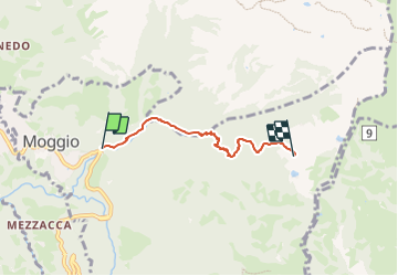

8.7 km | 14 km-effort


Tous les sentiers balisés d’Europe GUIDE+


FREE GPS app for hiking
 SityTrail
IGN / Geographical institutes
SityTrail World
The world is yours!
Trail On foot of 3.6 km to be discovered at Lombardy, Lecco, Moggio. This trail is proposed by SityTrail - itinéraires balisés pédestres.
Trail created by Comune di Moggio.
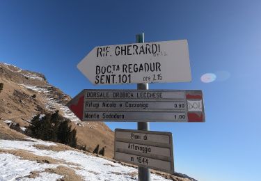
Symbol: blue circles on trees from detour to 724 "Sentiero del Vallone"


On foot

On foot
On foot
On foot
On foot
On foot
On foot

On foot
On foot