Trail On foot Lumezzane - Via del Sacro - Photo

Via del Sacro

Tous les sentiers balisés d’Europe PRO

© OpenStreetMap contributors
Length
Length
26 km
Max alt
Max alt
1334 m
Uphill gradient
Uphill gradient
1395 m
Km-Effort
Km-Effort  
47 km
Min alt
Min alt
501 m
Downhill gradient
Downhill gradient
1907 m
Boucle
Boucle
No
Signpost
Signpost
Creation date :
2022-02-15 18:07:31.179
Updated on :
2022-03-01 22:31:05.42

(0 Reviews)

On foot
On foot
10h34
Difficulty : Very difficult

Scan this QR Code to open this trail in the SityTrail application

FREE GPS app for hiking

Logo SityTrail SityTrail

IGN / Geographical institutes

Download SityTrail from the App Store Download SityTrail from Google Play

Logo SityTrail SityTrail World

The world is yours!

Download SityTrail from the App Store Download SityTrail from Google Play Download SityTrail on Huawei AppGallery

About

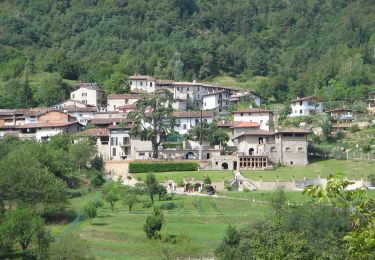
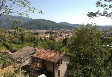
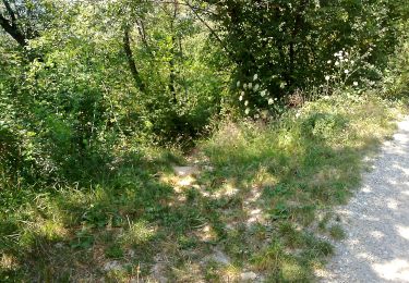
Trail On foot of 26 km to be discovered at Lombardy, Brescia, Lumezzane. This trail is proposed by SityTrail - itinéraires balisés pédestres.

Description

Trail created by Club Alpino Italiano - Sezione di Lumezzane.

Symbol: unmarked


Website: http://www.cailumezzane.it/sentieri/Via del Sacro/Via del Sacro a lumezzane.html

Photos

Positioning

Country:
Italy
Region :
Lombardy
Department/Province :
Brescia
Municipality :
Lumezzane
Location:
Unknown
Start:(UTM)
598045 ; 5053808 (32T) N.

Trails nearby

Trail On foot Lumezzane - Via del Sacro da Lumezzane (Fontana) - San Bernardo - Photo
On foot
PRO

On foot

Easy
Lumezzane, Lombardy, Brescia, Italy
3.4 km | 5.9 km-effort
1h 20min
No
Trail On foot Caino - Caino (Villa Sera) - Santuario di Conche - Colle di Sant'Eusebio - Photo
On foot
PRO

On foot

Difficult
Caino, Lombardy, Brescia, Italy
20 km | 38 km-effort
8h 33min
No
Trail On foot Lumezzane - Via del Sacro - Percorso principale - Photo
On foot
PRO

On foot

Very difficult
Lumezzane, Lombardy, Brescia, Italy
26 km | 50 km-effort
11h 21min
No
Trail On foot Bovezzo - Sentiero dei marroni - Photo
On foot
PRO

On foot

Medium
Bovezzo, Lombardy, Brescia, Italy
14.4 km | 27 km-effort
6h 6min
No
Trail On foot Bovezzo - Concesio (Sant'Andrea) - Sant'Onofrio - Photo
On foot
PRO

On foot

Easy
Bovezzo, Lombardy, Brescia, Italy
4.7 km | 7.2 km-effort
1h 37min
No
Trail On foot Bovezzo - Bovezzo - Sant'Onofrio - Photo
On foot
PRO

On foot

Easy
Bovezzo, Lombardy, Brescia, Italy
3.4 km | 10.5 km-effort
2h 23min
No
Trail On foot Lumezzane - Lumezzane (Pieve) - Grassi - Corna di Sonclino - Photo
On foot
PRO

On foot

Easy
Lumezzane, Lombardy, Brescia, Italy
8.1 km | 16.9 km-effort
3h 50min
No
Trail On foot Lumezzane - Lumezzane (Ver) - San Bernardo - Photo
On foot
PRO

On foot

Easy
Lumezzane, Lombardy, Brescia, Italy
4 km | 6.8 km-effort
1h 32min
No
Trail On foot Concesio - Concesio - Valsorda - Photo
On foot
PRO

On foot

Easy
Concesio, Lombardy, Brescia, Italy
6.1 km | 8.9 km-effort
2h 1min
Yes


Close
My subscriptions