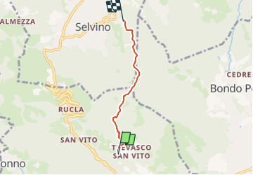
![](/images/other/stat-length.png)
![Trail On foot Nembro - Sentiero 536: Trevasco (Nembro) - Selvino - Photo](https://media.geolcdn.com/t/1900/400/ext.pjpeg?maxdim=2&url=https%3A%2F%2Fmedia.geolcdn.com%2Ff%2F1e205f2e-365b-41ac-ac73-ff0529e96084.jpeg)
Sentiero 536: Trevasco (Nembro) - Selvino
SityTrail - itinéraires balisés pédestres
Tous les sentiers balisés d’Europe PRO
![Length](/images/other/stat-length.png)
![Max alt](https://static1.geolcdn.com/siteimages/upload/files/1508320355ic_sort_altitude_max_24dp.png)
![Uphill gradient](https://static1.geolcdn.com/siteimages/upload/files/1508320355ic_sort_den_pos_24dp.png)
![Km-Effort](/images/other/stat-length.png)
![Min alt](https://static1.geolcdn.com/siteimages/upload/files/1508320355ic_sort_altitude_min_24dp.png)
![Downhill gradient](https://static1.geolcdn.com/siteimages/upload/files/1508320355ic_sort_den_neg_24dp.png)
![Boucle](https://static1.geolcdn.com/siteimages/upload/files/16400158638029165_repeat_loop_refresh_sync_direction_icon.png)
![On foot](https://static1.geolcdn.com/sitytour/trail-icons/100.png)
1h58
Difficulty : Easy
![Scan this QR Code to open this trail in the SityTrail application](https://capi.geolives.com/qq0zvz2zws4bq2lad0pu/sitytour/trails/3122633/qr.png?size=200)
FREE GPS app for hiking
About
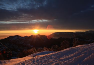
Trail On foot of 3.4 km to be discovered at Lombardy, Bergamo, Nembro. This trail is proposed by SityTrail - itinéraires balisés pédestres.
Description
Il sentiero si può imboccare in località Gioldo oppure in località Trevasco (Nembro), all’altezza della bella chiesetta del XV secolo che conserva una pala di Palma il Giovane (il tracciato è accessibile a tutti, pur essendo la parte iniziale, fino alla località Palazzo, abbastanza ripida). Si sale poi al panoramico “Pià ‘lla Löera” (944 m), dove si incrocia il sentiero 515.
Website: http://geoportale.caibergamo.it/sentiero/536
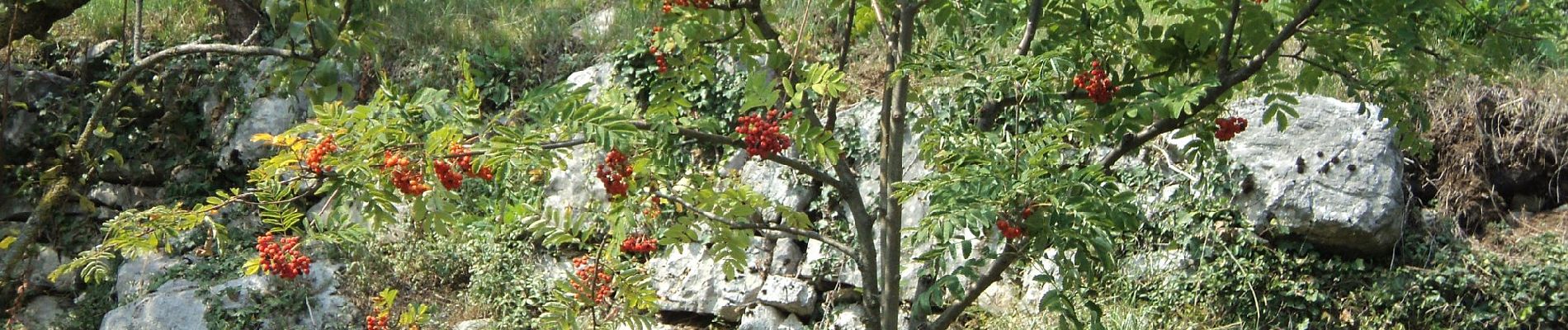
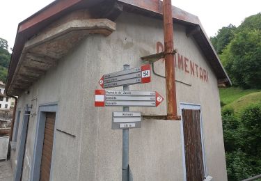
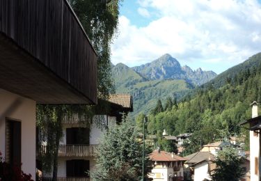
Positioning
Comments
Trails nearby
![Trail On foot Selvino - Sentiero 514: Selvino - Santuario del Perello - Zogno - Photo](https://media.geolcdn.com/t/375/260/ext.jpg?maxdim=2&url=https%3A%2F%2Fmedia.geolcdn.com%2Ff%2Fdccbd0a6-f30e-46d8-a9c3-ee6646a9e53f.jpeg)
![On foot On foot](https://static1.geolcdn.com/sitytour/trail-icons/100.png)
On foot
![](/images/other/stat-length.png)
![](https://static1.geolcdn.com/siteimages/upload/files/16400158638029165_repeat_loop_refresh_sync_direction_icon.png)
![Trail On foot Nembro - Sentiero 535: Madonna dello Zuccarello (Nembro) - Selvino - Photo](https://media.geolcdn.com/t/375/260/ext.jpg?maxdim=2&url=https%3A%2F%2Fmedia.geolcdn.com%2Ff%2F9211f234-c38d-4d87-acff-2d5b9b9d3736.jpeg)
![On foot On foot](https://static1.geolcdn.com/sitytour/trail-icons/100.png)
On foot
![](/images/other/stat-length.png)
![](https://static1.geolcdn.com/siteimages/upload/files/16400158638029165_repeat_loop_refresh_sync_direction_icon.png)
![Trail On foot Gazzaniga - Sentiero 521: Rova (Gazzaniga) - Monte Cornagera - Photo](https://media.geolcdn.com/t/375/260/ext.jpg?maxdim=2&url=https%3A%2F%2Fmedia.geolcdn.com%2Ff%2Fd72bf981-700c-4b40-85ab-18249d2c50a7.jpeg)
![On foot On foot](https://static1.geolcdn.com/sitytour/trail-icons/100.png)
On foot
![](/images/other/stat-length.png)
![](https://static1.geolcdn.com/siteimages/upload/files/16400158638029165_repeat_loop_refresh_sync_direction_icon.png)
![Trail On foot Gazzaniga - Sentiero 522: Gazzaniga - Cà de Spì - Photo](https://media.geolcdn.com/t/375/260/ext.jpg?maxdim=2&url=https%3A%2F%2Fmedia.geolcdn.com%2Ff%2F9ca92b27-d19a-4869-838b-66199694d2a5.jpeg)
![On foot On foot](https://static1.geolcdn.com/sitytour/trail-icons/100.png)
On foot
![](/images/other/stat-length.png)
![](https://static1.geolcdn.com/siteimages/upload/files/16400158638029165_repeat_loop_refresh_sync_direction_icon.png)
![Trail On foot Selvino - Sentiero 515: Albino - Selvino (Masu) - Photo](https://media.geolcdn.com/t/375/260/ext.jpg?maxdim=2&url=https%3A%2F%2Fmedia.geolcdn.com%2Ff%2F2d0d4309-5a55-443c-ad9d-ac784b1f603d.jpeg)
![On foot On foot](https://static1.geolcdn.com/sitytour/trail-icons/100.png)
On foot
![](/images/other/stat-length.png)
![](https://static1.geolcdn.com/siteimages/upload/files/16400158638029165_repeat_loop_refresh_sync_direction_icon.png)