Trail On foot Muggia - (SI A28) Muggia - San Bartolomeo - Photo

(SI A28) Muggia - San Bartolomeo

Tous les sentiers balisés d’Europe GUIDE+

© OpenStreetMap contributors
Length
Length
6.2 km
Max alt
Max alt
174 m
Uphill gradient
Uphill gradient
230 m
Km-Effort
Km-Effort  
9.2 km
Min alt
Min alt
6 m
Downhill gradient
Downhill gradient
235 m
Boucle
Boucle
No
Signpost
Signpost
Creation date :
2022-02-15 17:22:15.282
Updated on :
2022-03-01 20:43:24.198

(0 Reviews)

On foot
On foot
2h05
Difficulty : Easy

Scan this QR Code to open this trail in the SityTrail application

FREE GPS app for hiking

Logo SityTrail SityTrail

IGN / Geographical institutes

Download SityTrail from the App Store Download SityTrail from Google Play

Logo SityTrail SityTrail World

The world is yours!

Download SityTrail from the App Store Download SityTrail from Google Play Download SityTrail on Huawei AppGallery

About

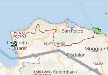
Trail On foot of 6.2 km to be discovered at Friuli Venezia Giulia, Unknown, Muggia. This trail is proposed by SityTrail - itinéraires balisés pédestres.

Description

Sentiero Italia CAI 2019
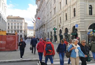
Elevation profile

Photos

Positioning

Country:
Italy
Region :
Friuli Venezia Giulia
Department/Province :
Unknown
Municipality :
Muggia
Location:
Unknown
Start:(UTM)
403815 ; 5050664 (33T) N.

Trails nearby

Trail Walking Triest - Trieste  - Photo
Walking
suzanne.bron

Walking

Easy
Triest, Friuli Venezia Giulia, Unknown, Italy
1.3 km | 1.5 km-effort
32min
No
Trail Hybrid bike Ankaran / Ancarano - Ankaran - Koper - Izola - Photo
Hybrid bike
Olivier Degimbe

Hybrid bike

Medium
Ankaran / Ancarano, Unknown, Unknown, Slovenia
31 km | 35 km-effort
3h 19min
No


Close
My subscriptions