Trail On foot Pontremoli - Trekking Lunigiana 5 - Photo

Trekking Lunigiana 5

Tous les sentiers balisés d’Europe PRO

© OpenStreetMap contributors
Length
Length
14.9 km
Max alt
Max alt
705 m
Uphill gradient
Uphill gradient
625 m
Km-Effort
Km-Effort  
23 km
Min alt
Min alt
356 m
Downhill gradient
Downhill gradient
611 m
Boucle
Boucle
No
Signpost
Signpost
Creation date :
2022-02-15 16:20:11.655
Updated on :
2022-03-01 18:01:14.36

(0 Reviews)

On foot
On foot
5h15
Difficulty : Medium

Scan this QR Code to open this trail in the SityTrail application

FREE GPS app for hiking

Logo SityTrail SityTrail

IGN / Geographical institutes

Download SityTrail from the App Store Download SityTrail from Google Play

Logo SityTrail SityTrail World

The world is yours!

Download SityTrail from the App Store Download SityTrail from Google Play Download SityTrail on Huawei AppGallery

About

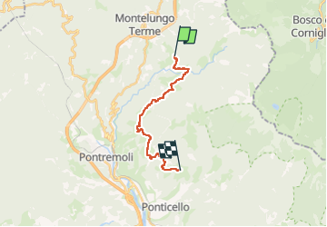
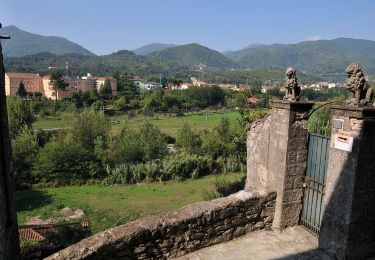
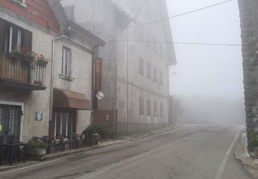
Trail On foot of 14.9 km to be discovered at Tuscany, Massa-Carrara, Pontremoli. This trail is proposed by SityTrail - itinéraires balisés pédestres.

Description

Trail created by Comunità Montana della Lunigiana.

Groppoli to Torrente Civasola survey undertaken 14.12.19 Torrente Civasola to Musellara survey undertaken 16.12.19 Casalina to Arzengio survey undertaken 29.12.19

Photos

Positioning

Country:
Italy
Region :
Tuscany
Department/Province :
Massa-Carrara
Municipality :
Pontremoli
Location:
Unknown
Start:(UTM)
574077 ; 4920041 (32T) N.

Trails nearby

Trail On foot Pontremoli - Via Francigena, Toscana var Montelungo-Pontremoli - Photo
On foot
PRO

On foot

Easy
Pontremoli, Tuscany, Massa-Carrara, Italy
13.1 km | 17.7 km-effort
4h 1min
No
Trail Walking Pontremoli - CR_Francigena_CD_27_Pontremoli-Col-Cisa_Pontremoli_20220609 - Photo
Walking
patrickdanilo

Walking

Very difficult
Pontremoli, Tuscany, Massa-Carrara, Italy
21 km | 26 km-effort
5h 50min
No
Trail On foot Berceto - (SI L24) Passo della Cisa - Passo dei due Santi - Photo
On foot
PRO

On foot

Difficult
Berceto, Emilia-Romagna, Parma, Italy
25 km | 39 km-effort
8h 57min
No
Trail On foot Borgo Val di Taro - Anello del Molinatico - Photo
On foot
PRO

On foot

Easy
Borgo Val di Taro, Emilia-Romagna, Parma, Italy
5.6 km | 9.8 km-effort
2h 13min
Yes


Close
My subscriptions