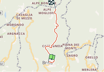
![](/images/other/stat-length.png)
![Trail On foot Cellio con Breia - IT-751 - Photo](https://media.geolcdn.com/t/1900/400/851bfe72-93ea-496d-8c58-d9d8a8ac66a1.jpeg&format=pjpeg&maxdim=2)
IT-751
SityTrail - itinéraires balisés pédestres
Tous les sentiers balisés d’Europe GUIDE+
![Length](/images/other/stat-length.png)
Length
3.8 km
![Max alt](https://static1.geolcdn.com/siteimages/upload/files/1508320355ic_sort_altitude_max_24dp.png)
Max alt
988 m
![Uphill gradient](https://static1.geolcdn.com/siteimages/upload/files/1508320355ic_sort_den_pos_24dp.png)
Uphill gradient
223 m
![Km-Effort](/images/other/stat-length.png)
Km-Effort
6.2 km
![Min alt](https://static1.geolcdn.com/siteimages/upload/files/1508320355ic_sort_altitude_min_24dp.png)
Min alt
795 m
![Downhill gradient](https://static1.geolcdn.com/siteimages/upload/files/1508320355ic_sort_den_neg_24dp.png)
Downhill gradient
47 m
![Boucle](https://static1.geolcdn.com/siteimages/upload/files/16400158638029165_repeat_loop_refresh_sync_direction_icon.png)
Boucle
No
Signpost
Creation date :
2022-02-15 15:36:19.817
Updated on :
2022-03-01 16:25:44.493
![On foot](https://static1.geolcdn.com/sitytour/trail-icons/100.png)
1h24
Difficulty : Easy
![Scan this QR Code to open this trail in the SityTrail application](https://capi.geolives.com/qq0zvz2zws4bq2lad0pu/sitytour/trails/3120989/qr.png?size=200)
FREE GPS app for hiking
About
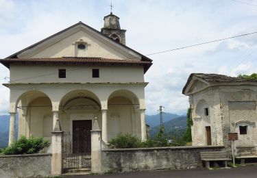
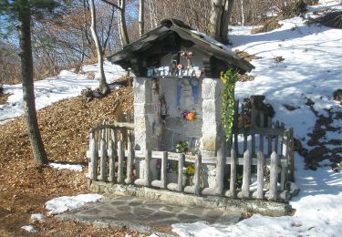
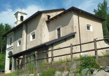
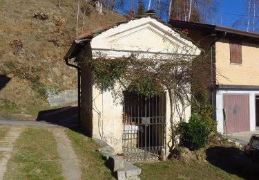
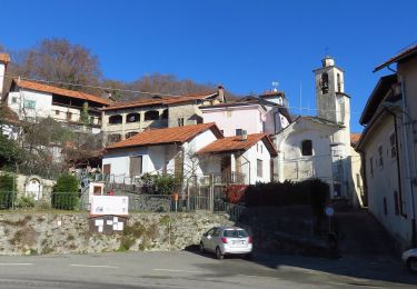
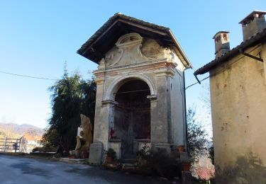
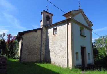
Trail On foot of 3.8 km to be discovered at Piemont, Vercelli, Cellio con Breia. This trail is proposed by SityTrail - itinéraires balisés pédestres.
Description
Symbol: 751 on white red flags
Website: http://www.caivarallo.it
Positioning
Country:
Italy
Region :
Piemont
Department/Province :
Vercelli
Municipality :
Cellio con Breia
Location:
Unknown
Start:(Dec)
Start:(UTM)
446134 ; 5068084 (32T) N.
Comments
Trails nearby
![Trail On foot Valduggia - IT-761 - Photo](https://media.geolcdn.com/t/375/260/934d12f1-7db7-4bc1-8159-abf4d6cc42c5.jpeg&format=jpg&maxdim=2)
![On foot On foot](https://static1.geolcdn.com/sitytour/trail-icons/100.png)
![Trail On foot Varallo - IT-644 - Photo](https://media.geolcdn.com/t/375/260/5951f56b-4d3c-4ae4-b49c-4f1583439f10.jpeg&format=jpg&maxdim=2)
![On foot On foot](https://static1.geolcdn.com/sitytour/trail-icons/100.png)
![Trail On foot Quarona - IT-732 - Photo](https://media.geolcdn.com/t/375/260/f1f34ddd-7b9a-4f4a-baaf-01f384629ebf.jpeg&format=jpg&maxdim=2)
![On foot On foot](https://static1.geolcdn.com/sitytour/trail-icons/100.png)
![Trail On foot Cellio con Breia - IT-735 - Photo](https://media.geolcdn.com/t/375/260/7560d5c5-9b4f-442c-80e6-95168a6c2722.jpeg&format=jpg&maxdim=2)
![On foot On foot](https://static1.geolcdn.com/sitytour/trail-icons/100.png)
![Trail On foot Quarona - IT-738 - Photo](https://media.geolcdn.com/t/375/260/1fcd30b2-74b7-4058-91f1-8b0c4d228632.jpeg&format=jpg&maxdim=2)
![On foot On foot](https://static1.geolcdn.com/sitytour/trail-icons/100.png)
![Trail On foot Borgosesia - IT-741 - Photo](https://media.geolcdn.com/t/375/260/d2204e3a-f0d5-4845-b561-938670c8d8fb.jpeg&format=jpg&maxdim=2)
![On foot On foot](https://static1.geolcdn.com/sitytour/trail-icons/100.png)
![Trail On foot Cellio con Breia - IT-746 - Photo](https://media.geolcdn.com/t/375/260/0bf9b827-9382-409d-b8cd-809e8109f7f7.jpeg&format=jpg&maxdim=2)
![On foot On foot](https://static1.geolcdn.com/sitytour/trail-icons/100.png)
![Trail On foot Civiasco - IT-747 - Photo](https://media.geolcdn.com/t/375/260/0e844bbf-5b22-444b-9d75-c1fd7c4b1cc5.jpeg&format=jpg&maxdim=2)
![On foot On foot](https://static1.geolcdn.com/sitytour/trail-icons/100.png)
![Trail On foot Valduggia - IT-759 - Photo](https://media.geolcdn.com/t/375/260/36dcf32a-4f16-4916-8d54-f79b1b4322bb.jpeg&format=jpg&maxdim=2)
![On foot On foot](https://static1.geolcdn.com/sitytour/trail-icons/100.png)