Trail On foot Colere - IT-404 - Photo

Tous les sentiers balisés d’Europe PRO

© OpenStreetMap contributors
Length
Length
6.2 km
Max alt
Max alt
2221 m
Uphill gradient
Uphill gradient
1136 m
Km-Effort
Km-Effort  
17.6 km
Min alt
Min alt
1076 m
Downhill gradient
Downhill gradient
4 m
Boucle
Boucle
No
Signpost
Signpost
Creation date :
2022-02-15 14:58:33.834
Updated on :
2022-03-01 15:29:28.079

(0 Reviews)

On foot
On foot
4h00
Difficulty : Easy

Scan this QR Code to open this trail in the SityTrail application

FREE GPS app for hiking

Logo SityTrail SityTrail

IGN / Geographical institutes

Download SityTrail from the App Store Download SityTrail from Google Play

Logo SityTrail SityTrail World

The world is yours!

Download SityTrail from the App Store Download SityTrail from Google Play Download SityTrail on Huawei AppGallery

About

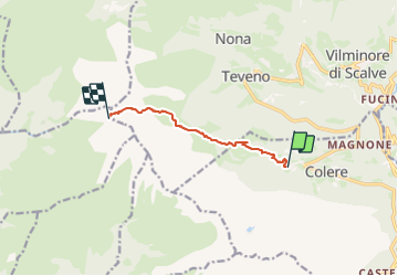
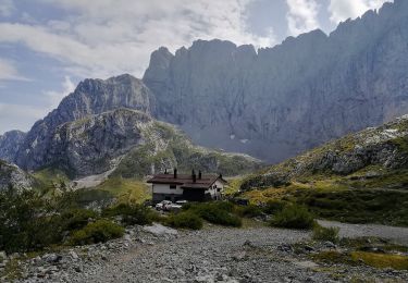
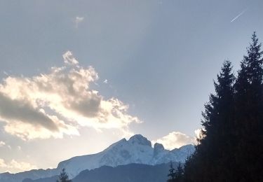
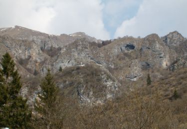
Trail On foot of 6.2 km to be discovered at Lombardy, Bergamo, Colere. This trail is proposed by SityTrail - itinéraires balisés pédestres.

Description

Partendo dalla frazione Carbonera di Colere (1043 m - parcheggio impianti di sci) si sale lungo la strada cementata fino alla malga Polzone, stazione intermedia degli impianti da sci (1571 m). Proseguendo in direzione ovest, dapprima sulla pista da sci e poi su sentiero, si giunge alla malga di Conchetta (1796 m) e da qui si sale tutta la val Conchetta fino a raggiungere il

Website: http://geoportale.caibergamo.it/it/sentiero/404

Photos

Positioning

Country:
Italy
Region :
Lombardy
Department/Province :
Bergamo
Municipality :
Colere
Location:
Unknown
Start:(UTM)
582943 ; 5091842 (32T) N.

Trails nearby

Trail On foot Vilminore di Scalve - IT-407 - Photo
On foot
PRO

On foot

Easy
Vilminore di Scalve, Lombardy, Bergamo, Italy
3 km | 5.4 km-effort
1h 13min
No
Trail On foot Colere - IT-401 - Photo
On foot
PRO

On foot

Easy
Colere, Lombardy, Bergamo, Italy
4 km | 7.2 km-effort
1h 38min
No
Trail On foot Oltressenda Alta - CAI320: Baite del Möschel - Grotta dei Pagani - Photo
On foot
PRO

On foot

Easy
Oltressenda Alta, Lombardy, Bergamo, Italy
6.2 km | 16.3 km-effort
3h 42min
No
Trail On foot Colere - Sentiero delle Orobie Orientali - Tappa finale Anello - Photo
On foot
PRO

On foot

Medium
Colere, Lombardy, Bergamo, Italy
14.9 km | 24 km-effort
5h 24min
No
Trail On foot Colere - Sentiero delle Orobie Orientali - Tappa finale Classico - Photo
On foot
PRO

On foot

Easy
Colere, Lombardy, Bergamo, Italy
9.4 km | 19.6 km-effort
4h 27min
No
Trail On foot Colere - IT-403 - Photo
On foot
PRO

On foot

Easy
Colere, Lombardy, Bergamo, Italy
3.9 km | 12.3 km-effort
2h 47min
No
Trail On foot Azzone - Trekking tra malghe e menhir anello 3: Salven - Costone - San Fermo - Photo
On foot
PRO

On foot

Medium
Azzone, Lombardy, Bergamo, Italy
13.5 km | 25 km-effort
5h 45min
Yes
Trail On foot Colere - CAI326: Rifugio Albani - Monte Visolo (ferrata della Porta) - Photo
On foot
PRO

On foot

Easy
Colere, Lombardy, Bergamo, Italy
3.4 km | 10 km-effort
2h 16min
No
Trail On foot Castione della Presolana - Castione - Via del Latte - Photo
On foot
PRO

On foot

Easy
Castione della Presolana, Lombardy, Bergamo, Italy
12.1 km | 18.5 km-effort
4h 12min
No


Close
My subscriptions