![](/images/other/stat-length.png)
![Trail On foot Aixe-sur-Vienne - Circuit Puys et Vallées en Pays d'Aixe - Photo](https://media.geolcdn.com/t/1900/400/ext.pjpeg?maxdim=2&url=https%3A%2F%2Fstatic1.geolcdn.com%2Fsiteimages%2Fupload%2Ffiles%2F1545311037marcheuse_200dpi.jpg)
Circuit Puys et Vallées en Pays d'Aixe
SityTrail - itinéraires balisés pédestres
Tous les sentiers balisés d’Europe GUIDE+
![Length](/images/other/stat-length.png)
![Max alt](https://static1.geolcdn.com/siteimages/upload/files/1508320355ic_sort_altitude_max_24dp.png)
![Uphill gradient](https://static1.geolcdn.com/siteimages/upload/files/1508320355ic_sort_den_pos_24dp.png)
![Km-Effort](/images/other/stat-length.png)
![Min alt](https://static1.geolcdn.com/siteimages/upload/files/1508320355ic_sort_altitude_min_24dp.png)
![Downhill gradient](https://static1.geolcdn.com/siteimages/upload/files/1508320355ic_sort_den_neg_24dp.png)
![Boucle](https://static1.geolcdn.com/siteimages/upload/files/16400158638029165_repeat_loop_refresh_sync_direction_icon.png)
![On foot](https://static1.geolcdn.com/sitytour/trail-icons/100.png)
2h09
Difficulty : Easy
![Scan this QR Code to open this trail in the SityTrail application](https://capi.geolives.com/qq0zvz2zws4bq2lad0pu/sitytour/trails/3120097/qr.png?size=200)
FREE GPS app for hiking
About
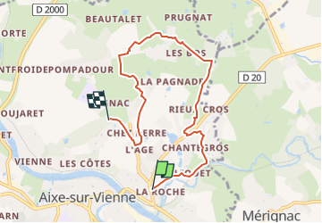
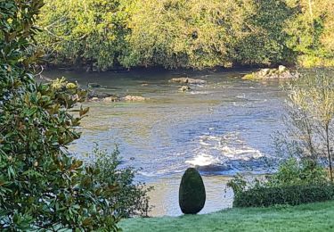
Trail On foot of 7.1 km to be discovered at New Aquitaine, Haute-Vienne, Aixe-sur-Vienne. This trail is proposed by SityTrail - itinéraires balisés pédestres.
Description
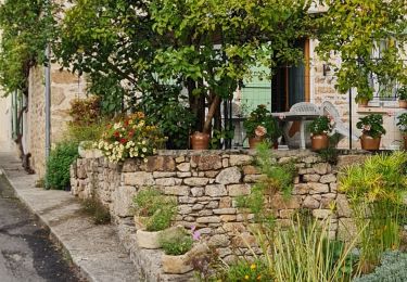
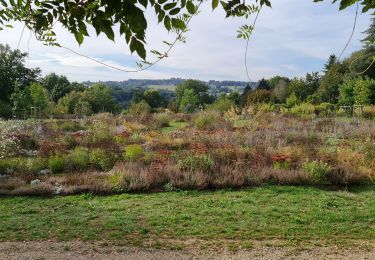
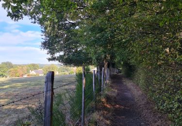
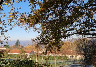
Le "circuit des puys et vallées en pays d'Aixe" vous emmène sur les rives de la Vienne et à la rencontre d'un riche patrimoine architectural. A voir la chapelle d'Arliquet et le château de l'Osmon
Website: http://www.tourisme-hautevienne.com/activites-de-plein-air/activites-terrestres/sentiers-de-randonnee/circuit-puys-et-vallees-en-pays-d-aixe-1209
Positioning
Comments
Trails nearby
![Trail Equestrian Saint-Priest-sous-Aixe - Circuit Balade en forêt des Loges - Saint-Priest-sous-Aixe - Photo](https://media.geolcdn.com/t/375/260/ext.jpg?maxdim=2&url=https%3A%2F%2Fservices.sitytrail.com%2FGeolivesWS%2FDownloadMedia.ashx%3FTrailID%3D112122%26Media%3D9917_5.jpg)
![Equestrian Equestrian](https://static1.geolcdn.com/sitytour/trail-icons/300.png)
Equestrian
![](/images/other/stat-length.png)
![](https://static1.geolcdn.com/siteimages/upload/files/16400158638029165_repeat_loop_refresh_sync_direction_icon.png)
![Trail Walking Isle - Isle - Photo](https://media.geolcdn.com/t/375/260/8f614de0-0d7a-42d9-a6cd-ee4626bee712.jpg&format=jpg&maxdim=2)
![Walking Walking](https://static1.geolcdn.com/sitytour/trail-icons/101.png)
![Trail Walking Isle - Isle - Photo](https://media.geolcdn.com/t/375/260/08956d6c-6dcd-4bf6-84f5-554d3ae12f2d.jpg&format=jpg&maxdim=2)
![Walking Walking](https://static1.geolcdn.com/sitytour/trail-icons/101.png)
![Trail Walking Verneuil-sur-Vienne - la Merlie - Photo](https://media.geolcdn.com/t/375/260/f0ccb62f-91e1-4793-b7a0-3618cfa5bd59.jpg&format=jpg&maxdim=2)
![Walking Walking](https://static1.geolcdn.com/sitytour/trail-icons/101.png)
Walking
![](/images/other/stat-length.png)
![](https://static1.geolcdn.com/siteimages/upload/files/16400158638029165_repeat_loop_refresh_sync_direction_icon.png)
![Trail Walking Saint-Priest-sous-Aixe - les Richards bosredonbos Lagarde la grauliere leygnat la tremouille - Photo](https://media.geolcdn.com/t/375/260/02d53e4f-31e4-45b4-86fb-a0497f362bab.jpg&format=jpg&maxdim=2)
![Walking Walking](https://static1.geolcdn.com/sitytour/trail-icons/101.png)
Walking
![](/images/other/stat-length.png)
![](https://static1.geolcdn.com/siteimages/upload/files/16400158638029165_repeat_loop_refresh_sync_direction_icon.png)
![Trail Walking Limoges - Limoges moulin blanc parcs - Photo](https://media.geolcdn.com/t/375/260/b087b6bb-d662-4118-808c-c2a1d43f368b.jpg&format=jpg&maxdim=2)
![Walking Walking](https://static1.geolcdn.com/sitytour/trail-icons/101.png)
Walking
![](/images/other/stat-length.png)
![](https://static1.geolcdn.com/siteimages/upload/files/16400158638029165_repeat_loop_refresh_sync_direction_icon.png)
![Trail Walking Isle - croix du thay - Photo](https://media.geolcdn.com/t/375/260/e4cc455d-5745-48dd-89aa-fbf535c11cb4.jpg&format=jpg&maxdim=2)
![Walking Walking](https://static1.geolcdn.com/sitytour/trail-icons/101.png)
Walking
![](/images/other/stat-length.png)
![](https://static1.geolcdn.com/siteimages/upload/files/16400158638029165_repeat_loop_refresh_sync_direction_icon.png)
![Trail Walking Verneuil-sur-Vienne - la merlie - Photo](https://media.geolcdn.com/t/375/260/025039ff-5caf-470d-b1cb-c65cb78ac80c.jpg&format=jpg&maxdim=2)
![Walking Walking](https://static1.geolcdn.com/sitytour/trail-icons/101.png)
Walking
![](/images/other/stat-length.png)
![](https://static1.geolcdn.com/siteimages/upload/files/16400158638029165_repeat_loop_refresh_sync_direction_icon.png)
![Trail Walking Aixe-sur-Vienne - Aix-en-Provence sur V. - Photo](https://media.geolcdn.com/t/375/260/de392b40-54e7-4254-b92a-c645f5871cff.jpg&format=jpg&maxdim=2)
![Walking Walking](https://static1.geolcdn.com/sitytour/trail-icons/101.png)
Walking
![](/images/other/stat-length.png)
![](https://static1.geolcdn.com/siteimages/upload/files/16400158638029165_repeat_loop_refresh_sync_direction_icon.png)