![](/images/other/stat-length.png)
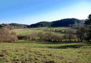
![Trail On foot Manzat - La Roche de Sauterre - Photo](https://media.geolcdn.com/t/1900/400/8dba4542-9ef0-4bdf-8b1f-a5675463ca16.jpeg&format=pjpeg&maxdim=2)
La Roche de Sauterre
SityTrail - itinéraires balisés pédestres
Tous les sentiers balisés d’Europe GUIDE+
![Length](/images/other/stat-length.png)
Length
4.2 km
![Max alt](https://static1.geolcdn.com/siteimages/upload/files/1508320355ic_sort_altitude_max_24dp.png)
Max alt
976 m
![Uphill gradient](https://static1.geolcdn.com/siteimages/upload/files/1508320355ic_sort_den_pos_24dp.png)
Uphill gradient
117 m
![Km-Effort](/images/other/stat-length.png)
Km-Effort
5.8 km
![Min alt](https://static1.geolcdn.com/siteimages/upload/files/1508320355ic_sort_altitude_min_24dp.png)
Min alt
866 m
![Downhill gradient](https://static1.geolcdn.com/siteimages/upload/files/1508320355ic_sort_den_neg_24dp.png)
Downhill gradient
121 m
![Boucle](https://static1.geolcdn.com/siteimages/upload/files/16400158638029165_repeat_loop_refresh_sync_direction_icon.png)
Boucle
Yes
Signpost
Creation date :
2022-02-15 13:27:41.251
Updated on :
2022-03-02 15:48:26.566
![On foot](https://static1.geolcdn.com/sitytour/trail-icons/100.png)
1h18
Difficulty : Easy
![Scan this QR Code to open this trail in the SityTrail application](https://capi.geolives.com/qq0zvz2zws4bq2lad0pu/sitytour/trails/3119285/qr.png?size=200)
FREE GPS app for hiking
About
Trail On foot of 4.2 km to be discovered at Auvergne-Rhône-Alpes, Puy-de-Dôme, Manzat. This trail is proposed by SityTrail - itinéraires balisés pédestres.
Description
Trail created by CD63.
Positioning
Country:
France
Region :
Auvergne-Rhône-Alpes
Department/Province :
Puy-de-Dôme
Municipality :
Manzat
Location:
Unknown
Start:(Dec)
Start:(UTM)
494378 ; 5084251 (31T) N.
Comments
Trails nearby
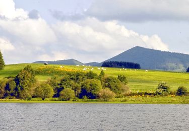
![Trail Walking Pulvérières - Pulverieres_Etang_Grand - Photo](https://media.geolcdn.com/t/375/260/422b13e9-38d7-4e06-b1aa-c671b113145c.jpg&format=jpg&maxdim=2)
![Walking Walking](https://static1.geolcdn.com/sitytour/trail-icons/101.png)
Pulverieres_Etang_Grand
Walking
Easy
(1)
Pulvérières,
Auvergne-Rhône-Alpes,
Puy-de-Dôme,
France
![](/images/other/stat-length.png)
8 km | 9.9 km-effort
2h 30min
![](https://static1.geolcdn.com/siteimages/upload/files/16400158638029165_repeat_loop_refresh_sync_direction_icon.png)
Yes
![Trail On foot Chapdes-Beaufort - Le Chemin Fais'Art - Photo](https://media.geolcdn.com/t/375/260/6a67584d-6d2a-4686-9980-b00966620a6c.jpeg&format=jpg&maxdim=2)
![On foot On foot](https://static1.geolcdn.com/sitytour/trail-icons/100.png)
Le Chemin Fais'Art
On foot
Easy
Chapdes-Beaufort,
Auvergne-Rhône-Alpes,
Puy-de-Dôme,
France
![](/images/other/stat-length.png)
6.5 km | 8.6 km-effort
1h 57min
![](https://static1.geolcdn.com/siteimages/upload/files/16400158638029165_repeat_loop_refresh_sync_direction_icon.png)
Yes
![Trail On foot Chapdes-Beaufort - La Vierge de Beaufort - Photo](https://media.geolcdn.com/t/375/260/6a67584d-6d2a-4686-9980-b00966620a6c.jpeg&format=jpg&maxdim=2)
![On foot On foot](https://static1.geolcdn.com/sitytour/trail-icons/100.png)
La Vierge de Beaufort
On foot
Easy
Chapdes-Beaufort,
Auvergne-Rhône-Alpes,
Puy-de-Dôme,
France
![](/images/other/stat-length.png)
10.8 km | 14.7 km-effort
3h 20min
![](https://static1.geolcdn.com/siteimages/upload/files/16400158638029165_repeat_loop_refresh_sync_direction_icon.png)
Yes
![Trail On foot Manzat - Aux Sources de la Morge - Photo](https://media.geolcdn.com/t/375/260/5410179d-bc75-4fce-aa40-6165831bf324.jpeg&format=jpg&maxdim=2)
![On foot On foot](https://static1.geolcdn.com/sitytour/trail-icons/100.png)
Aux Sources de la Morge
On foot
Medium
Manzat,
Auvergne-Rhône-Alpes,
Puy-de-Dôme,
France
![](/images/other/stat-length.png)
16.3 km | 23 km-effort
5h 8min
![](https://static1.geolcdn.com/siteimages/upload/files/16400158638029165_repeat_loop_refresh_sync_direction_icon.png)
Yes
![Trail On foot Saint-Georges-de-Mons - Les Meandres de Queuillle - Photo](https://media.geolcdn.com/t/375/260/078844af-a0a5-4551-8bac-d787e0bf10fc.jpeg&format=jpg&maxdim=2)
![On foot On foot](https://static1.geolcdn.com/sitytour/trail-icons/100.png)
Les Meandres de Queuillle
On foot
Easy
Saint-Georges-de-Mons,
Auvergne-Rhône-Alpes,
Puy-de-Dôme,
France
![](/images/other/stat-length.png)
11.7 km | 16.7 km-effort
3h 47min
![](https://static1.geolcdn.com/siteimages/upload/files/16400158638029165_repeat_loop_refresh_sync_direction_icon.png)
Yes
![Trail Walking Charbonnières-les-Varennes - Le Puy de Paugnat - Photo](https://media.geolcdn.com/t/375/260/b631891c-a86d-4ad8-811c-e5b56ec82195.jpg&format=jpg&maxdim=2)
![Walking Walking](https://static1.geolcdn.com/sitytour/trail-icons/101.png)
Le Puy de Paugnat
Walking
Medium
Charbonnières-les-Varennes,
Auvergne-Rhône-Alpes,
Puy-de-Dôme,
France
![](/images/other/stat-length.png)
10.7 km | 13.9 km-effort
2h 40min
![](https://static1.geolcdn.com/siteimages/upload/files/16400158638029165_repeat_loop_refresh_sync_direction_icon.png)
Yes
![Trail Nordic walking Chapdes-Beaufort - la Vierge de Beaufort - Photo](https://media.geolcdn.com/t/375/260/07e3c048-3b64-447c-9c82-7cc4c6a72d27.jpg&format=jpg&maxdim=2)
![Nordic walking Nordic walking](https://static1.geolcdn.com/sitytour/trail-icons/102.png)
la Vierge de Beaufort
Nordic walking
Easy
Chapdes-Beaufort,
Auvergne-Rhône-Alpes,
Puy-de-Dôme,
France
![](/images/other/stat-length.png)
11.8 km | 15.9 km-effort
3h 9min
![](https://static1.geolcdn.com/siteimages/upload/files/16400158638029165_repeat_loop_refresh_sync_direction_icon.png)
Yes
![Trail Walking Charbonnières-les-Varennes - Beaunit_Narse_JG_02 - Photo](https://media.geolcdn.com/t/375/260/2347cc26-eafa-4011-be79-b7d07d478152.jpg&format=jpg&maxdim=2)
![Walking Walking](https://static1.geolcdn.com/sitytour/trail-icons/101.png)
Beaunit_Narse_JG_02
Walking
Easy
Charbonnières-les-Varennes,
Auvergne-Rhône-Alpes,
Puy-de-Dôme,
France
![](/images/other/stat-length.png)
8.2 km | 10.4 km-effort
2h 30min
![](https://static1.geolcdn.com/siteimages/upload/files/16400158638029165_repeat_loop_refresh_sync_direction_icon.png)
Yes
![Trail Walking Charbonnières-les-Varennes - Grande Boucle Veygoux_T - Photo](https://media.geolcdn.com/t/375/260/b9d23140-608b-474b-a6ea-9e930976d1ba.jpg&format=jpg&maxdim=2)
![Walking Walking](https://static1.geolcdn.com/sitytour/trail-icons/101.png)
Grande Boucle Veygoux_T
Walking
Easy
Charbonnières-les-Varennes,
Auvergne-Rhône-Alpes,
Puy-de-Dôme,
France
![](/images/other/stat-length.png)
13.1 km | 16.4 km-effort
3h 37min
![](https://static1.geolcdn.com/siteimages/upload/files/16400158638029165_repeat_loop_refresh_sync_direction_icon.png)
Yes