![](/images/other/stat-length.png)
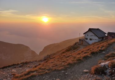
![Trail On foot Brentonico - IT-O654 - Photo](https://media.geolcdn.com/t/1900/400/471fd94c-bd42-437a-9cd8-0693f7690595.jpeg&format=pjpeg&maxdim=2)
IT-O654
SityTrail - itinéraires balisés pédestres
Tous les sentiers balisés d’Europe GUIDE+
![Length](/images/other/stat-length.png)
Length
6.3 km
![Max alt](https://static1.geolcdn.com/siteimages/upload/files/1508320355ic_sort_altitude_max_24dp.png)
Max alt
1505 m
![Uphill gradient](https://static1.geolcdn.com/siteimages/upload/files/1508320355ic_sort_den_pos_24dp.png)
Uphill gradient
329 m
![Km-Effort](/images/other/stat-length.png)
Km-Effort
10.1 km
![Min alt](https://static1.geolcdn.com/siteimages/upload/files/1508320355ic_sort_altitude_min_24dp.png)
Min alt
1182 m
![Downhill gradient](https://static1.geolcdn.com/siteimages/upload/files/1508320355ic_sort_den_neg_24dp.png)
Downhill gradient
160 m
![Boucle](https://static1.geolcdn.com/siteimages/upload/files/16400158638029165_repeat_loop_refresh_sync_direction_icon.png)
Boucle
No
Signpost
Creation date :
2022-02-15 13:13:49.948
Updated on :
2022-03-01 11:15:46.558
![On foot](https://static1.geolcdn.com/sitytour/trail-icons/100.png)
2h18
Difficulty : Easy
![Scan this QR Code to open this trail in the SityTrail application](https://capi.geolives.com/qq0zvz2zws4bq2lad0pu/sitytour/trails/3118955/qr.png?size=200)
FREE GPS app for hiking
About
Trail On foot of 6.3 km to be discovered at Trentino-Alto Adige/Südtirol, Provincia di Trento, Brentonico. This trail is proposed by SityTrail - itinéraires balisés pédestres.
Description
Trail created by Società degli Alpinisti Tridentini.
Website: http://www.sat.tn.it/
Positioning
Country:
Italy
Region :
Trentino-Alto Adige/Südtirol
Department/Province :
Provincia di Trento
Municipality :
Brentonico
Location:
Unknown
Start:(Dec)
Start:(UTM)
648231 ; 5071733 (32T) N.
Comments
Trails nearby
![Trail On foot Malcesine - Sentiero delle Creste - Photo](https://media.geolcdn.com/t/375/260/96362f89-dd5f-48cd-afb7-948e16a28761.jpeg&format=jpg&maxdim=2)
![On foot On foot](https://static1.geolcdn.com/sitytour/trail-icons/100.png)
Sentiero delle Creste
On foot
Medium
Malcesine,
Veneto,
Verona,
Italy
![](/images/other/stat-length.png)
11.5 km | 23 km-effort
5h 16min
![](https://static1.geolcdn.com/siteimages/upload/files/16400158638029165_repeat_loop_refresh_sync_direction_icon.png)
No
![Trail On foot Avio - IT-O652 - Photo](https://media.geolcdn.com/t/375/260/5e7c333d-5ccf-463b-9f3f-4867284d4645.jpeg&format=jpg&maxdim=2)
![On foot On foot](https://static1.geolcdn.com/sitytour/trail-icons/100.png)
IT-O652
On foot
Medium
Avio,
Trentino-Alto Adige/Südtirol,
Provincia di Trento,
Italy
![](/images/other/stat-length.png)
8 km | 21 km-effort
4h 49min
![](https://static1.geolcdn.com/siteimages/upload/files/16400158638029165_repeat_loop_refresh_sync_direction_icon.png)
No
![Trail On foot Brentonico - IT-O651 - Photo](https://media.geolcdn.com/t/375/260/6911bd7a-2777-48f7-ba85-a30fc036b9ed.jpeg&format=jpg&maxdim=2)
![On foot On foot](https://static1.geolcdn.com/sitytour/trail-icons/100.png)
IT-O651
On foot
Easy
Brentonico,
Trentino-Alto Adige/Südtirol,
Provincia di Trento,
Italy
![](/images/other/stat-length.png)
4.2 km | 6.3 km-effort
1h 25min
![](https://static1.geolcdn.com/siteimages/upload/files/16400158638029165_repeat_loop_refresh_sync_direction_icon.png)
No
![Trail On foot Avio - IT-O687 - Photo](https://media.geolcdn.com/t/375/260/85ac9577-5449-4da4-afaf-1a1ca896112b.jpeg&format=jpg&maxdim=2)
![On foot On foot](https://static1.geolcdn.com/sitytour/trail-icons/100.png)
IT-O687
On foot
Easy
Avio,
Trentino-Alto Adige/Südtirol,
Provincia di Trento,
Italy
![](/images/other/stat-length.png)
7 km | 18.4 km-effort
4h 11min
![](https://static1.geolcdn.com/siteimages/upload/files/16400158638029165_repeat_loop_refresh_sync_direction_icon.png)
No
![Trail On foot Malcesine - Navene - Bocca di Navene inn. sent. 651 - Photo](https://media.geolcdn.com/t/375/260/5fda416f-890b-4937-a005-cc5453fc5dd8.jpeg&format=jpg&maxdim=2)
![On foot On foot](https://static1.geolcdn.com/sitytour/trail-icons/100.png)
Navene - Bocca di Navene inn. sent. 651
On foot
Easy
Malcesine,
Veneto,
Verona,
Italy
![](/images/other/stat-length.png)
4.5 km | 8.2 km-effort
1h 51min
![](https://static1.geolcdn.com/siteimages/upload/files/16400158638029165_repeat_loop_refresh_sync_direction_icon.png)
No
![Trail On foot Malcesine - San Michele - Tratto Spino - Photo](https://media.geolcdn.com/t/375/260/2b9498f9-6de9-4966-a9d3-1462bea31fd2.jpeg&format=jpg&maxdim=2)
![On foot On foot](https://static1.geolcdn.com/sitytour/trail-icons/100.png)
San Michele - Tratto Spino
On foot
Easy
Malcesine,
Veneto,
Verona,
Italy
![](/images/other/stat-length.png)
6.5 km | 10.1 km-effort
2h 18min
![](https://static1.geolcdn.com/siteimages/upload/files/16400158638029165_repeat_loop_refresh_sync_direction_icon.png)
No
![Trail On foot Avio - IT-O686 - Photo](https://media.geolcdn.com/t/375/260/85ac9577-5449-4da4-afaf-1a1ca896112b.jpeg&format=jpg&maxdim=2)
![On foot On foot](https://static1.geolcdn.com/sitytour/trail-icons/100.png)
IT-O686
On foot
Easy
Avio,
Trentino-Alto Adige/Südtirol,
Provincia di Trento,
Italy
![](/images/other/stat-length.png)
5.1 km | 15.4 km-effort
3h 30min
![](https://static1.geolcdn.com/siteimages/upload/files/16400158638029165_repeat_loop_refresh_sync_direction_icon.png)
No
![Trail On foot Brentonico - IT-O622 - Photo](https://media.geolcdn.com/t/375/260/828c08fb-f486-4383-81f2-b81a7a546dcd.jpeg&format=jpg&maxdim=2)
![On foot On foot](https://static1.geolcdn.com/sitytour/trail-icons/100.png)
IT-O622
On foot
Easy
Brentonico,
Trentino-Alto Adige/Südtirol,
Provincia di Trento,
Italy
![](/images/other/stat-length.png)
5 km | 7.8 km-effort
1h 46min
![](https://static1.geolcdn.com/siteimages/upload/files/16400158638029165_repeat_loop_refresh_sync_direction_icon.png)
No
![Trail On foot Malcesine - Il Signor- Prai - Bocca di Navene - Photo](https://media.geolcdn.com/t/375/260/98998bc8-5bd6-4599-a608-a554e86f7e61.jpeg&format=jpg&maxdim=2)
![On foot On foot](https://static1.geolcdn.com/sitytour/trail-icons/100.png)
Il Signor- Prai - Bocca di Navene
On foot
Easy
Malcesine,
Veneto,
Verona,
Italy
![](/images/other/stat-length.png)
5 km | 11.1 km-effort
2h 31min
![](https://static1.geolcdn.com/siteimages/upload/files/16400158638029165_repeat_loop_refresh_sync_direction_icon.png)
No