


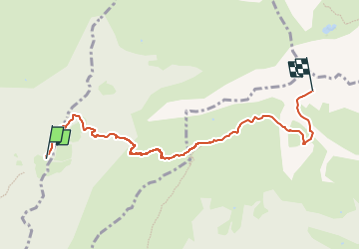

4 km | 7.2 km-effort

Tous les sentiers balisés d’Europe GUIDE+


FREE GPS app for hiking
 SityTrail
IGN / Geographical institutes
SityTrail World
The world is yours!
Trail On foot of 6.2 km to be discovered at Lombardy, Bergamo, Oltressenda Alta. This trail is proposed by SityTrail - itinéraires balisés pédestres.
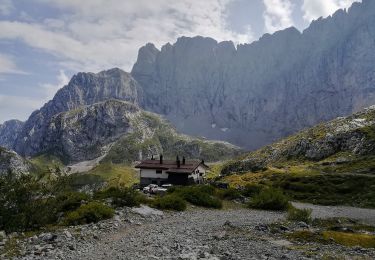
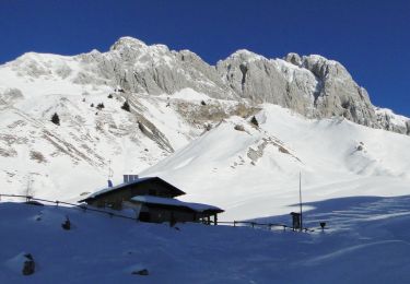
Dalle baite del Möschel (1265 m – raggiungibili da Valzurio in 2 ore) si sale per pochi minuti (15-20') lungo il sentiero 311. Si lascia la strada forestale e si devia poi a destra in direzione baita bassa Bruseda (1498 m) e si sale nel vallone che porta al rifugio Olmo (1819 m). Oltrepassato il rifugio, il sentiero procede in direzione ENE risalendo dolcemente il largo
Website: http://geoportale.caibergamo.it/it/sentiero/320


On foot
On foot

On foot
On foot
On foot
On foot