Trail On foot Mezzoldo - Sentiero 124: Rifugio Madonna delle Nevi - Bivacco Zamboni - Photo

Sentiero 124: Rifugio Madonna delle Nevi - Bivacco Zamboni

Tous les sentiers balisés d’Europe PRO

© OpenStreetMap contributors
Length
Length
4 km
Max alt
Max alt
2009 m
Uphill gradient
Uphill gradient
687 m
Km-Effort
Km-Effort  
10.9 km
Min alt
Min alt
1309 m
Downhill gradient
Downhill gradient
2 m
Boucle
Boucle
No
Signpost
Signpost
Creation date :
2022-02-15 08:07:12.293
Updated on :
2022-03-01 06:33:58.842

(0 Reviews)

On foot
On foot
2h28
Difficulty : Easy

Scan this QR Code to open this trail in the SityTrail application

FREE GPS app for hiking

Logo SityTrail SityTrail

IGN / Geographical institutes

Download SityTrail from the App Store Download SityTrail from Google Play

Logo SityTrail SityTrail World

The world is yours!

Download SityTrail from the App Store Download SityTrail from Google Play Download SityTrail on Huawei AppGallery

About

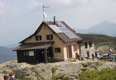
Trail On foot of 4 km to be discovered at Lombardy, Bergamo, Mezzoldo. This trail is proposed by SityTrail - itinéraires balisés pédestres.

Description

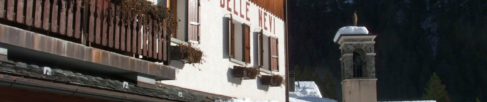
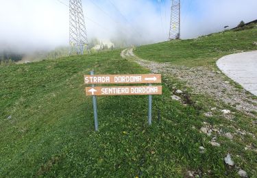
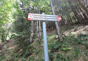
Dal rifugio Madonna delle Nevi (1336 m) si risale la valle del fiume Brembo (è possibile sia sul lato destro che sinistro, poi le strade si uniscono). Si continua poi sul lato orografico sinistro fino a quota 1430 m circa (segnalazioni), per lasciare quindi il fondovalle e piegare a sinistra salendo nel bosco. Con percorso a tornanti si arriva alla baita Cassù (1624 m) e si

Website: http://geoportale.caibergamo.it/it/sentiero/124

Photos

Positioning

Country:
Italy
Region :
Lombardy
Department/Province :
Bergamo
Municipality :
Mezzoldo
Location:
Unknown
Start:(UTM)
550699 ; 5098884 (32T) N.

Trails nearby

Trail On foot Mezzoldo - Sentiero 111: Mezzoldo (Madonna delle Nevi) - Forcella Rossa - Photo
On foot
PRO

On foot

Easy
Mezzoldo, Lombardy, Bergamo, Italy
3.7 km | 9.7 km-effort
2h 12min
No
Trail On foot Mezzoldo - Sentiero 115: Mezzoldo (Ponte dell'Acqua) - Passo di S. Simone - Photo
On foot
PRO

On foot

Easy
Mezzoldo, Lombardy, Bergamo, Italy
5.6 km | 13.8 km-effort
3h 7min
No
Trail On foot Averara - Sentiero 113: Mezzoldo (Soliva) - Ca' San Marco - Photo
On foot
PRO

On foot

Easy
Averara, Lombardy, Bergamo, Italy
6.4 km | 9.8 km-effort
2h 13min
No
Trail On foot Averara - IT-161 - Photo
On foot
PRO

On foot

Easy
Averara, Lombardy, Bergamo, Italy
7.5 km | 14.8 km-effort
3h 21min
No
Trail On foot Valleve - IT-201 - Photo
On foot
PRO

On foot

Easy
Valleve, Lombardy, Bergamo, Italy
4.6 km | 9 km-effort
2h 3min
No
Trail On foot Mezzoldo - (SI D17S) Rifugio Balicco - Rifugio Dordona - Photo
On foot
PRO

On foot

Medium
Mezzoldo, Lombardy, Bergamo, Italy
11.5 km | 22 km-effort
5h 3min
No
Trail On foot Averara - Sentiero delle Orobie Occidentali - Tappa 4 - Photo
On foot
PRO

On foot

Difficult
Averara, Lombardy, Bergamo, Italy
17.8 km | 33 km-effort
7h 34min
No
Trail On foot Piazzatorre - Sentiero 121: Piazzatorre (Piazzo) - Torcola Vaga (sentiero 119) - Photo
On foot
PRO

On foot

Easy
Piazzatorre, Lombardy, Bergamo, Italy
3.2 km | 9 km-effort
2h 2min
No
Trail On foot Piazzatorre - Sentiero 118: Piazzatorre (Piazzo) - Passo e Casera di Monte Colle - Photo
On foot
PRO

On foot

Easy
Piazzatorre, Lombardy, Bergamo, Italy
3.9 km | 12.4 km-effort
2h 49min
No


Close
My subscriptions