![](/images/other/stat-length.png)
![Trail On foot Modigliana - IT-573 - Photo](https://media.geolcdn.com/t/1900/400/ext.pjpeg?maxdim=2&url=https%3A%2F%2Fmedia.geolcdn.com%2Ff%2Fc37c17cc-8b7a-4bd5-9607-206acd225376.jpeg)
IT-573
SityTrail - itinéraires balisés pédestres
Tous les sentiers balisés d’Europe PRO
![Length](/images/other/stat-length.png)
Length
7.6 km
![Max alt](https://static1.geolcdn.com/siteimages/upload/files/1508320355ic_sort_altitude_max_24dp.png)
Max alt
617 m
![Uphill gradient](https://static1.geolcdn.com/siteimages/upload/files/1508320355ic_sort_den_pos_24dp.png)
Uphill gradient
488 m
![Km-Effort](/images/other/stat-length.png)
Km-Effort
12.7 km
![Min alt](https://static1.geolcdn.com/siteimages/upload/files/1508320355ic_sort_altitude_min_24dp.png)
Min alt
184 m
![Downhill gradient](https://static1.geolcdn.com/siteimages/upload/files/1508320355ic_sort_den_neg_24dp.png)
Downhill gradient
58 m
![Boucle](https://static1.geolcdn.com/siteimages/upload/files/16400158638029165_repeat_loop_refresh_sync_direction_icon.png)
Boucle
No
Signpost
Creation date :
2022-02-15 06:22:28.236
Updated on :
2022-03-01 05:06:55.674
![On foot](https://static1.geolcdn.com/sitytour/trail-icons/100.png)
2h53
Difficulty : Easy
![Scan this QR Code to open this trail in the SityTrail application](https://capi.geolives.com/qq0zvz2zws4bq2lad0pu/sitytour/trails/3116541/qr.png?size=200)
FREE GPS app for hiking
About
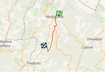
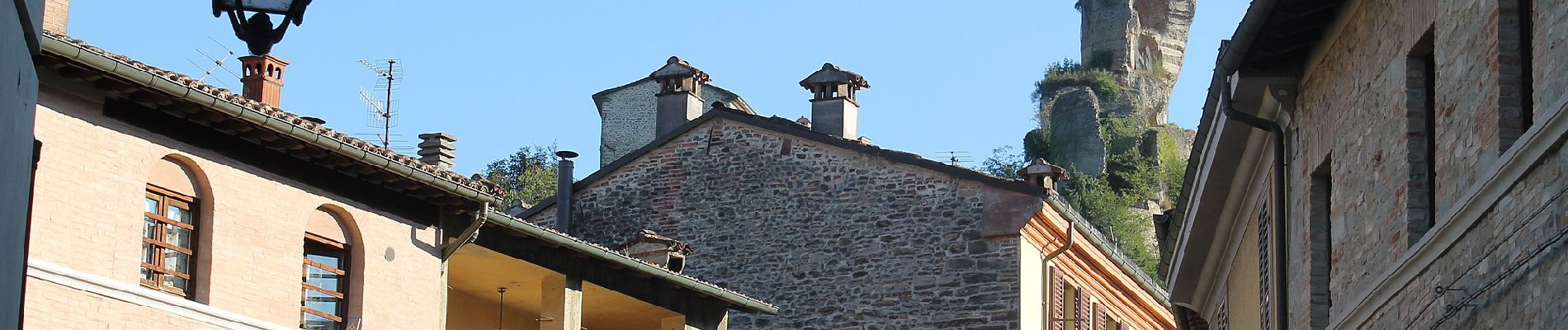
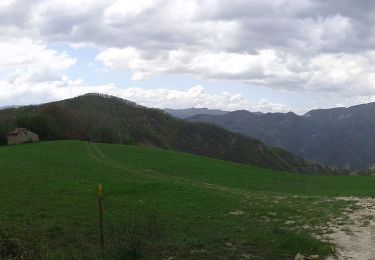
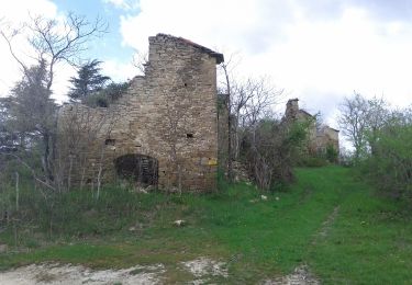
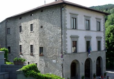
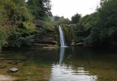
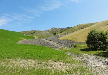
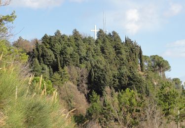
Trail On foot of 7.6 km to be discovered at Emilia-Romagna, Forlì-Cesena, Modigliana. This trail is proposed by SityTrail - itinéraires balisés pédestres.
Description
Trail created by CAI Faenza.
Relation maintened by Gabriele Sani (CAI-FA)
Symbol: 573 on white red flag
Website: http://www.caifaenza.it/
Positioning
Country:
Italy
Region :
Emilia-Romagna
Department/Province :
Forlì-Cesena
Municipality :
Modigliana
Location:
Unknown
Start:(Dec)
Start:(UTM)
723492 ; 4892902 (32T) N.
Comments
Trails nearby
![Trail On foot Predappio - Terre Spungone Trekking - Photo](https://media.geolcdn.com/t/375/260/ext.jpg?maxdim=2&url=https%3A%2F%2Fmedia.geolcdn.com%2Ff%2Ffe49aee0-f977-423a-8629-a40b309820e8.jpeg)
![On foot On foot](https://static1.geolcdn.com/sitytour/trail-icons/100.png)
Terre Spungone Trekking
On foot
Easy
Predappio,
Emilia-Romagna,
Forlì-Cesena,
Italy
![](/images/other/stat-length.png)
10.4 km | 14.8 km-effort
3h 22min
![](https://static1.geolcdn.com/siteimages/upload/files/16400158638029165_repeat_loop_refresh_sync_direction_icon.png)
No
![Trail On foot Brisighella - Sentiero Frassati B - Photo](https://media.geolcdn.com/t/375/260/ext.jpg?maxdim=2&url=https%3A%2F%2Fmedia.geolcdn.com%2Ff%2F9a6f6896-ddfd-4247-ab63-1698eeffcc1b.jpeg)
![On foot On foot](https://static1.geolcdn.com/sitytour/trail-icons/100.png)
Sentiero Frassati B
On foot
Medium
Brisighella,
Emilia-Romagna,
Ravenna,
Italy
![](/images/other/stat-length.png)
16.4 km | 26 km-effort
5h 51min
![](https://static1.geolcdn.com/siteimages/upload/files/16400158638029165_repeat_loop_refresh_sync_direction_icon.png)
Yes
![Trail On foot Brisighella - Sentiero Frassati A - Photo](https://media.geolcdn.com/t/375/260/ext.jpg?maxdim=2&url=https%3A%2F%2Fmedia.geolcdn.com%2Ff%2F7717021e-3e23-41b7-8f9a-f019ec2e273e.jpeg)
![On foot On foot](https://static1.geolcdn.com/sitytour/trail-icons/100.png)
Sentiero Frassati A
On foot
Easy
Brisighella,
Emilia-Romagna,
Ravenna,
Italy
![](/images/other/stat-length.png)
8.9 km | 13.2 km-effort
3h 0min
![](https://static1.geolcdn.com/siteimages/upload/files/16400158638029165_repeat_loop_refresh_sync_direction_icon.png)
Yes
![Trail On foot Brisighella - Il Sentiero dell'Olio - Photo](https://media.geolcdn.com/t/375/260/ext.jpg?maxdim=2&url=https%3A%2F%2Fmedia.geolcdn.com%2Ff%2F4d2b4d8a-b0b3-41d5-9036-cfa7292177ed.jpeg)
![On foot On foot](https://static1.geolcdn.com/sitytour/trail-icons/100.png)
Il Sentiero dell'Olio
On foot
Easy
Brisighella,
Emilia-Romagna,
Ravenna,
Italy
![](/images/other/stat-length.png)
5.8 km | 8.7 km-effort
1h 58min
![](https://static1.geolcdn.com/siteimages/upload/files/16400158638029165_repeat_loop_refresh_sync_direction_icon.png)
No
![Trail On foot Palazzuolo sul Senio - IT-60 - Photo](https://media.geolcdn.com/t/375/260/ext.jpg?maxdim=2&url=https%3A%2F%2Fmedia.geolcdn.com%2Ff%2F4cc445d7-5b36-4e4e-bb44-0b0d749d9736.jpeg)
![On foot On foot](https://static1.geolcdn.com/sitytour/trail-icons/100.png)
IT-60
On foot
Difficult
Palazzuolo sul Senio,
Tuscany,
Metropolitan City of Florence,
Italy
![](/images/other/stat-length.png)
24 km | 37 km-effort
8h 19min
![](https://static1.geolcdn.com/siteimages/upload/files/16400158638029165_repeat_loop_refresh_sync_direction_icon.png)
No
![Trail On foot Palazzuolo sul Senio - IT-20 - Photo](https://media.geolcdn.com/t/375/260/ext.jpg?maxdim=2&url=https%3A%2F%2Fmedia.geolcdn.com%2Ff%2Fad1c1d1f-4634-4db4-9012-3bad84e9e165.jpeg)
![On foot On foot](https://static1.geolcdn.com/sitytour/trail-icons/100.png)
IT-20
On foot
Easy
Palazzuolo sul Senio,
Tuscany,
Metropolitan City of Florence,
Italy
![](/images/other/stat-length.png)
11.3 km | 18.4 km-effort
4h 10min
![](https://static1.geolcdn.com/siteimages/upload/files/16400158638029165_repeat_loop_refresh_sync_direction_icon.png)
No
![Trail On foot Borgo Tossignano - L'Anello della Riva di San Biagio - Photo](https://media.geolcdn.com/t/375/260/ext.jpg?maxdim=2&url=https%3A%2F%2Fmedia.geolcdn.com%2Ff%2F98ecc143-18d6-4b6c-927b-b5e8bf5096ae.jpeg)
![On foot On foot](https://static1.geolcdn.com/sitytour/trail-icons/100.png)
L'Anello della Riva di San Biagio
On foot
Easy
Borgo Tossignano,
Emilia-Romagna,
Bologna,
Italy
![](/images/other/stat-length.png)
6.1 km | 11.8 km-effort
2h 41min
![](https://static1.geolcdn.com/siteimages/upload/files/16400158638029165_repeat_loop_refresh_sync_direction_icon.png)
No
![Trail On foot Riolo Terme - L'Anello di Monte Mauro - Photo](https://media.geolcdn.com/t/375/260/ext.jpg?maxdim=2&url=https%3A%2F%2Fmedia.geolcdn.com%2Ff%2F0996e483-5ddb-4f7f-b714-a50b02cd9289.jpeg)
![On foot On foot](https://static1.geolcdn.com/sitytour/trail-icons/100.png)
L'Anello di Monte Mauro
On foot
Easy
Riolo Terme,
Emilia-Romagna,
Ravenna,
Italy
![](/images/other/stat-length.png)
10.4 km | 18.9 km-effort
4h 18min
![](https://static1.geolcdn.com/siteimages/upload/files/16400158638029165_repeat_loop_refresh_sync_direction_icon.png)
Yes
![Trail On foot Brisighella - L'Anello del Carnè - Photo](https://media.geolcdn.com/t/375/260/ext.jpg?maxdim=2&url=https%3A%2F%2Fmedia.geolcdn.com%2Ff%2Fb47d208e-9dc9-44a3-9e00-212e56fa737c.jpeg)
![On foot On foot](https://static1.geolcdn.com/sitytour/trail-icons/100.png)
L'Anello del Carnè
On foot
Easy
Brisighella,
Emilia-Romagna,
Ravenna,
Italy
![](/images/other/stat-length.png)
5.4 km | 8.3 km-effort
1h 53min
![](https://static1.geolcdn.com/siteimages/upload/files/16400158638029165_repeat_loop_refresh_sync_direction_icon.png)
Yes