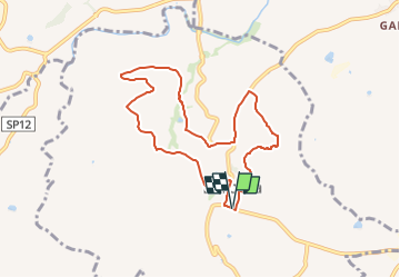
![](/images/other/stat-length.png)
![Trail On foot Barbara - Ciclando - Passeggiando - Photo](https://media.geolcdn.com/t/1900/400/ext.pjpeg?maxdim=2&url=https%3A%2F%2Fstatic1.geolcdn.com%2Fsiteimages%2Fupload%2Ffiles%2F1545311037marcheuse_200dpi.jpg)
Ciclando - Passeggiando
SityTrail - itinéraires balisés pédestres
Tous les sentiers balisés d’Europe GUIDE+
![Length](/images/other/stat-length.png)
Length
8.5 km
![Max alt](https://static1.geolcdn.com/siteimages/upload/files/1508320355ic_sort_altitude_max_24dp.png)
Max alt
223 m
![Uphill gradient](https://static1.geolcdn.com/siteimages/upload/files/1508320355ic_sort_den_pos_24dp.png)
Uphill gradient
252 m
![Km-Effort](/images/other/stat-length.png)
Km-Effort
11.8 km
![Min alt](https://static1.geolcdn.com/siteimages/upload/files/1508320355ic_sort_altitude_min_24dp.png)
Min alt
112 m
![Downhill gradient](https://static1.geolcdn.com/siteimages/upload/files/1508320355ic_sort_den_neg_24dp.png)
Downhill gradient
248 m
![Boucle](https://static1.geolcdn.com/siteimages/upload/files/16400158638029165_repeat_loop_refresh_sync_direction_icon.png)
Boucle
Yes
Signpost
Creation date :
2022-02-15 06:07:27.393
Updated on :
2022-03-01 04:34:16.722
![On foot](https://static1.geolcdn.com/sitytour/trail-icons/100.png)
2h41
Difficulty : Easy
![Scan this QR Code to open this trail in the SityTrail application](https://capi.geolives.com/qq0zvz2zws4bq2lad0pu/sitytour/trails/3116309/qr.png?size=200)
FREE GPS app for hiking
About
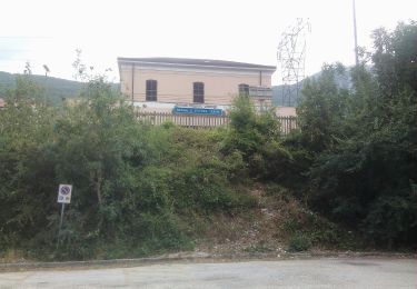
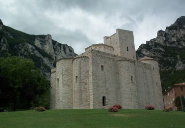
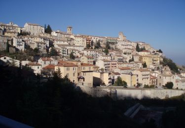
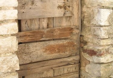
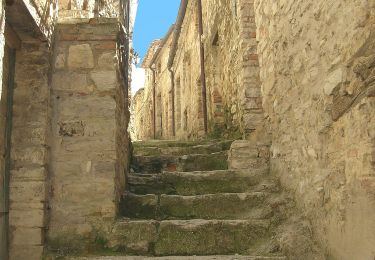
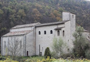
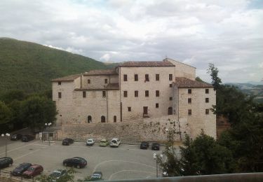
Trail On foot of 8.5 km to be discovered at Marche, Ancona, Barbara. This trail is proposed by SityTrail - itinéraires balisés pédestres.
Description
Trail created by Comune di Barbara.
Website: http://www.comune.barbara.an.it/po/mostra_news.php?id=217
Positioning
Country:
Italy
Region :
Marche
Department/Province :
Ancona
Municipality :
Barbara
Location:
Unknown
Start:(Dec)
Start:(UTM)
340656 ; 4826980 (33T) N.
Comments
Trails nearby
![Trail On foot Genga - IT-118 - Photo](https://media.geolcdn.com/t/375/260/21d09fbd-1b17-407a-bd4d-f07640efdab1.jpeg&format=jpg&maxdim=2)
![On foot On foot](https://static1.geolcdn.com/sitytour/trail-icons/100.png)
![Trail On foot Genga - IT-146A - Photo](https://media.geolcdn.com/t/375/260/e5bd19e9-cc2a-42a3-9bae-cc346e37a653.jpeg&format=jpg&maxdim=2)
![On foot On foot](https://static1.geolcdn.com/sitytour/trail-icons/100.png)
![Trail On foot Arcevia - IT-142A - Photo](https://media.geolcdn.com/t/375/260/3f6e9675-7f72-4305-bc9f-6db91bccec95.jpeg&format=jpg&maxdim=2)
![On foot On foot](https://static1.geolcdn.com/sitytour/trail-icons/100.png)
![Trail On foot Genga - IT-146 - Photo](https://media.geolcdn.com/t/375/260/e5bd19e9-cc2a-42a3-9bae-cc346e37a653.jpeg&format=jpg&maxdim=2)
![On foot On foot](https://static1.geolcdn.com/sitytour/trail-icons/100.png)
![Trail On foot Arcevia - IT-144 - Photo](https://media.geolcdn.com/t/375/260/d0e6c8db-26d8-41a8-b1cb-3cabc839203c.jpeg&format=jpg&maxdim=2)
![On foot On foot](https://static1.geolcdn.com/sitytour/trail-icons/100.png)
![Trail On foot Fabriano - IT-110 - Photo](https://media.geolcdn.com/t/375/260/41a34a9f-d318-4120-bba9-d5b648277397.jpeg&format=jpg&maxdim=2)
![On foot On foot](https://static1.geolcdn.com/sitytour/trail-icons/100.png)
![Trail On foot Fabriano - IT-109 - Photo](https://media.geolcdn.com/t/375/260/f1c10ca7-0849-40fe-ad8c-b991cfdbc86b.jpeg&format=jpg&maxdim=2)
![On foot On foot](https://static1.geolcdn.com/sitytour/trail-icons/100.png)
![Trail On foot Sassoferrato - IT-133 - Photo](https://media.geolcdn.com/t/375/260/fb75f8a7-37ea-42d8-b65d-9ab0900627a9.jpeg&format=jpg&maxdim=2)
![On foot On foot](https://static1.geolcdn.com/sitytour/trail-icons/100.png)
![Trail On foot Genga - IT-121 - Photo](https://media.geolcdn.com/t/375/260/77ce4d28-db65-4c89-88b7-083fae640ca4.jpeg&format=jpg&maxdim=2)
![On foot On foot](https://static1.geolcdn.com/sitytour/trail-icons/100.png)