![](/images/other/stat-length.png)
![Trail On foot San Lorenzo Dorsino - Sentiero della Ceda - Photo](https://media.geolcdn.com/t/1900/400/e492bf64-9925-4916-83b3-8d59586a5288.jpeg&format=pjpeg&maxdim=2)
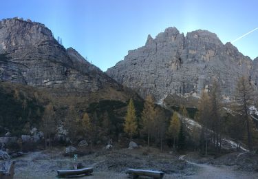
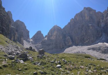
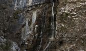
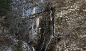
Sentiero della Ceda
SityTrail - itinéraires balisés pédestres
Tous les sentiers balisés d’Europe GUIDE+
![Length](/images/other/stat-length.png)
Length
5.9 km
![Max alt](https://static1.geolcdn.com/siteimages/upload/files/1508320355ic_sort_altitude_max_24dp.png)
Max alt
2389 m
![Uphill gradient](https://static1.geolcdn.com/siteimages/upload/files/1508320355ic_sort_den_pos_24dp.png)
Uphill gradient
1429 m
![Km-Effort](/images/other/stat-length.png)
Km-Effort
20 km
![Min alt](https://static1.geolcdn.com/siteimages/upload/files/1508320355ic_sort_altitude_min_24dp.png)
Min alt
933 m
![Downhill gradient](https://static1.geolcdn.com/siteimages/upload/files/1508320355ic_sort_den_neg_24dp.png)
Downhill gradient
2 m
![Boucle](https://static1.geolcdn.com/siteimages/upload/files/16400158638029165_repeat_loop_refresh_sync_direction_icon.png)
Boucle
No
Signpost
Creation date :
2022-02-15 05:49:15.929
Updated on :
2022-03-01 04:11:12.007
![On foot](https://static1.geolcdn.com/sitytour/trail-icons/100.png)
4h35
Difficulty : Medium
![Scan this QR Code to open this trail in the SityTrail application](https://capi.geolives.com/qq0zvz2zws4bq2lad0pu/sitytour/trails/3116137/qr.png?size=200)
FREE GPS app for hiking
About
Trail On foot of 5.9 km to be discovered at Trentino-Alto Adige/Südtirol, Provincia di Trento, San Lorenzo Dorsino. This trail is proposed by SityTrail - itinéraires balisés pédestres.
Description
Trail created by Società degli Alpinisti Tridentini.
Website: http://www.sat.tn.it/
Positioning
Country:
Italy
Region :
Trentino-Alto Adige/Südtirol
Department/Province :
Provincia di Trento
Municipality :
San Lorenzo Dorsino
Location:
Unknown
Start:(Dec)
Start:(UTM)
650836 ; 5110996 (32T) N.
Comments
Trails nearby
![Trail On foot Molveno - Senter de la Mars - Photo](https://media.geolcdn.com/t/375/260/73a3f382-f1e1-4c06-92a6-bda5359b56f6.jpeg&format=jpg&maxdim=2)
![On foot On foot](https://static1.geolcdn.com/sitytour/trail-icons/100.png)
Senter de la Mars
On foot
Easy
Molveno,
Trentino-Alto Adige/Südtirol,
Provincia di Trento,
Italy
![](/images/other/stat-length.png)
5.1 km | 13.4 km-effort
3h 2min
![](https://static1.geolcdn.com/siteimages/upload/files/16400158638029165_repeat_loop_refresh_sync_direction_icon.png)
No
![Trail On foot Vallelaghi - IT-O643 - Photo](https://media.geolcdn.com/t/375/260/6da6a6d3-c1d0-4573-a925-996af0c455a0.jpeg&format=jpg&maxdim=2)
![On foot On foot](https://static1.geolcdn.com/sitytour/trail-icons/100.png)
IT-O643
On foot
Easy
Vallelaghi,
Trentino-Alto Adige/Südtirol,
Provincia di Trento,
Italy
![](/images/other/stat-length.png)
7.5 km | 10.9 km-effort
2h 29min
![](https://static1.geolcdn.com/siteimages/upload/files/16400158638029165_repeat_loop_refresh_sync_direction_icon.png)
No
![Trail On foot Cavedago - IT-O352 - Photo](https://media.geolcdn.com/t/375/260/6abe9acf-2eff-4b9f-840f-c09176db15c9.jpeg&format=jpg&maxdim=2)
![On foot On foot](https://static1.geolcdn.com/sitytour/trail-icons/100.png)
IT-O352
On foot
Easy
Cavedago,
Trentino-Alto Adige/Südtirol,
Provincia di Trento,
Italy
![](/images/other/stat-length.png)
5.4 km | 8.7 km-effort
1h 58min
![](https://static1.geolcdn.com/siteimages/upload/files/16400158638029165_repeat_loop_refresh_sync_direction_icon.png)
No
![Trail On foot Molveno - IT-O612 - Photo](https://media.geolcdn.com/t/375/260/35430ee0-ea3d-4a52-911a-5fac9b65047d.jpeg&format=jpg&maxdim=2)
![On foot On foot](https://static1.geolcdn.com/sitytour/trail-icons/100.png)
IT-O612
On foot
Medium
Molveno,
Trentino-Alto Adige/Südtirol,
Provincia di Trento,
Italy
![](/images/other/stat-length.png)
9.2 km | 21 km-effort
4h 47min
![](https://static1.geolcdn.com/siteimages/upload/files/16400158638029165_repeat_loop_refresh_sync_direction_icon.png)
No
![Trail On foot Molveno - IT-O332 - Photo](https://media.geolcdn.com/t/375/260/68d90697-01df-4bc7-adf9-856c53dba8ef.jpeg&format=jpg&maxdim=2)
![On foot On foot](https://static1.geolcdn.com/sitytour/trail-icons/100.png)
IT-O332
On foot
Easy
Molveno,
Trentino-Alto Adige/Südtirol,
Provincia di Trento,
Italy
![](/images/other/stat-length.png)
4.7 km | 8 km-effort
1h 48min
![](https://static1.geolcdn.com/siteimages/upload/files/16400158638029165_repeat_loop_refresh_sync_direction_icon.png)
No
![Trail On foot Molveno - IT-O340 - Photo](https://media.geolcdn.com/t/375/260/d7a9ef71-99da-44bc-81bd-fb0afb7e7510.jpeg&format=jpg&maxdim=2)
![On foot On foot](https://static1.geolcdn.com/sitytour/trail-icons/100.png)
IT-O340
On foot
Easy
Molveno,
Trentino-Alto Adige/Südtirol,
Provincia di Trento,
Italy
![](/images/other/stat-length.png)
7.3 km | 11.8 km-effort
2h 40min
![](https://static1.geolcdn.com/siteimages/upload/files/16400158638029165_repeat_loop_refresh_sync_direction_icon.png)
No
![Trail On foot San Lorenzo Dorsino - IT-O319 - Photo](https://media.geolcdn.com/t/375/260/30fb0826-1604-471a-9434-ca100c02637c.jpeg&format=jpg&maxdim=2)
![On foot On foot](https://static1.geolcdn.com/sitytour/trail-icons/100.png)
IT-O319
On foot
Easy
San Lorenzo Dorsino,
Trentino-Alto Adige/Südtirol,
Provincia di Trento,
Italy
![](/images/other/stat-length.png)
8.7 km | 13.9 km-effort
3h 9min
![](https://static1.geolcdn.com/siteimages/upload/files/16400158638029165_repeat_loop_refresh_sync_direction_icon.png)
No
![Trail On foot San Lorenzo Dorsino - Via ferrata alpinistica](https://media.geolcdn.com/t/375/260/3be0f61e-ddd3-4f01-b921-193662ba83c5.jpeg&format=jpg&maxdim=2)
![On foot On foot](https://static1.geolcdn.com/sitytour/trail-icons/100.png)
Via ferrata alpinistica "Livio Brentari"
On foot
Easy
San Lorenzo Dorsino,
Trentino-Alto Adige/Südtirol,
Provincia di Trento,
Italy
![](/images/other/stat-length.png)
4 km | 9.9 km-effort
2h 15min
![](https://static1.geolcdn.com/siteimages/upload/files/16400158638029165_repeat_loop_refresh_sync_direction_icon.png)
No
![Trail On foot San Lorenzo Dorsino - Via ferrata Bocca di Brenta Sentiero dei Brentei - Photo](https://media.geolcdn.com/t/375/260/3be0f61e-ddd3-4f01-b921-193662ba83c5.jpeg&format=jpg&maxdim=2)
![On foot On foot](https://static1.geolcdn.com/sitytour/trail-icons/100.png)
Via ferrata Bocca di Brenta Sentiero dei Brentei
On foot
Easy
San Lorenzo Dorsino,
Trentino-Alto Adige/Südtirol,
Provincia di Trento,
Italy
![](/images/other/stat-length.png)
3.3 km | 6.2 km-effort
1h 24min
![](https://static1.geolcdn.com/siteimages/upload/files/16400158638029165_repeat_loop_refresh_sync_direction_icon.png)
No