![](/images/other/stat-length.png)
![Trail On foot San Godenzo - Sentiero Natura Acquacheta - Photo](https://media.geolcdn.com/t/1900/400/c8ebfc66-ef46-49ea-beb1-6eb8f9fabe57.jpeg&format=pjpeg&maxdim=2)
Sentiero Natura Acquacheta
SityTrail - itinéraires balisés pédestres
Tous les sentiers balisés d’Europe GUIDE+
![Length](/images/other/stat-length.png)
Length
4.6 km
![Max alt](https://static1.geolcdn.com/siteimages/upload/files/1508320355ic_sort_altitude_max_24dp.png)
Max alt
719 m
![Uphill gradient](https://static1.geolcdn.com/siteimages/upload/files/1508320355ic_sort_den_pos_24dp.png)
Uphill gradient
34 m
![Km-Effort](/images/other/stat-length.png)
Km-Effort
5.7 km
![Min alt](https://static1.geolcdn.com/siteimages/upload/files/1508320355ic_sort_altitude_min_24dp.png)
Min alt
511 m
![Downhill gradient](https://static1.geolcdn.com/siteimages/upload/files/1508320355ic_sort_den_neg_24dp.png)
Downhill gradient
231 m
![Boucle](https://static1.geolcdn.com/siteimages/upload/files/16400158638029165_repeat_loop_refresh_sync_direction_icon.png)
Boucle
No
Signpost
Creation date :
2022-02-15 04:38:17.371
Updated on :
2022-03-01 01:59:31.052
![On foot](https://static1.geolcdn.com/sitytour/trail-icons/100.png)
1h17
Difficulty : Easy
![Scan this QR Code to open this trail in the SityTrail application](https://capi.geolives.com/qq0zvz2zws4bq2lad0pu/sitytour/trails/3115216/qr.png?size=200)
FREE GPS app for hiking
About
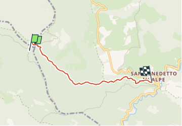
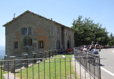
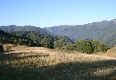
Trail On foot of 4.6 km to be discovered at Tuscany, Metropolitan City of Florence, San Godenzo. This trail is proposed by SityTrail - itinéraires balisés pédestres.
Description
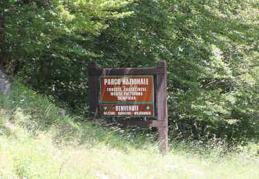
Trail created by Parco Nazionale Foreste Casentinesi.
Positioning
Country:
Italy
Region :
Tuscany
Department/Province :
Metropolitan City of Florence
Municipality :
San Godenzo
Location:
Unknown
Start:(Dec)
Start:(UTM)
712043 ; 4874158 (32T) N.
Comments
Trails nearby
![Trail On foot Portico e San Benedetto - Un grande anello sopra a Castel dell’Alpe - Photo](https://media.geolcdn.com/t/375/260/0fa289ca-7c51-4ac9-85e8-89b1f300995c.jpeg&format=jpg&maxdim=2)
![On foot On foot](https://static1.geolcdn.com/sitytour/trail-icons/100.png)
Un grande anello sopra a Castel dell’Alpe
On foot
Medium
Portico e San Benedetto,
Emilia-Romagna,
Forlì-Cesena,
Italy
![](/images/other/stat-length.png)
14.5 km | 23 km-effort
5h 12min
![](https://static1.geolcdn.com/siteimages/upload/files/16400158638029165_repeat_loop_refresh_sync_direction_icon.png)
Yes
![Trail On foot Marradi - L’Acquacheta e il Monte Lavane - Photo](https://media.geolcdn.com/t/375/260/73c97019-1353-4905-9a28-67cb30531393.jpeg&format=jpg&maxdim=2)
![On foot On foot](https://static1.geolcdn.com/sitytour/trail-icons/100.png)
L’Acquacheta e il Monte Lavane
On foot
Medium
Marradi,
Tuscany,
Metropolitan City of Florence,
Italy
![](/images/other/stat-length.png)
14 km | 25 km-effort
5h 43min
![](https://static1.geolcdn.com/siteimages/upload/files/16400158638029165_repeat_loop_refresh_sync_direction_icon.png)
No
![Trail On foot Portico e San Benedetto - L’anello classico dell’Acquacheta - Photo](https://media.geolcdn.com/t/375/260/e0e65af1-b08c-4714-9518-f040c77653ce.jpeg&format=jpg&maxdim=2)
![On foot On foot](https://static1.geolcdn.com/sitytour/trail-icons/100.png)
L’anello classico dell’Acquacheta
On foot
Easy
Portico e San Benedetto,
Emilia-Romagna,
Forlì-Cesena,
Italy
![](/images/other/stat-length.png)
10.3 km | 17.1 km-effort
3h 53min
![](https://static1.geolcdn.com/siteimages/upload/files/16400158638029165_repeat_loop_refresh_sync_direction_icon.png)
Yes
![Trail On foot Portico e San Benedetto - Tra i giganti della Val Tramazzo - Photo](https://media.geolcdn.com/t/375/260/ff2fdc6b-7a3c-4e1d-8ca2-846b130f5ad3.jpeg&format=jpg&maxdim=2)
![On foot On foot](https://static1.geolcdn.com/sitytour/trail-icons/100.png)
Tra i giganti della Val Tramazzo
On foot
Easy
Portico e San Benedetto,
Emilia-Romagna,
Forlì-Cesena,
Italy
![](/images/other/stat-length.png)
8.5 km | 14.7 km-effort
3h 19min
![](https://static1.geolcdn.com/siteimages/upload/files/16400158638029165_repeat_loop_refresh_sync_direction_icon.png)
Yes
![Trail On foot Tredozio - L’Acquacheta e l’Alto Montone - Photo](https://media.geolcdn.com/t/375/260/130d3e21-ebaa-4aab-ad63-5ee7456f7c76.jpeg&format=jpg&maxdim=2)
![On foot On foot](https://static1.geolcdn.com/sitytour/trail-icons/100.png)
L’Acquacheta e l’Alto Montone
On foot
Very difficult
Tredozio,
Emilia-Romagna,
Forlì-Cesena,
Italy
![](/images/other/stat-length.png)
24 km | 41 km-effort
9h 19min
![](https://static1.geolcdn.com/siteimages/upload/files/16400158638029165_repeat_loop_refresh_sync_direction_icon.png)
No
![Trail On foot Marradi - L'Acquacheta e l'Alto Tramazzo - Photo](https://media.geolcdn.com/t/375/260/ext.jpg?maxdim=2&url=https%3A%2F%2Fupload.wikimedia.org%2Fwikipedia%2Fcommons%2Fthumb%2Fb%2Fb4%2FParco_nazionale_delle_Foreste_Casentinesi_%252801%2529.jpg%2F2000px-Parco_nazionale_delle_Foreste_Casentinesi_%252801%2529.jpg)
![On foot On foot](https://static1.geolcdn.com/sitytour/trail-icons/100.png)
L'Acquacheta e l'Alto Tramazzo
On foot
Easy
Marradi,
Tuscany,
Metropolitan City of Florence,
Italy
![](/images/other/stat-length.png)
10 km | 16.3 km-effort
3h 41min
![](https://static1.geolcdn.com/siteimages/upload/files/16400158638029165_repeat_loop_refresh_sync_direction_icon.png)
No
![Trail On foot Marradi - IT-501 - Photo](https://media.geolcdn.com/t/375/260/a2d8eaba-d795-4e7f-9a08-00b864a5c67a.jpeg&format=jpg&maxdim=2)
![On foot On foot](https://static1.geolcdn.com/sitytour/trail-icons/100.png)
IT-501
On foot
Easy
Marradi,
Tuscany,
Metropolitan City of Florence,
Italy
![](/images/other/stat-length.png)
3.5 km | 6.1 km-effort
1h 23min
![](https://static1.geolcdn.com/siteimages/upload/files/16400158638029165_repeat_loop_refresh_sync_direction_icon.png)
No
![Trail On foot Portico e San Benedetto - IT-427 - Photo](https://media.geolcdn.com/t/375/260/c8ebfc66-ef46-49ea-beb1-6eb8f9fabe57.jpeg&format=jpg&maxdim=2)
![On foot On foot](https://static1.geolcdn.com/sitytour/trail-icons/100.png)
IT-427
On foot
Medium
Portico e San Benedetto,
Emilia-Romagna,
Forlì-Cesena,
Italy
![](/images/other/stat-length.png)
14.9 km | 22 km-effort
4h 58min
![](https://static1.geolcdn.com/siteimages/upload/files/16400158638029165_repeat_loop_refresh_sync_direction_icon.png)
No
![Trail On foot San Godenzo - IT-10 - Photo](https://media.geolcdn.com/t/375/260/39b67f34-95ac-4631-8e83-22266628bc03.jpeg&format=jpg&maxdim=2)
![On foot On foot](https://static1.geolcdn.com/sitytour/trail-icons/100.png)
IT-10
On foot
Easy
San Godenzo,
Tuscany,
Metropolitan City of Florence,
Italy
![](/images/other/stat-length.png)
6.8 km | 9.2 km-effort
2h 5min
![](https://static1.geolcdn.com/siteimages/upload/files/16400158638029165_repeat_loop_refresh_sync_direction_icon.png)
No