![](/images/other/stat-length.png)
![Trail On foot Sarezzo - Sarezzo - Sentiero 13 - Photo](https://media.geolcdn.com/t/1900/400/ext.pjpeg?maxdim=2&url=https%3A%2F%2Fstatic1.geolcdn.com%2Fsiteimages%2Fupload%2Ffiles%2F1545311037marcheuse_200dpi.jpg)
Sarezzo - Sentiero 13
SityTrail - itinéraires balisés pédestres
Tous les sentiers balisés d’Europe GUIDE+
![Length](/images/other/stat-length.png)
Length
3.2 km
![Max alt](https://static1.geolcdn.com/siteimages/upload/files/1508320355ic_sort_altitude_max_24dp.png)
Max alt
531 m
![Uphill gradient](https://static1.geolcdn.com/siteimages/upload/files/1508320355ic_sort_den_pos_24dp.png)
Uphill gradient
357 m
![Km-Effort](/images/other/stat-length.png)
Km-Effort
7.6 km
![Min alt](https://static1.geolcdn.com/siteimages/upload/files/1508320355ic_sort_altitude_min_24dp.png)
Min alt
263 m
![Downhill gradient](https://static1.geolcdn.com/siteimages/upload/files/1508320355ic_sort_den_neg_24dp.png)
Downhill gradient
247 m
![Boucle](https://static1.geolcdn.com/siteimages/upload/files/16400158638029165_repeat_loop_refresh_sync_direction_icon.png)
Boucle
No
Signpost
Creation date :
2022-02-15 03:40:21.374
Updated on :
2022-03-01 00:21:35.651
![On foot](https://static1.geolcdn.com/sitytour/trail-icons/100.png)
1h43
Difficulty : Easy
![Scan this QR Code to open this trail in the SityTrail application](https://capi.geolives.com/qq0zvz2zws4bq2lad0pu/sitytour/trails/3114578/qr.png?size=200)
FREE GPS app for hiking
About
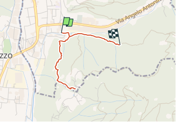
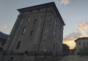
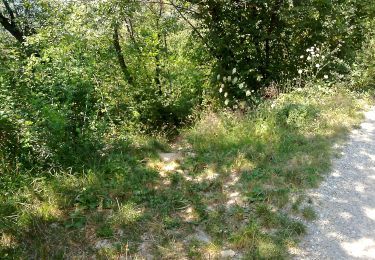
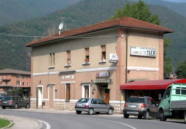
Trail On foot of 3.2 km to be discovered at Lombardy, Brescia, Sarezzo. This trail is proposed by SityTrail - itinéraires balisés pédestres.
Description
Trail created by Comune di Sarezzo.
Incompleto perchè per un tratto ne è stato impedito l'accesso da un privato
Symbol: unmarked
Positioning
Country:
Italy
Region :
Lombardy
Department/Province :
Brescia
Municipality :
Sarezzo
Location:
Unknown
Start:(Dec)
Start:(UTM)
593927 ; 5055669 (32T) N.
Comments
Trails nearby
![Trail On foot Lumezzane - Via del Sacro - Photo](https://media.geolcdn.com/t/375/260/ee7a6f42-fb6b-4c8e-8663-19cf2f9fcc71.jpeg&format=jpg&maxdim=2)
![On foot On foot](https://static1.geolcdn.com/sitytour/trail-icons/100.png)
Via del Sacro
On foot
Very difficult
Lumezzane,
Lombardy,
Brescia,
Italy
![](/images/other/stat-length.png)
26 km | 47 km-effort
10h 34min
![](https://static1.geolcdn.com/siteimages/upload/files/16400158638029165_repeat_loop_refresh_sync_direction_icon.png)
No
![Trail On foot Lumezzane - Via del Sacro da Lumezzane (Fontana) - San Bernardo - Photo](https://media.geolcdn.com/t/375/260/ee7a6f42-fb6b-4c8e-8663-19cf2f9fcc71.jpeg&format=jpg&maxdim=2)
![On foot On foot](https://static1.geolcdn.com/sitytour/trail-icons/100.png)
Via del Sacro da Lumezzane (Fontana) - San Bernardo
On foot
Easy
Lumezzane,
Lombardy,
Brescia,
Italy
![](/images/other/stat-length.png)
3.4 km | 5.9 km-effort
1h 20min
![](https://static1.geolcdn.com/siteimages/upload/files/16400158638029165_repeat_loop_refresh_sync_direction_icon.png)
No
![Trail On foot Lumezzane - Via del Sacro - Percorso principale - Photo](https://media.geolcdn.com/t/375/260/ee7a6f42-fb6b-4c8e-8663-19cf2f9fcc71.jpeg&format=jpg&maxdim=2)
![On foot On foot](https://static1.geolcdn.com/sitytour/trail-icons/100.png)
Via del Sacro - Percorso principale
On foot
Very difficult
Lumezzane,
Lombardy,
Brescia,
Italy
![](/images/other/stat-length.png)
26 km | 50 km-effort
11h 21min
![](https://static1.geolcdn.com/siteimages/upload/files/16400158638029165_repeat_loop_refresh_sync_direction_icon.png)
No
![Trail On foot Bovezzo - Concesio (Sant'Andrea) - Sant'Onofrio - Photo](https://media.geolcdn.com/t/375/260/7b6a69c3-7f33-48b6-b0fd-8924403e1065.jpeg&format=jpg&maxdim=2)
![On foot On foot](https://static1.geolcdn.com/sitytour/trail-icons/100.png)
Concesio (Sant'Andrea) - Sant'Onofrio
On foot
Easy
Bovezzo,
Lombardy,
Brescia,
Italy
![](/images/other/stat-length.png)
4.7 km | 7.2 km-effort
1h 37min
![](https://static1.geolcdn.com/siteimages/upload/files/16400158638029165_repeat_loop_refresh_sync_direction_icon.png)
No
![Trail On foot Lumezzane - Lumezzane (Pieve) - San Bernardo - Corna di Sonclino - Photo](https://media.geolcdn.com/t/375/260/ee7a6f42-fb6b-4c8e-8663-19cf2f9fcc71.jpeg&format=jpg&maxdim=2)
![On foot On foot](https://static1.geolcdn.com/sitytour/trail-icons/100.png)
Lumezzane (Pieve) - San Bernardo - Corna di Sonclino
On foot
Easy
Lumezzane,
Lombardy,
Brescia,
Italy
![](/images/other/stat-length.png)
5 km | 7.8 km-effort
1h 46min
![](https://static1.geolcdn.com/siteimages/upload/files/16400158638029165_repeat_loop_refresh_sync_direction_icon.png)
No
![Trail On foot Lumezzane - Lumezzane (Pieve) - Grassi - Corna di Sonclino - Photo](https://media.geolcdn.com/t/375/260/ee7a6f42-fb6b-4c8e-8663-19cf2f9fcc71.jpeg&format=jpg&maxdim=2)
![On foot On foot](https://static1.geolcdn.com/sitytour/trail-icons/100.png)
Lumezzane (Pieve) - Grassi - Corna di Sonclino
On foot
Easy
Lumezzane,
Lombardy,
Brescia,
Italy
![](/images/other/stat-length.png)
8.1 km | 16.9 km-effort
3h 50min
![](https://static1.geolcdn.com/siteimages/upload/files/16400158638029165_repeat_loop_refresh_sync_direction_icon.png)
No
![Trail On foot Villa Carcina - Sentiero Domenico Cancarini e Antonio Giubileo - Photo](https://media.geolcdn.com/t/375/260/0944373e-8521-4c9f-b680-40b4090a3c1b.jpeg&format=jpg&maxdim=2)
![On foot On foot](https://static1.geolcdn.com/sitytour/trail-icons/100.png)
Sentiero Domenico Cancarini e Antonio Giubileo
On foot
Easy
Villa Carcina,
Lombardy,
Brescia,
Italy
![](/images/other/stat-length.png)
3.1 km | 9 km-effort
2h 3min
![](https://static1.geolcdn.com/siteimages/upload/files/16400158638029165_repeat_loop_refresh_sync_direction_icon.png)
No
![Trail On foot Lumezzane - Lumezzane (Ver) - San Bernardo - Photo](https://media.geolcdn.com/t/375/260/a74a7468-9d4b-454c-90a3-1fd4ee4786bb.jpeg&format=jpg&maxdim=2)
![On foot On foot](https://static1.geolcdn.com/sitytour/trail-icons/100.png)
Lumezzane (Ver) - San Bernardo
On foot
Easy
Lumezzane,
Lombardy,
Brescia,
Italy
![](/images/other/stat-length.png)
4 km | 6.8 km-effort
1h 32min
![](https://static1.geolcdn.com/siteimages/upload/files/16400158638029165_repeat_loop_refresh_sync_direction_icon.png)
No
![Trail On foot Concesio - Concesio (Via Mandò) - Costa - Quarone di Sopra - Photo](https://media.geolcdn.com/t/375/260/9d92b133-cd22-4475-a028-2128482ed182.jpeg&format=jpg&maxdim=2)
![On foot On foot](https://static1.geolcdn.com/sitytour/trail-icons/100.png)
Concesio (Via Mandò) - Costa - Quarone di Sopra
On foot
Easy
Concesio,
Lombardy,
Brescia,
Italy
![](/images/other/stat-length.png)
3.3 km | 8.6 km-effort
1h 57min
![](https://static1.geolcdn.com/siteimages/upload/files/16400158638029165_repeat_loop_refresh_sync_direction_icon.png)
No