


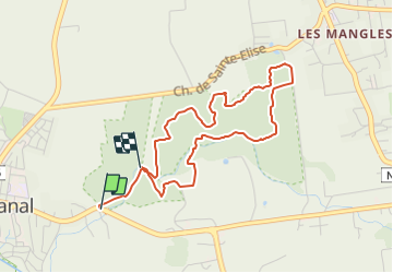

6.5 km | 7.5 km-effort


Tous les sentiers balisés d’Europe GUIDE+


FREE GPS app for hiking
 SityTrail
IGN / Geographical institutes
SityTrail World
The world is yours!
Trail On foot of 5.7 km to be discovered at Guadeloupe, Unknown, Petit-Canal. This trail is proposed by SityTrail - itinéraires balisés pédestres.
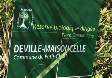
Trail created by Forêt départementale de Deville Maisoncelle.
Symbol: yellow bar on top, blue bar below
Walking
Walking

Walking

Trail
Walking
Walking
Walking
Walking
Walking