![](/images/other/stat-length.png)
![Trail On foot Valvestino - Armo (Valvestino) - Ponte Franato - Denai (Magasa) - Photo](https://media.geolcdn.com/t/1900/400/c27f382b-c73c-4664-bd37-2b51f6ebbd18.jpeg&format=pjpeg&maxdim=2)
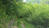
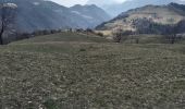
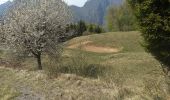
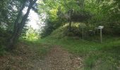
Armo (Valvestino) - Ponte Franato - Denai (Magasa)
SityTrail - itinéraires balisés pédestres
Tous les sentiers balisés d’Europe GUIDE+
![Length](/images/other/stat-length.png)
Length
10.7 km
![Max alt](https://static1.geolcdn.com/siteimages/upload/files/1508320355ic_sort_altitude_max_24dp.png)
Max alt
1290 m
![Uphill gradient](https://static1.geolcdn.com/siteimages/upload/files/1508320355ic_sort_den_pos_24dp.png)
Uphill gradient
794 m
![Km-Effort](/images/other/stat-length.png)
Km-Effort
19.8 km
![Min alt](https://static1.geolcdn.com/siteimages/upload/files/1508320355ic_sort_altitude_min_24dp.png)
Min alt
724 m
![Downhill gradient](https://static1.geolcdn.com/siteimages/upload/files/1508320355ic_sort_den_neg_24dp.png)
Downhill gradient
349 m
![Boucle](https://static1.geolcdn.com/siteimages/upload/files/16400158638029165_repeat_loop_refresh_sync_direction_icon.png)
Boucle
No
Signpost
Creation date :
2022-02-15 02:28:38.378
Updated on :
2022-02-28 22:47:52.247
![On foot](https://static1.geolcdn.com/sitytour/trail-icons/100.png)
4h30
Difficulty : Easy
![Scan this QR Code to open this trail in the SityTrail application](https://capi.geolives.com/qq0zvz2zws4bq2lad0pu/sitytour/trails/3113949/qr.png?size=200)
FREE GPS app for hiking
About
Trail On foot of 10.7 km to be discovered at Lombardy, Brescia, Valvestino. This trail is proposed by SityTrail - itinéraires balisés pédestres.
Description
Trail created by Comune di Valvestino.
Positioning
Country:
Italy
Region :
Lombardy
Department/Province :
Brescia
Municipality :
Valvestino
Location:
Unknown
Start:(Dec)
Start:(UTM)
623929 ; 5069780 (32T) N.
Comments
Trails nearby
![Trail On foot Magasa - Bivio Camiöl (Magasa) - Bocca alla Croce (Valvestino) - Photo](https://media.geolcdn.com/t/375/260/580ecafd-ad64-4f47-8c09-961c31257996.jpeg&format=jpg&maxdim=2)
![On foot On foot](https://static1.geolcdn.com/sitytour/trail-icons/100.png)
Bivio Camiöl (Magasa) - Bocca alla Croce (Valvestino)
On foot
Easy
Magasa,
Lombardy,
Brescia,
Italy
![](/images/other/stat-length.png)
3.5 km | 6.1 km-effort
1h 23min
![](https://static1.geolcdn.com/siteimages/upload/files/16400158638029165_repeat_loop_refresh_sync_direction_icon.png)
No
![Trail On foot Valvestino - Sentiero dei Lanzichenecchi - Photo](https://media.geolcdn.com/t/375/260/2eecc7fb-afff-4e65-b137-d71887278931.jpeg&format=jpg&maxdim=2)
![On foot On foot](https://static1.geolcdn.com/sitytour/trail-icons/100.png)
Sentiero dei Lanzichenecchi
On foot
Easy
Valvestino,
Lombardy,
Brescia,
Italy
![](/images/other/stat-length.png)
8 km | 15.3 km-effort
3h 28min
![](https://static1.geolcdn.com/siteimages/upload/files/16400158638029165_repeat_loop_refresh_sync_direction_icon.png)
No
![Trail On foot Valvestino - IT-297 - Photo](https://media.geolcdn.com/t/375/260/399ec3ab-8816-4abb-8c49-02c6852cbfdc.jpeg&format=jpg&maxdim=2)
![On foot On foot](https://static1.geolcdn.com/sitytour/trail-icons/100.png)
![Trail On foot Magasa - Malga Casina, Bocca di Cablone, Malga Tombea - Photo](https://media.geolcdn.com/t/375/260/380e7a67-1ed1-419f-bf9f-5819034ffc9b.jpeg&format=jpg&maxdim=2)
![On foot On foot](https://static1.geolcdn.com/sitytour/trail-icons/100.png)
Malga Casina, Bocca di Cablone, Malga Tombea
On foot
Easy
Magasa,
Lombardy,
Brescia,
Italy
![](/images/other/stat-length.png)
7.4 km | 10.4 km-effort
2h 21min
![](https://static1.geolcdn.com/siteimages/upload/files/16400158638029165_repeat_loop_refresh_sync_direction_icon.png)
No
![Trail On foot Bondone - Vesta - Castel San Giovanni - Vesta - Photo](https://media.geolcdn.com/t/375/260/9977e466-5fe6-4dc8-ba42-39ec3072b8af.jpeg&format=jpg&maxdim=2)
![On foot On foot](https://static1.geolcdn.com/sitytour/trail-icons/100.png)
Vesta - Castel San Giovanni - Vesta
On foot
Easy
Bondone,
Trentino-Alto Adige/Südtirol,
Provincia di Trento,
Italy
![](/images/other/stat-length.png)
5.6 km | 9.1 km-effort
2h 3min
![](https://static1.geolcdn.com/siteimages/upload/files/16400158638029165_repeat_loop_refresh_sync_direction_icon.png)
No
![Trail On foot Valvestino - Molino di Bollone (Valvestino) - Droane (Valvestino) - Photo](https://media.geolcdn.com/t/375/260/790f2372-f395-45d8-83f8-9962c90e9ea3.jpeg&format=jpg&maxdim=2)
![On foot On foot](https://static1.geolcdn.com/sitytour/trail-icons/100.png)
Molino di Bollone (Valvestino) - Droane (Valvestino)
On foot
Easy
Valvestino,
Lombardy,
Brescia,
Italy
![](/images/other/stat-length.png)
6 km | 8.7 km-effort
1h 58min
![](https://static1.geolcdn.com/siteimages/upload/files/16400158638029165_repeat_loop_refresh_sync_direction_icon.png)
No
![Trail On foot Magasa - Droanello (Gargnano) - Cima Rest (Magasa) - Photo](https://media.geolcdn.com/t/375/260/85ad8e13-3b08-42cc-86db-701e2392570a.jpeg&format=jpg&maxdim=2)
![On foot On foot](https://static1.geolcdn.com/sitytour/trail-icons/100.png)
Droanello (Gargnano) - Cima Rest (Magasa)
On foot
Easy
Magasa,
Lombardy,
Brescia,
Italy
![](/images/other/stat-length.png)
5.9 km | 8.3 km-effort
1h 52min
![](https://static1.geolcdn.com/siteimages/upload/files/16400158638029165_repeat_loop_refresh_sync_direction_icon.png)
No
![Trail On foot Tremosine sul Garda - San Michele, Malga Lorina - Photo](https://media.geolcdn.com/t/375/260/058422c6-93ca-4113-a2a0-832fecaf5664.jpeg&format=jpg&maxdim=2)
![On foot On foot](https://static1.geolcdn.com/sitytour/trail-icons/100.png)
San Michele, Malga Lorina
On foot
Easy
Tremosine sul Garda,
Lombardy,
Brescia,
Italy
![](/images/other/stat-length.png)
8.7 km | 13.3 km-effort
3h 0min
![](https://static1.geolcdn.com/siteimages/upload/files/16400158638029165_repeat_loop_refresh_sync_direction_icon.png)
No
![Trail On foot Tremosine sul Garda - Malga Spiazzo, Malga Lavino, Bocca di Lorina - Photo](https://media.geolcdn.com/t/375/260/14fb5565-3028-4e19-b895-517d359cc4bd.jpeg&format=jpg&maxdim=2)
![On foot On foot](https://static1.geolcdn.com/sitytour/trail-icons/100.png)
Malga Spiazzo, Malga Lavino, Bocca di Lorina
On foot
Medium
Tremosine sul Garda,
Lombardy,
Brescia,
Italy
![](/images/other/stat-length.png)
17.3 km | 27 km-effort
6h 8min
![](https://static1.geolcdn.com/siteimages/upload/files/16400158638029165_repeat_loop_refresh_sync_direction_icon.png)
No