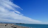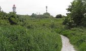

Autour du Cap
SityTrail - itinéraires balisés pédestres
Tous les sentiers balisés d’Europe GUIDE+

Length
4.8 km

Max alt
97 m

Uphill gradient
101 m

Km-Effort
5.9 km

Min alt
0 m

Downhill gradient
31 m
Boucle
No
Signpost
Creation date :
2022-02-15 02:14:22.737
Updated on :
2022-03-02 10:44:07.095
1h20
Difficulty : Easy

FREE GPS app for hiking
About
Trail On foot of 4.8 km to be discovered at Normandy, Seine-Maritime, Le Havre. This trail is proposed by SityTrail - itinéraires balisés pédestres.
Description
Trail created by CODAH.
Positioning
Country:
France
Region :
Normandy
Department/Province :
Seine-Maritime
Municipality :
Le Havre
Location:
Unknown
Start:(Dec)
Start:(UTM)
289250 ; 5487105 (31U) N.
Comments
Trails nearby
Découvrir Le Havre


Walking
Difficult
(1)
Le Havre,
Normandy,
Seine-Maritime,
France

14.2 km | 17 km-effort
3h 30min
Yes
Les Bassins des Vallées


On foot
Easy
Fontaine-la-Mallet,
Normandy,
Seine-Maritime,
France

5.1 km | 6 km-effort
1h 21min
No

076-05-Le Havre A-Midi 9km


Walking
Easy
(1)
Le Havre,
Normandy,
Seine-Maritime,
France

8.8 km | 11.5 km-effort
2h 49min
Yes
le havre parcs


Walking
Difficult
Le Havre,
Normandy,
Seine-Maritime,
France

12.1 km | 14.5 km-effort
3h 25min
Yes
Le havre front de mer


Walking
Medium
Le Havre,
Normandy,
Seine-Maritime,
France

8.2 km | 9.7 km-effort
3h 14min
Yes
Le Havre plage


Nordic walking
Very easy
Sainte-Adresse,
Normandy,
Seine-Maritime,
France

7.2 km | 7.8 km-effort
2h 0min
No
Le Havre / la rue Edgard Faure / le lycée C Monet / l'escalier Lechiblier / ...


Walking
Very easy
Sainte-Adresse,
Normandy,
Seine-Maritime,
France

7.5 km | 9 km-effort
2h 23min
Yes

Le Havre / Ste Cécile / La Vierge Noire / Le Bois Cody / Ste Cécile


Walking
Very easy
Le Havre,
Normandy,
Seine-Maritime,
France

5.2 km | 6.8 km-effort
1h 46min
Yes
Le Havre: Forêt de Montgeon variante N°4


Walking
Very easy
(1)
Fontaine-la-Mallet,
Normandy,
Seine-Maritime,
France

8.5 km | 10.7 km-effort
2h 29min
Yes


 SityTrail


