![](/images/other/stat-length.png)
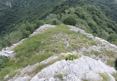
![Trail On foot Lecco - Percorso Giorgio Combi - Photo](https://media.geolcdn.com/t/1900/400/48ecfc1f-868d-4b17-879f-6b7b4f7605e2.jpeg&format=pjpeg&maxdim=2)
Percorso Giorgio Combi
SityTrail - itinéraires balisés pédestres
Tous les sentiers balisés d’Europe GUIDE+
![Length](/images/other/stat-length.png)
Length
5.4 km
![Max alt](https://static1.geolcdn.com/siteimages/upload/files/1508320355ic_sort_altitude_max_24dp.png)
Max alt
605 m
![Uphill gradient](https://static1.geolcdn.com/siteimages/upload/files/1508320355ic_sort_den_pos_24dp.png)
Uphill gradient
321 m
![Km-Effort](/images/other/stat-length.png)
Km-Effort
9.4 km
![Min alt](https://static1.geolcdn.com/siteimages/upload/files/1508320355ic_sort_altitude_min_24dp.png)
Min alt
379 m
![Downhill gradient](https://static1.geolcdn.com/siteimages/upload/files/1508320355ic_sort_den_neg_24dp.png)
Downhill gradient
235 m
![Boucle](https://static1.geolcdn.com/siteimages/upload/files/16400158638029165_repeat_loop_refresh_sync_direction_icon.png)
Boucle
No
Signpost
Creation date :
2022-02-15 00:18:38.956
Updated on :
2022-02-28 18:50:25.575
![On foot](https://static1.geolcdn.com/sitytour/trail-icons/100.png)
2h07
Difficulty : Easy
![Scan this QR Code to open this trail in the SityTrail application](https://capi.geolives.com/qq0zvz2zws4bq2lad0pu/sitytour/trails/3112778/qr.png?size=200)
FREE GPS app for hiking
About
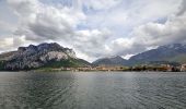
Trail On foot of 5.4 km to be discovered at Lombardy, Lecco, Lecco. This trail is proposed by SityTrail - itinéraires balisés pédestres.
Description
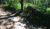
Trail created by APE Lecco.
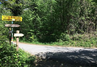
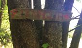
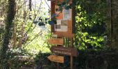
Symbol: yellow markers and yellow metal plates with text "PERCORSO GIORGIO COMBI"
Positioning
Country:
Italy
Region :
Lombardy
Department/Province :
Lecco
Municipality :
Lecco
Location:
Unknown
Start:(Dec)
Start:(UTM)
533214 ; 5078299 (32T) N.
Comments
Trails nearby
![Trail On foot Erve - Sentiero 831: Cappella del Corno (Erve) - M. Spedone - Nesolio - Erve - Photo](https://media.geolcdn.com/t/375/260/c22af308-c393-4424-b1e9-a24d00feb4e3.jpeg&format=jpg&maxdim=2)
![On foot On foot](https://static1.geolcdn.com/sitytour/trail-icons/100.png)
Sentiero 831: Cappella del Corno (Erve) - M. Spedone - Nesolio - Erve
On foot
Easy
Erve,
Lombardy,
Lecco,
Italy
![](/images/other/stat-length.png)
6.2 km | 12.7 km-effort
2h 52min
![](https://static1.geolcdn.com/siteimages/upload/files/16400158638029165_repeat_loop_refresh_sync_direction_icon.png)
Yes
![Trail On foot Sant'Omobono Terme - Sentiero 574: Valsecca - Pertüs - Photo](https://media.geolcdn.com/t/375/260/2ab6dc35-7a72-45e4-9d9e-f66156b77729.jpeg&format=jpg&maxdim=2)
![On foot On foot](https://static1.geolcdn.com/sitytour/trail-icons/100.png)
Sentiero 574: Valsecca - Pertüs
On foot
Easy
Sant'Omobono Terme,
Lombardy,
Bergamo,
Italy
![](/images/other/stat-length.png)
4.2 km | 6.1 km-effort
1h 22min
![](https://static1.geolcdn.com/siteimages/upload/files/16400158638029165_repeat_loop_refresh_sync_direction_icon.png)
No
![Trail On foot Carenno - Sentiero 801D: Convento del Pertus - Erve - Photo](https://media.geolcdn.com/t/375/260/3e10b426-148b-4fde-88cc-6904e8efdfd2.jpeg&format=jpg&maxdim=2)
![On foot On foot](https://static1.geolcdn.com/sitytour/trail-icons/100.png)
Sentiero 801D: Convento del Pertus - Erve
On foot
Easy
Carenno,
Lombardy,
Lecco,
Italy
![](/images/other/stat-length.png)
4.1 km | 6.9 km-effort
1h 33min
![](https://static1.geolcdn.com/siteimages/upload/files/16400158638029165_repeat_loop_refresh_sync_direction_icon.png)
No
![Trail On foot Erve - Variante per Prá di Rat - Photo](https://media.geolcdn.com/t/375/260/b3ff494c-2581-4b0a-a6cd-25ad3d352528.jpeg&format=jpg&maxdim=2)
![On foot On foot](https://static1.geolcdn.com/sitytour/trail-icons/100.png)
Variante per Prá di Rat
On foot
Easy
Erve,
Lombardy,
Lecco,
Italy
![](/images/other/stat-length.png)
4.6 km | 16.9 km-effort
3h 50min
![](https://static1.geolcdn.com/siteimages/upload/files/16400158638029165_repeat_loop_refresh_sync_direction_icon.png)
No
![Trail On foot Morterone - Sentiero dei Grandi Alberi - anello principale - Photo](https://media.geolcdn.com/t/375/260/b0ae6341-4f3f-457a-9fa7-59eb2b1b7750.jpeg&format=jpg&maxdim=2)
![On foot On foot](https://static1.geolcdn.com/sitytour/trail-icons/100.png)
Sentiero dei Grandi Alberi - anello principale
On foot
Easy
Morterone,
Lombardy,
Lecco,
Italy
![](/images/other/stat-length.png)
7.5 km | 12.1 km-effort
2h 45min
![](https://static1.geolcdn.com/siteimages/upload/files/16400158638029165_repeat_loop_refresh_sync_direction_icon.png)
Yes
![Trail On foot Morterone - Sentiero dei Grandi Alberi - Photo](https://media.geolcdn.com/t/375/260/b0ae6341-4f3f-457a-9fa7-59eb2b1b7750.jpeg&format=jpg&maxdim=2)
![On foot On foot](https://static1.geolcdn.com/sitytour/trail-icons/100.png)
Sentiero dei Grandi Alberi
On foot
Easy
Morterone,
Lombardy,
Lecco,
Italy
![](/images/other/stat-length.png)
7.5 km | 12.1 km-effort
2h 45min
![](https://static1.geolcdn.com/siteimages/upload/files/16400158638029165_repeat_loop_refresh_sync_direction_icon.png)
Yes
![Trail On foot Lecco - Sentiero 2 della Val Calolden - Photo](https://media.geolcdn.com/t/375/260/6a9d73e2-be77-4099-a255-f8b347ac14ac.jpeg&format=jpg&maxdim=2)
![On foot On foot](https://static1.geolcdn.com/sitytour/trail-icons/100.png)
Sentiero 2 della Val Calolden
On foot
Easy
Lecco,
Lombardy,
Lecco,
Italy
![](/images/other/stat-length.png)
3.2 km | 11.2 km-effort
2h 32min
![](https://static1.geolcdn.com/siteimages/upload/files/16400158638029165_repeat_loop_refresh_sync_direction_icon.png)
No
![Trail On foot Galbiate - Sentiero di mezzo 301: Galbiate - Pian Sciresa - Photo](https://media.geolcdn.com/t/375/260/cf2c8a80-6b26-4473-8806-ccb71f3807cc.jpeg&format=jpg&maxdim=2)
![On foot On foot](https://static1.geolcdn.com/sitytour/trail-icons/100.png)
Sentiero di mezzo 301: Galbiate - Pian Sciresa
On foot
Easy
Galbiate,
Lombardy,
Lecco,
Italy
![](/images/other/stat-length.png)
4.7 km | 8.9 km-effort
2h 0min
![](https://static1.geolcdn.com/siteimages/upload/files/16400158638029165_repeat_loop_refresh_sync_direction_icon.png)
No
![Trail On foot Lecco - Sentiero 18 (della Corna Cammello): Versasio - Piani d'Erna - Photo](https://media.geolcdn.com/t/375/260/8ce93a6f-64ae-432f-a2ee-6859572d3ed1.jpeg&format=jpg&maxdim=2)
![On foot On foot](https://static1.geolcdn.com/sitytour/trail-icons/100.png)
Sentiero 18 (della Corna Cammello): Versasio - Piani d'Erna
On foot
Easy
Lecco,
Lombardy,
Lecco,
Italy
![](/images/other/stat-length.png)
3.1 km | 9.8 km-effort
2h 13min
![](https://static1.geolcdn.com/siteimages/upload/files/16400158638029165_repeat_loop_refresh_sync_direction_icon.png)
No