

IT-3A
SityTrail - itinéraires balisés pédestres
Tous les sentiers balisés d’Europe GUIDE+

Length
3.4 km

Max alt
2634 m

Uphill gradient
660 m

Km-Effort
10 km

Min alt
1964 m

Downhill gradient
0 m

Boucle
No
Signpost
Creation date :
2022-02-15 00:15:09.542
Updated on :
2022-02-28 18:40:45.107

2h16
Difficulty : Easy

FREE GPS app for hiking
About
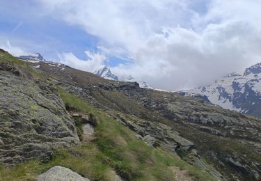
Trail On foot of 3.4 km to be discovered at Aosta Valley, Unknown, Valsavarenche. This trail is proposed by SityTrail - itinéraires balisés pédestres.
Description
2017/07/07, collapsed bridge (altitude 2322m) temporary closed, possible bypass for the upstream bridge at an altitude of 2377m
Positioning
Country:
Italy
Region :
Aosta Valley
Department/Province :
Unknown
Municipality :
Valsavarenche
Location:
Unknown
Start:(Dec)
Start:(UTM)
359470 ; 5042817 (32T) N.
Comments
Trails nearby


Alta Via n. 2 della Valle d'Aosta - Tappa 8
On foot
Difficult
Valsavarenche,
Aosta Valley,
Unknown,
Italy

17.2 km | 36 km-effort
8h 15min

No


(SI F01) Rifugio Savoia - Rhêmes-Notre-Dame
On foot
Difficult
Valsavarenche,
Aosta Valley,
Unknown,
Italy

21 km | 35 km-effort
8h 3min

No


valsavarenche le pont
Walking
Medium
Valsavarenche,
Aosta Valley,
Unknown,
Italy

6.2 km | 10.9 km-effort
4h 44min

Yes

