![](/images/other/stat-length.png)
![Trail On foot Camaiore - IT-106 - Photo](https://media.geolcdn.com/t/1900/400/5c694b32-0bfb-408b-b26b-adbfa9c39ac6.jpeg&format=pjpeg&maxdim=2)
IT-106
SityTrail - itinéraires balisés pédestres
Tous les sentiers balisés d’Europe GUIDE+
![Length](/images/other/stat-length.png)
Length
6.7 km
![Max alt](https://static1.geolcdn.com/siteimages/upload/files/1508320355ic_sort_altitude_max_24dp.png)
Max alt
887 m
![Uphill gradient](https://static1.geolcdn.com/siteimages/upload/files/1508320355ic_sort_den_pos_24dp.png)
Uphill gradient
512 m
![Km-Effort](/images/other/stat-length.png)
Km-Effort
12.6 km
![Min alt](https://static1.geolcdn.com/siteimages/upload/files/1508320355ic_sort_altitude_min_24dp.png)
Min alt
583 m
![Downhill gradient](https://static1.geolcdn.com/siteimages/upload/files/1508320355ic_sort_den_neg_24dp.png)
Downhill gradient
249 m
![Boucle](https://static1.geolcdn.com/siteimages/upload/files/16400158638029165_repeat_loop_refresh_sync_direction_icon.png)
Boucle
No
Signpost
Creation date :
2022-02-14 22:39:45.066
Updated on :
2022-02-28 16:07:04.988
![On foot](https://static1.geolcdn.com/sitytour/trail-icons/100.png)
2h52
Difficulty : Easy
![Scan this QR Code to open this trail in the SityTrail application](https://capi.geolives.com/qq0zvz2zws4bq2lad0pu/sitytour/trails/3112119/qr.png?size=200)
FREE GPS app for hiking
About
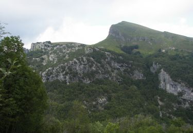
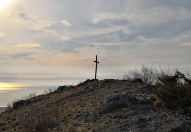
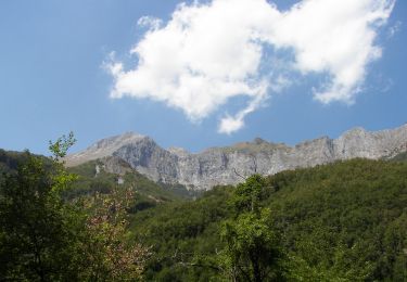
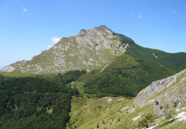
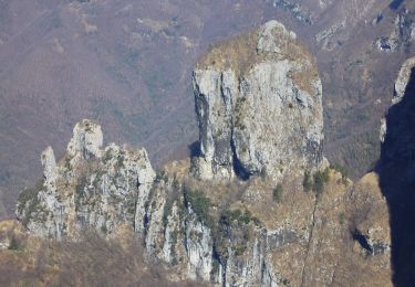
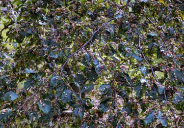
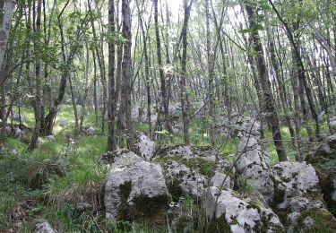
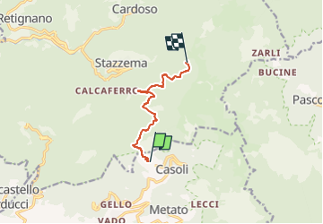
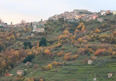
Trail On foot of 6.7 km to be discovered at Tuscany, Lucca, Camaiore. This trail is proposed by SityTrail - itinéraires balisés pédestres.
Description
Trail created by Club Alpino Italiano.
Symbol: red square and white stripe with black text
Positioning
Country:
Italy
Region :
Tuscany
Department/Province :
Lucca
Municipality :
Camaiore
Location:
Unknown
Start:(Dec)
Start:(UTM)
606064 ; 4868905 (32T) N.
Comments
Trails nearby
![Trail On foot Stazzema - IT-135 - Photo](https://media.geolcdn.com/t/375/260/afbb2918-0f5b-4035-af54-890ccf904e62.jpeg&format=jpg&maxdim=2)
![On foot On foot](https://static1.geolcdn.com/sitytour/trail-icons/100.png)
![Trail On foot Stazzema - Sentiero Alta Versilia - Tappa 07 - Retignano - Volegno - Pruno - Photo](https://media.geolcdn.com/t/375/260/c4d41a4c-594e-434a-8810-de484311b09d.jpeg&format=jpg&maxdim=2)
![On foot On foot](https://static1.geolcdn.com/sitytour/trail-icons/100.png)
Sentiero Alta Versilia - Tappa 07 - Retignano - Volegno - Pruno
On foot
Easy
Stazzema,
Tuscany,
Lucca,
Italy
![](/images/other/stat-length.png)
5.4 km | 8.7 km-effort
1h 58min
![](https://static1.geolcdn.com/siteimages/upload/files/16400158638029165_repeat_loop_refresh_sync_direction_icon.png)
No
![Trail On foot Stazzema - IT-137 - Photo](https://media.geolcdn.com/t/375/260/8b1858e1-1976-4918-aa76-14de1d0253da.jpeg&format=jpg&maxdim=2)
![On foot On foot](https://static1.geolcdn.com/sitytour/trail-icons/100.png)
![Trail On foot Stazzema - IT-107 - Photo](https://media.geolcdn.com/t/375/260/a26e1a52-0c10-42c7-a5c9-5a566a7b01a6.jpeg&format=jpg&maxdim=2)
![On foot On foot](https://static1.geolcdn.com/sitytour/trail-icons/100.png)
![Trail On foot Stazzema - IT-6 - Photo](https://media.geolcdn.com/t/375/260/2d4f9d9b-b3e6-4010-9dca-09b2e01d5d32.jpeg&format=jpg&maxdim=2)
![On foot On foot](https://static1.geolcdn.com/sitytour/trail-icons/100.png)
![Trail On foot Stazzema - IT-124 - Photo](https://media.geolcdn.com/t/375/260/a682ea7a-2be8-44f6-8e19-b2bc7a4d6538.jpeg&format=jpg&maxdim=2)
![On foot On foot](https://static1.geolcdn.com/sitytour/trail-icons/100.png)
![Trail On foot Stazzema - IT-5 - Photo](https://media.geolcdn.com/t/375/260/5c694b32-0bfb-408b-b26b-adbfa9c39ac6.jpeg&format=jpg&maxdim=2)
![On foot On foot](https://static1.geolcdn.com/sitytour/trail-icons/100.png)
![Trail On foot Stazzema - IT-7 - Photo](https://media.geolcdn.com/t/375/260/a0b8b456-8162-4fc4-ba95-338d1f3ae320.jpeg&format=jpg&maxdim=2)
![On foot On foot](https://static1.geolcdn.com/sitytour/trail-icons/100.png)
![Trail On foot Stazzema - IT-121 - Photo](https://media.geolcdn.com/t/375/260/2e588f57-6b23-41b2-b4ca-b6e58c12b35e.jpeg&format=jpg&maxdim=2)
![On foot On foot](https://static1.geolcdn.com/sitytour/trail-icons/100.png)