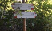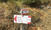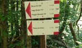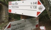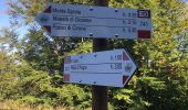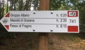

Monte Montagnana - Monte Cavalcalupo - Monte Cervellino - Monte Polo - Passo Sillara - Groppo Albero - Monte Borgognone
SityTrail - itinéraires balisés pédestres
Tous les sentiers balisés d’Europe GUIDE+

Length
19.9 km

Max alt
1485 m

Uphill gradient
836 m

Km-Effort
31 km

Min alt
1197 m

Downhill gradient
807 m
Boucle
No
Signpost
Creation date :
2022-02-14 22:25:57.266
Updated on :
2022-02-28 15:56:25.392
7h01
Difficulty : Medium

FREE GPS app for hiking
About
Trail On foot of 19.9 km to be discovered at Emilia-Romagna, Parma, Corniglio. This trail is proposed by SityTrail - itinéraires balisés pédestres.
Description
relation maintained by Capataz (CAI Parma)
Symbol: 741 on white red flags
Positioning
Country:
Italy
Region :
Emilia-Romagna
Department/Province :
Parma
Municipality :
Corniglio
Location:
Unknown
Start:(Dec)
Start:(UTM)
587087 ; 4934237 (32T) N.
Comments
Trails nearby
Calestano - Fragno - Fragnolo - Percorso 773


On foot
Easy
Calestano,
Emilia-Romagna,
Parma,
Italy

7.9 km | 13.4 km-effort
3h 2min
No
Chiastre - Torrente Baganza - Cassio - Chiastra di San Benedetto


On foot
Easy
Calestano,
Emilia-Romagna,
Parma,
Italy

4.6 km | 8.4 km-effort
1h 54min
No

Cassio - Torrente Baganza - Il Casino - Chiastre - Dente del Gigante


On foot
Easy
Terenzo,
Emilia-Romagna,
Parma,
Italy

5.7 km | 10.1 km-effort
2h 17min
No
Castello di Ravarano - San Biagio - Monte Scaletta - Castello di Ravarano


On foot
Easy
Calestano,
Emilia-Romagna,
Parma,
Italy

5.4 km | 9.2 km-effort
2h 4min
Yes
CR_Francigena_CB_26_Terenzo-Case-Storti_Berceto_20220608


Walking
Difficult
Terenzo,
Emilia-Romagna,
Parma,
Italy

19.3 km | 28 km-effort
5h 52min
No


 SityTrail


