![](/images/other/stat-length.png)
![Trail On foot Savogna d'Isonzo / Sovodnje ob Soči - Sentiero Abramo Schmid - Photo](https://media.geolcdn.com/t/1900/400/d3825a17-9b4b-4de5-8f3d-2ad5d15a1e13.jpeg&format=pjpeg&maxdim=2)
Sentiero Abramo Schmid
SityTrail - itinéraires balisés pédestres
Tous les sentiers balisés d’Europe GUIDE+
![Length](/images/other/stat-length.png)
Length
14.1 km
![Max alt](https://static1.geolcdn.com/siteimages/upload/files/1508320355ic_sort_altitude_max_24dp.png)
Max alt
229 m
![Uphill gradient](https://static1.geolcdn.com/siteimages/upload/files/1508320355ic_sort_den_pos_24dp.png)
Uphill gradient
495 m
![Km-Effort](/images/other/stat-length.png)
Km-Effort
20 km
![Min alt](https://static1.geolcdn.com/siteimages/upload/files/1508320355ic_sort_altitude_min_24dp.png)
Min alt
17 m
![Downhill gradient](https://static1.geolcdn.com/siteimages/upload/files/1508320355ic_sort_den_neg_24dp.png)
Downhill gradient
378 m
![Boucle](https://static1.geolcdn.com/siteimages/upload/files/16400158638029165_repeat_loop_refresh_sync_direction_icon.png)
Boucle
No
Signpost
Creation date :
2022-02-14 22:03:03.856
Updated on :
2022-02-28 15:07:13.849
![On foot](https://static1.geolcdn.com/sitytour/trail-icons/100.png)
4h36
Difficulty : Medium
![Scan this QR Code to open this trail in the SityTrail application](https://capi.geolives.com/qq0zvz2zws4bq2lad0pu/sitytour/trails/3111866/qr.png?size=200)
FREE GPS app for hiking
About
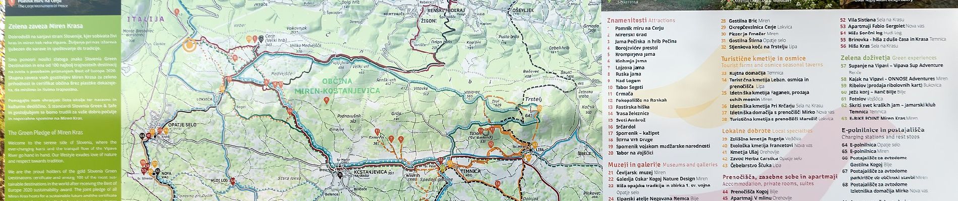
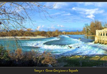
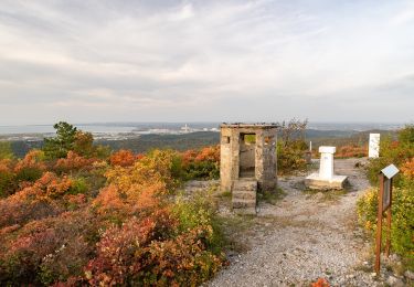
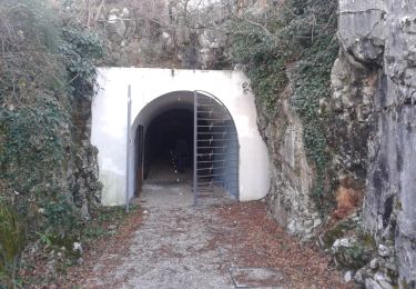
Trail On foot of 14.1 km to be discovered at Friuli Venezia Giulia, Unknown, Savogna d'Isonzo / Sovodnje ob Soči. This trail is proposed by SityTrail - itinéraires balisés pédestres.
Description
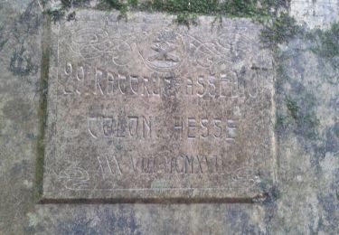
Trail created by Club Alpino Italiano (C.A.I.).
Symbol: rosso-bianco-rosso con il numero 79 in nero sulla striscia bianca
Positioning
Country:
Italy
Region :
Friuli Venezia Giulia
Department/Province :
Unknown
Municipality :
Savogna d'Isonzo / Sovodnje ob Soči
Location:
Unknown
Start:(Dec)
Start:(UTM)
389935 ; 5082462 (33T) N.
Comments
Trails nearby
![Trail On foot Sagrado - Sentiero CAI n. 76 - Photo](https://media.geolcdn.com/t/375/260/a4ddb17d-8541-411c-abb2-7b3a8c1ffb50.jpeg&format=jpg&maxdim=2)
![On foot On foot](https://static1.geolcdn.com/sitytour/trail-icons/100.png)
Sentiero CAI n. 76
On foot
Easy
Sagrado,
Friuli Venezia Giulia,
Unknown,
Italy
![](/images/other/stat-length.png)
6.5 km | 8.1 km-effort
1h 50min
![](https://static1.geolcdn.com/siteimages/upload/files/16400158638029165_repeat_loop_refresh_sync_direction_icon.png)
No
![Trail On foot Savogna d'Isonzo / Sovodnje ob Soči - Sentiero CAI n. 75 - Photo](https://media.geolcdn.com/t/375/260/28686f26-e1c4-4a8d-98a8-ad245db17825.jpeg&format=jpg&maxdim=2)
![On foot On foot](https://static1.geolcdn.com/sitytour/trail-icons/100.png)
Sentiero CAI n. 75
On foot
Easy
Savogna d'Isonzo / Sovodnje ob Soči,
Friuli Venezia Giulia,
Unknown,
Italy
![](/images/other/stat-length.png)
10.5 km | 14.2 km-effort
3h 14min
![](https://static1.geolcdn.com/siteimages/upload/files/16400158638029165_repeat_loop_refresh_sync_direction_icon.png)
No
![Trail On foot Savogna d'Isonzo / Sovodnje ob Soči - Sentiero CAI n. 74 - Photo](https://media.geolcdn.com/t/375/260/a42028e1-69b8-412f-91d3-557d9990a076.jpeg&format=jpg&maxdim=2)
![On foot On foot](https://static1.geolcdn.com/sitytour/trail-icons/100.png)
Sentiero CAI n. 74
On foot
Easy
Savogna d'Isonzo / Sovodnje ob Soči,
Friuli Venezia Giulia,
Unknown,
Italy
![](/images/other/stat-length.png)
4.7 km | 6.5 km-effort
1h 28min
![](https://static1.geolcdn.com/siteimages/upload/files/16400158638029165_repeat_loop_refresh_sync_direction_icon.png)
No
![Trail On foot Savogna d'Isonzo / Sovodnje ob Soči - Sentiero CAI n. 71 - Photo](https://media.geolcdn.com/t/375/260/26ad6a9f-1117-4a4f-86b2-48e1d065d86d.jpeg&format=jpg&maxdim=2)
![On foot On foot](https://static1.geolcdn.com/sitytour/trail-icons/100.png)
Sentiero CAI n. 71
On foot
Easy
Savogna d'Isonzo / Sovodnje ob Soči,
Friuli Venezia Giulia,
Unknown,
Italy
![](/images/other/stat-length.png)
4.8 km | 6.9 km-effort
1h 33min
![](https://static1.geolcdn.com/siteimages/upload/files/16400158638029165_repeat_loop_refresh_sync_direction_icon.png)
No
![Trail On foot Doberdò del Lago / Doberdob - Sentiero CAI n. 77 - Photo](https://media.geolcdn.com/t/375/260/a69c6a39-90fe-4869-9122-9b6a4d3d5164.jpeg&format=jpg&maxdim=2)
![On foot On foot](https://static1.geolcdn.com/sitytour/trail-icons/100.png)
Sentiero CAI n. 77
On foot
Easy
Doberdò del Lago / Doberdob,
Friuli Venezia Giulia,
Unknown,
Italy
![](/images/other/stat-length.png)
8.2 km | 9.7 km-effort
2h 12min
![](https://static1.geolcdn.com/siteimages/upload/files/16400158638029165_repeat_loop_refresh_sync_direction_icon.png)
No