![](/images/other/stat-length.png)
![Trail On foot Madremanya - Madremanya-Millàs-Pedrinyà - Photo](https://media.geolcdn.com/t/1900/400/0e7a18d2-ebc0-4296-be0d-903afa5d9f2a.jpeg&format=pjpeg&maxdim=2)
Madremanya-Millàs-Pedrinyà
SityTrail - itinéraires balisés pédestres
Tous les sentiers balisés d’Europe GUIDE+
![Length](/images/other/stat-length.png)
![Max alt](https://static1.geolcdn.com/siteimages/upload/files/1508320355ic_sort_altitude_max_24dp.png)
![Uphill gradient](https://static1.geolcdn.com/siteimages/upload/files/1508320355ic_sort_den_pos_24dp.png)
![Km-Effort](/images/other/stat-length.png)
![Min alt](https://static1.geolcdn.com/siteimages/upload/files/1508320355ic_sort_altitude_min_24dp.png)
![Downhill gradient](https://static1.geolcdn.com/siteimages/upload/files/1508320355ic_sort_den_neg_24dp.png)
![Boucle](https://static1.geolcdn.com/siteimages/upload/files/16400158638029165_repeat_loop_refresh_sync_direction_icon.png)
![On foot](https://static1.geolcdn.com/sitytour/trail-icons/100.png)
2h46
Difficulty : Easy
![Scan this QR Code to open this trail in the SityTrail application](https://capi.geolives.com/qq0zvz2zws4bq2lad0pu/sitytour/trails/3110625/qr.png?size=200)
FREE GPS app for hiking
About
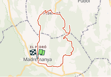
Trail On foot of 9.4 km to be discovered at Catalonia, Girona, Madremanya. This trail is proposed by SityTrail - itinéraires balisés pédestres.
Description
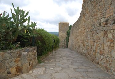
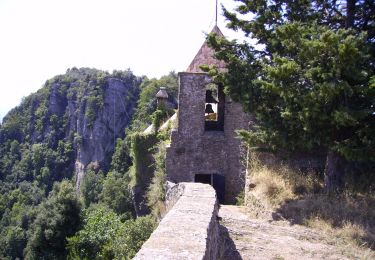
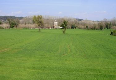
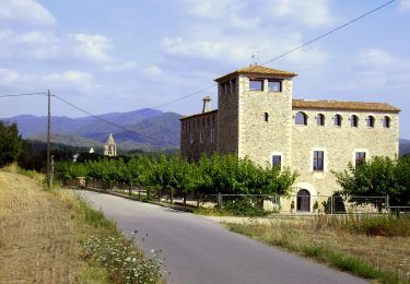
Breu introducció. Ruta matinal pels voltants de Madremanya, a la comarca del Gironès, que passa pels nuclis de Millàs i Pedrinyà, i per prats i boscos amb boniques vistes dels cims de les Gavarres i del Pirineu gironí. Dades tècniques: Durada de la ruta. Aproximadament unes 2.30-3.00 hores, per a una persona acostumada a caminar,…
Website: https://senderismegirona.org/2018/04/05/ruta-de-madremanya-a-millas-i-pedrinya/
Positioning
Comments
Trails nearby
![Trail Walking Bellcaire d'Empordà - bellcaire - Photo](https://media.geolcdn.com/t/375/260/ext.jpg?maxdim=2&url=https%3A%2F%2Fstatic1.geolcdn.com%2Fsiteimages%2Fupload%2Ffiles%2F1553511878bg_sport_marche.png)
![Walking Walking](https://static1.geolcdn.com/sitytour/trail-icons/101.png)
Walking
![](/images/other/stat-length.png)
![](https://static1.geolcdn.com/siteimages/upload/files/16400158638029165_repeat_loop_refresh_sync_direction_icon.png)
![Trail Walking Bellcaire d'Empordà - La boleria 2 - Photo](https://media.geolcdn.com/t/375/260/ext.jpg?maxdim=2&url=https%3A%2F%2Fstatic1.geolcdn.com%2Fsiteimages%2Fupload%2Ffiles%2F1553511878bg_sport_marche.png)
![Walking Walking](https://static1.geolcdn.com/sitytour/trail-icons/101.png)
Walking
![](/images/other/stat-length.png)
![](https://static1.geolcdn.com/siteimages/upload/files/16400158638029165_repeat_loop_refresh_sync_direction_icon.png)
![Trail On foot Cornellà del Terri - Cornellà de Terri, per la Plana de Sords i Pujals - Photo](https://media.geolcdn.com/t/375/260/12ade5c4-1787-4032-b590-7176ea3076da.jpeg&format=jpg&maxdim=2)
![On foot On foot](https://static1.geolcdn.com/sitytour/trail-icons/100.png)
On foot
![](/images/other/stat-length.png)
![](https://static1.geolcdn.com/siteimages/upload/files/16400158638029165_repeat_loop_refresh_sync_direction_icon.png)
![Trail On foot Forallac - Vulpellac-Clots de Sant Julià-Peratallada - Photo](https://media.geolcdn.com/t/375/260/3a241a3c-717f-469b-9949-3d0e3f0155e9.jpeg&format=jpg&maxdim=2)
![On foot On foot](https://static1.geolcdn.com/sitytour/trail-icons/100.png)
On foot
![](/images/other/stat-length.png)
![](https://static1.geolcdn.com/siteimages/upload/files/16400158638029165_repeat_loop_refresh_sync_direction_icon.png)
![Trail On foot Pals - Pals-Palau-sator - Photo](https://media.geolcdn.com/t/375/260/fb13bdbe-802a-4d8f-9dd4-9db427da680b.jpeg&format=jpg&maxdim=2)
![On foot On foot](https://static1.geolcdn.com/sitytour/trail-icons/100.png)
![Trail On foot Canet d'Adri - D'Adr al Santuari de Rocacorba - Photo](https://media.geolcdn.com/t/375/260/dfbb557a-308a-40ef-803b-1b33d6c08043.jpeg&format=jpg&maxdim=2)
![On foot On foot](https://static1.geolcdn.com/sitytour/trail-icons/100.png)
On foot
![](/images/other/stat-length.png)
![](https://static1.geolcdn.com/siteimages/upload/files/16400158638029165_repeat_loop_refresh_sync_direction_icon.png)
![Trail On foot Canet d'Adri - Font de la Torre i volcà de Puig d'Adri - Photo](https://media.geolcdn.com/t/375/260/f20ea49b-0dd3-4f96-8c60-d8699143bd2a.jpeg&format=jpg&maxdim=2)
![On foot On foot](https://static1.geolcdn.com/sitytour/trail-icons/100.png)
On foot
![](/images/other/stat-length.png)
![](https://static1.geolcdn.com/siteimages/upload/files/16400158638029165_repeat_loop_refresh_sync_direction_icon.png)
![Trail On foot Sant Gregori - De Sant Gregori a Santa Afra - Photo](https://media.geolcdn.com/t/375/260/b89006f2-0e49-4c78-8b2a-b137f45c47a6.jpeg&format=jpg&maxdim=2)
![On foot On foot](https://static1.geolcdn.com/sitytour/trail-icons/100.png)
On foot
![](/images/other/stat-length.png)
![](https://static1.geolcdn.com/siteimages/upload/files/16400158638029165_repeat_loop_refresh_sync_direction_icon.png)
![Trail On foot Sant Gregori - De Sant Gregori a Sant Grau - Photo](https://media.geolcdn.com/t/375/260/173cf9a6-5b45-4e78-87e1-6cc6e1d37cfc.jpeg&format=jpg&maxdim=2)
![On foot On foot](https://static1.geolcdn.com/sitytour/trail-icons/100.png)
On foot
![](/images/other/stat-length.png)
![](https://static1.geolcdn.com/siteimages/upload/files/16400158638029165_repeat_loop_refresh_sync_direction_icon.png)