![](/images/other/stat-length.png)
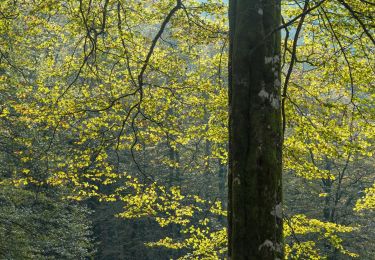
![Trail On foot Larraun - SL-NA 302 Nacedero del Larraun - Iribas - Photo](https://media.geolcdn.com/t/1900/400/640acbd9-1b81-423b-8adf-6c53d0779550.jpeg&format=pjpeg&maxdim=2)
SL-NA 302 Nacedero del Larraun - Iribas
SityTrail - itinéraires balisés pédestres
Tous les sentiers balisés d’Europe GUIDE+
![Length](/images/other/stat-length.png)
Length
4.9 km
![Max alt](https://static1.geolcdn.com/siteimages/upload/files/1508320355ic_sort_altitude_max_24dp.png)
Max alt
669 m
![Uphill gradient](https://static1.geolcdn.com/siteimages/upload/files/1508320355ic_sort_den_pos_24dp.png)
Uphill gradient
93 m
![Km-Effort](/images/other/stat-length.png)
Km-Effort
6.1 km
![Min alt](https://static1.geolcdn.com/siteimages/upload/files/1508320355ic_sort_altitude_min_24dp.png)
Min alt
573 m
![Downhill gradient](https://static1.geolcdn.com/siteimages/upload/files/1508320355ic_sort_den_neg_24dp.png)
Downhill gradient
99 m
![Boucle](https://static1.geolcdn.com/siteimages/upload/files/16400158638029165_repeat_loop_refresh_sync_direction_icon.png)
Boucle
Yes
Signpost
Creation date :
2022-02-14 15:23:12.477
Updated on :
2022-02-14 15:23:12.477
![On foot](https://static1.geolcdn.com/sitytour/trail-icons/100.png)
1h23
Difficulty : Easy
![Scan this QR Code to open this trail in the SityTrail application](https://capi.geolives.com/qq0zvz2zws4bq2lad0pu/sitytour/trails/3110104/qr.png?size=200)
FREE GPS app for hiking
About
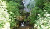
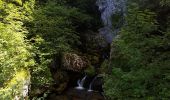
Trail On foot of 4.9 km to be discovered at Navarre, Unknown, Larraun. This trail is proposed by SityTrail - itinéraires balisés pédestres.
Description
Symbol: white strip on top of green strip
Positioning
Country:
Spain
Region :
Navarre
Department/Province :
Unknown
Municipality :
Larraun
Location:
Unknown
Start:(Dec)
Start:(UTM)
589362 ; 4760186 (30T) N.
Comments
Trails nearby
![Trail On foot Zubieta - Mendrasako itzulia - Photo](https://media.geolcdn.com/t/375/260/8db24c19-ae27-4ffc-b99b-f43dbed43de3.jpeg&format=jpg&maxdim=2)
![On foot On foot](https://static1.geolcdn.com/sitytour/trail-icons/100.png)
Mendrasako itzulia
On foot
Easy
Zubieta,
Navarre,
Unknown,
Spain
![](/images/other/stat-length.png)
6.7 km | 10.5 km-effort
2h 23min
![](https://static1.geolcdn.com/siteimages/upload/files/16400158638029165_repeat_loop_refresh_sync_direction_icon.png)
Yes
![Trail On foot Zubieta - Aurkidiko itzulia - Photo](https://media.geolcdn.com/t/375/260/8db24c19-ae27-4ffc-b99b-f43dbed43de3.jpeg&format=jpg&maxdim=2)
![On foot On foot](https://static1.geolcdn.com/sitytour/trail-icons/100.png)
![Trail On foot Urrotz - SL-NA 7 Leurtzako ibilbidea - Photo](https://media.geolcdn.com/t/375/260/fb1e8c87-4fad-47a1-b5ba-82d93accfdfb.jpeg&format=jpg&maxdim=2)
![On foot On foot](https://static1.geolcdn.com/sitytour/trail-icons/100.png)
SL-NA 7 Leurtzako ibilbidea
On foot
Easy
Urrotz,
Navarre,
Unknown,
Spain
![](/images/other/stat-length.png)
3.4 km | 4.6 km-effort
1h 2min
![](https://static1.geolcdn.com/siteimages/upload/files/16400158638029165_repeat_loop_refresh_sync_direction_icon.png)
Yes
![Walking Walking](https://static1.geolcdn.com/sitytour/trail-icons/101.png)
3 Sommets et Portupekoleze, grotte de Lezaundi Puerto Lizarraga
Walking
Very difficult
Andia,
Navarre,
Unknown,
Spain
![](/images/other/stat-length.png)
15 km | 21 km-effort
4h 47min
![](https://static1.geolcdn.com/siteimages/upload/files/16400158638029165_repeat_loop_refresh_sync_direction_icon.png)
Yes
![Trail Walking Urbasa - Wikiloc - Arco de Portupekoleze y cueva de Lezaundi desde venta Lizarraga - Photo](https://media.geolcdn.com/t/375/260/75529867-0d72-4e6e-9500-320394cb120a.jpg&format=jpg&maxdim=2)
![Walking Walking](https://static1.geolcdn.com/sitytour/trail-icons/101.png)
Wikiloc - Arco de Portupekoleze y cueva de Lezaundi desde venta Lizarraga
Walking
Difficult
Urbasa,
Navarre,
Unknown,
Spain
![](/images/other/stat-length.png)
12.5 km | 16.6 km-effort
3h 46min
![](https://static1.geolcdn.com/siteimages/upload/files/16400158638029165_repeat_loop_refresh_sync_direction_icon.png)
Yes
![Trail Walking Urrotz - Sommets et lacs de Leurtza depuis Urrotz. - Photo](https://media.geolcdn.com/t/375/260/b62a619a-68e4-4382-9ee8-0685c844df71.jpg&format=jpg&maxdim=2)
![Walking Walking](https://static1.geolcdn.com/sitytour/trail-icons/101.png)
Sommets et lacs de Leurtza depuis Urrotz.
Walking
Very difficult
(1)
Urrotz,
Navarre,
Unknown,
Spain
![](/images/other/stat-length.png)
14.6 km | 22 km-effort
5h 6min
![](https://static1.geolcdn.com/siteimages/upload/files/16400158638029165_repeat_loop_refresh_sync_direction_icon.png)
Yes
![Trail On foot Valle de Ollo/Ollaran - Tour de la Vallée d'Ollo - Photo](https://media.geolcdn.com/t/375/260/a0453985-2772-4ca4-af23-6827107d5ac9.jpeg&format=jpg&maxdim=2)
![On foot On foot](https://static1.geolcdn.com/sitytour/trail-icons/100.png)
Tour de la Vallée d'Ollo
On foot
Easy
Valle de Ollo/Ollaran,
Navarre,
Unknown,
Spain
![](/images/other/stat-length.png)
7.4 km | 10.7 km-effort
2h 25min
![](https://static1.geolcdn.com/siteimages/upload/files/16400158638029165_repeat_loop_refresh_sync_direction_icon.png)
No
![Trail On foot Irañeta - Irañetako haritzen ibilbidea - Photo](https://media.geolcdn.com/t/375/260/dfe2db9b-ad76-45f6-917f-6bfd76dab101.jpeg&format=jpg&maxdim=2)
![On foot On foot](https://static1.geolcdn.com/sitytour/trail-icons/100.png)
Irañetako haritzen ibilbidea
On foot
Easy
Irañeta,
Navarre,
Unknown,
Spain
![](/images/other/stat-length.png)
3.1 km | 5.7 km-effort
1h 17min
![](https://static1.geolcdn.com/siteimages/upload/files/16400158638029165_repeat_loop_refresh_sync_direction_icon.png)
No
![Trail On foot Zaldibia - SL-GI 2008 Amundarainerreka ibilbidea - Photo](https://media.geolcdn.com/t/375/260/b7a09982-a1b8-4cf6-b8b8-1ab7c4685e71.jpeg&format=jpg&maxdim=2)
![On foot On foot](https://static1.geolcdn.com/sitytour/trail-icons/100.png)
SL-GI 2008 Amundarainerreka ibilbidea
On foot
Easy
Zaldibia,
Autonomous Community of the Basque Country,
Gipuzkoa,
Spain
![](/images/other/stat-length.png)
7.7 km | 9.8 km-effort
2h 14min
![](https://static1.geolcdn.com/siteimages/upload/files/16400158638029165_repeat_loop_refresh_sync_direction_icon.png)
Yes