![](/images/other/stat-length.png)
![Trail On foot Porqueres - Ruta de l’Estany a Sant Patllari - Photo](https://media.geolcdn.com/t/1900/400/07edbf09-16f8-412a-bc92-e1691e5495ce.jpeg&format=pjpeg&maxdim=2)
Ruta de l’Estany a Sant Patllari
SityTrail - itinéraires balisés pédestres
Tous les sentiers balisés d’Europe GUIDE+
![Length](/images/other/stat-length.png)
![Max alt](https://static1.geolcdn.com/siteimages/upload/files/1508320355ic_sort_altitude_max_24dp.png)
![Uphill gradient](https://static1.geolcdn.com/siteimages/upload/files/1508320355ic_sort_den_pos_24dp.png)
![Km-Effort](/images/other/stat-length.png)
![Min alt](https://static1.geolcdn.com/siteimages/upload/files/1508320355ic_sort_altitude_min_24dp.png)
![Downhill gradient](https://static1.geolcdn.com/siteimages/upload/files/1508320355ic_sort_den_neg_24dp.png)
![Boucle](https://static1.geolcdn.com/siteimages/upload/files/16400158638029165_repeat_loop_refresh_sync_direction_icon.png)
![On foot](https://static1.geolcdn.com/sitytour/trail-icons/100.png)
2h34
Difficulty : Easy
![Scan this QR Code to open this trail in the SityTrail application](https://capi.geolives.com/qq0zvz2zws4bq2lad0pu/sitytour/trails/3110054/qr.png?size=200)
FREE GPS app for hiking
About
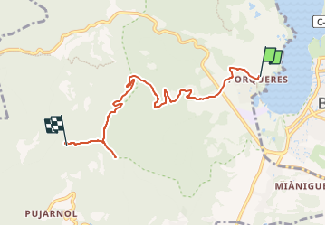
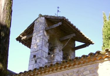
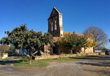
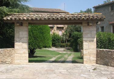
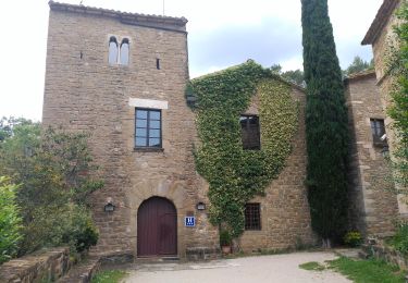
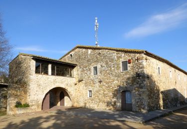
Trail On foot of 6.7 km to be discovered at Catalonia, Girona, Porqueres. This trail is proposed by SityTrail - itinéraires balisés pédestres.
Description
Trail created by Consell Comarcal del Pla de l'Estany.
Website: http://turisme.plaestany.cat/wp-content/uploads/2018/07/Ruta-de-l-Estany-a-Sant-Patllari-turisme-pla-estany.pdf
Positioning
Comments
Trails nearby
![Trail On foot Fontcoberta - Itinerari Mitjà - Fontcoberta - Photo](https://media.geolcdn.com/t/375/260/3a50dc6f-a7ba-41a9-a9d5-33599dc651b3.jpeg&format=jpg&maxdim=2)
![On foot On foot](https://static1.geolcdn.com/sitytour/trail-icons/100.png)
On foot
![](/images/other/stat-length.png)
![](https://static1.geolcdn.com/siteimages/upload/files/16400158638029165_repeat_loop_refresh_sync_direction_icon.png)
![Trail On foot Fontcoberta - Itinerari Llarg - Fontcoberta - Photo](https://media.geolcdn.com/t/375/260/3723e66b-0129-4439-9875-6515162a7c96.jpeg&format=jpg&maxdim=2)
![On foot On foot](https://static1.geolcdn.com/sitytour/trail-icons/100.png)
On foot
![](/images/other/stat-length.png)
![](https://static1.geolcdn.com/siteimages/upload/files/16400158638029165_repeat_loop_refresh_sync_direction_icon.png)
![Trail On foot Fontcoberta - Ruta de la platja d’Espolla i Usall - Photo](https://media.geolcdn.com/t/375/260/7dd26220-3984-4d0b-9cf8-3c431ceaacd5.jpeg&format=jpg&maxdim=2)
![On foot On foot](https://static1.geolcdn.com/sitytour/trail-icons/100.png)
On foot
![](/images/other/stat-length.png)
![](https://static1.geolcdn.com/siteimages/upload/files/16400158638029165_repeat_loop_refresh_sync_direction_icon.png)
![Trail On foot Porqueres - Altres Itineraris - Les costes de Mata - Photo](https://media.geolcdn.com/t/375/260/3cbe01ee-0b36-45a6-a6d8-d37be4abb104.jpeg&format=jpg&maxdim=2)
![On foot On foot](https://static1.geolcdn.com/sitytour/trail-icons/100.png)
On foot
![](/images/other/stat-length.png)
![](https://static1.geolcdn.com/siteimages/upload/files/16400158638029165_repeat_loop_refresh_sync_direction_icon.png)
![Trail On foot Porqueres - Itinerari Mitjà - Mata-Les Pedreres - Photo](https://media.geolcdn.com/t/375/260/37db7905-6463-446b-ac6a-2eb5f114312b.jpeg&format=jpg&maxdim=2)
![On foot On foot](https://static1.geolcdn.com/sitytour/trail-icons/100.png)
On foot
![](/images/other/stat-length.png)
![](https://static1.geolcdn.com/siteimages/upload/files/16400158638029165_repeat_loop_refresh_sync_direction_icon.png)
![Trail On foot Porqueres - Itinerari Llarg - Mata-Miànigues - Photo](https://media.geolcdn.com/t/375/260/1112356c-98f0-4ffc-a30f-19b7c4b0ea39.jpeg&format=jpg&maxdim=2)
![On foot On foot](https://static1.geolcdn.com/sitytour/trail-icons/100.png)
On foot
![](/images/other/stat-length.png)
![](https://static1.geolcdn.com/siteimages/upload/files/16400158638029165_repeat_loop_refresh_sync_direction_icon.png)
![Trail On foot Camós - Itinerari Mitjà - Camós - Photo](https://media.geolcdn.com/t/375/260/37db7905-6463-446b-ac6a-2eb5f114312b.jpeg&format=jpg&maxdim=2)
![On foot On foot](https://static1.geolcdn.com/sitytour/trail-icons/100.png)
On foot
![](/images/other/stat-length.png)
![](https://static1.geolcdn.com/siteimages/upload/files/16400158638029165_repeat_loop_refresh_sync_direction_icon.png)
![Trail On foot Porqueres - Itinerari Llarg - Camós - Photo](https://media.geolcdn.com/t/375/260/bf80a82b-965f-4e0f-8e68-fcefbeaf6f31.jpeg&format=jpg&maxdim=2)
![On foot On foot](https://static1.geolcdn.com/sitytour/trail-icons/100.png)
On foot
![](/images/other/stat-length.png)
![](https://static1.geolcdn.com/siteimages/upload/files/16400158638029165_repeat_loop_refresh_sync_direction_icon.png)
![Trail On foot - Ruta de les fonts i del patrimoni de Fontcoberta - Photo](https://media.geolcdn.com/t/375/260/55f4bf0e-44f2-4e8f-8b47-9f1724528b17.jpeg&format=jpg&maxdim=2)
![On foot On foot](https://static1.geolcdn.com/sitytour/trail-icons/100.png)
On foot
![](/images/other/stat-length.png)
![](https://static1.geolcdn.com/siteimages/upload/files/16400158638029165_repeat_loop_refresh_sync_direction_icon.png)