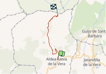

4.7 km | 6.2 km-effort


Tous les sentiers balisés d’Europe GUIDE+


FREE GPS app for hiking
 SityTrail
IGN / Geographical institutes
SityTrail World
The world is yours!
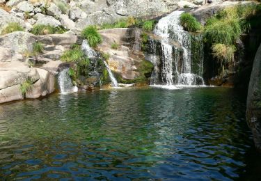
Trail On foot of 8.6 km to be discovered at Extremadura, Cáceres, Aldeanueva de la Vera. This trail is proposed by SityTrail - itinéraires balisés pédestres.
![Trail On foot Jarandilla de la Vera - [SL-CC 56] Ruta de los Puentes - Photo](https://media.geolcdn.com/t/375/260/fd07e3b8-ad49-470f-b694-03d4b41a51c1.jpeg&format=jpg&maxdim=2)
On foot