


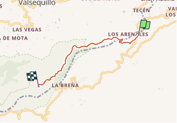

11 km | 18.8 km-effort

Tous les sentiers balisés d’Europe GUIDE+


FREE GPS app for hiking
 SityTrail
IGN / Geographical institutes
SityTrail World
The world is yours!
Trail On foot of 5.1 km to be discovered at Canary Islands, Las Palmas, Telde. This trail is proposed by SityTrail - itinéraires balisés pédestres.


Walking
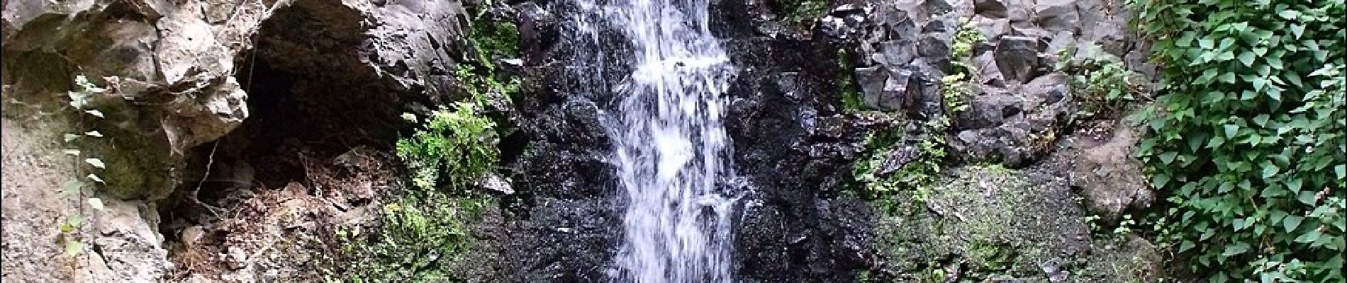
vous pouvez commencer la randonnée à peu près 1,5 km plus loin si vous ne souhaitez pas prendre la route. la dernière partie n'est pas accessible. c'est une zone naturelle préservée