![](/images/other/stat-length.png)
![Trail On foot Villa de Mazo - SL LP 123 - Photo](https://media.geolcdn.com/t/1900/400/1d3b948a-f4cc-454a-ad13-e1472e6b165f.jpeg&format=pjpeg&maxdim=2)
SL LP 123
SityTrail - itinéraires balisés pédestres
Tous les sentiers balisés d’Europe GUIDE+
![Length](/images/other/stat-length.png)
Length
3.4 km
![Max alt](https://static1.geolcdn.com/siteimages/upload/files/1508320355ic_sort_altitude_max_24dp.png)
Max alt
924 m
![Uphill gradient](https://static1.geolcdn.com/siteimages/upload/files/1508320355ic_sort_den_pos_24dp.png)
Uphill gradient
64 m
![Km-Effort](/images/other/stat-length.png)
Km-Effort
4.6 km
![Min alt](https://static1.geolcdn.com/siteimages/upload/files/1508320355ic_sort_altitude_min_24dp.png)
Min alt
797 m
![Downhill gradient](https://static1.geolcdn.com/siteimages/upload/files/1508320355ic_sort_den_neg_24dp.png)
Downhill gradient
163 m
![Boucle](https://static1.geolcdn.com/siteimages/upload/files/16400158638029165_repeat_loop_refresh_sync_direction_icon.png)
Boucle
No
Signpost
Creation date :
2022-02-14 14:46:26.277
Updated on :
2022-02-14 14:46:26.277
![On foot](https://static1.geolcdn.com/sitytour/trail-icons/100.png)
1h03
Difficulty : Easy
![Scan this QR Code to open this trail in the SityTrail application](https://capi.geolives.com/qq0zvz2zws4bq2lad0pu/sitytour/trails/3109244/qr.png?size=200)
FREE GPS app for hiking
About
Trail On foot of 3.4 km to be discovered at Canary Islands, Santa Cruz de Tenerife, Villa de Mazo. This trail is proposed by SityTrail - itinéraires balisés pédestres.
Description
Trail created by Senderos de La Palma.
Symbol: parallel green and white horizontal bar
Positioning
Country:
Spain
Region :
Canary Islands
Department/Province :
Santa Cruz de Tenerife
Municipality :
Villa de Mazo
Location:
Unknown
Start:(Dec)
Start:(UTM)
226328 ; 3166839 (28R) N.
Comments
Trails nearby
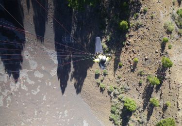
![Trail On foot El Paso - SL LP 105 Coladas de San Juan-Camino Barquito - Photo](https://media.geolcdn.com/t/375/260/2abdaf06-fcdc-4aac-8c3a-03e25c71a2e6.jpeg&format=jpg&maxdim=2)
![On foot On foot](https://static1.geolcdn.com/sitytour/trail-icons/100.png)
SL LP 105 Coladas de San Juan-Camino Barquito
On foot
Easy
El Paso,
Canary Islands,
Santa Cruz de Tenerife,
Spain
![](/images/other/stat-length.png)
3.4 km | 5 km-effort
1h 8min
![](https://static1.geolcdn.com/siteimages/upload/files/16400158638029165_repeat_loop_refresh_sync_direction_icon.png)
No
![Trail On foot El Paso - SL LP 103 Coladas de San Juan-Llano de Jable - Photo](https://media.geolcdn.com/t/375/260/4ced803e-2e30-46cb-a168-37a82f9e2e6e.jpeg&format=jpg&maxdim=2)
![On foot On foot](https://static1.geolcdn.com/sitytour/trail-icons/100.png)
SL LP 103 Coladas de San Juan-Llano de Jable
On foot
Easy
El Paso,
Canary Islands,
Santa Cruz de Tenerife,
Spain
![](/images/other/stat-length.png)
4 km | 5.3 km-effort
1h 12min
![](https://static1.geolcdn.com/siteimages/upload/files/16400158638029165_repeat_loop_refresh_sync_direction_icon.png)
No
![Trail On foot Villa de Mazo - SL VM 125 Llano de las Moscas-Pico Nambroque - Photo](https://media.geolcdn.com/t/375/260/035e1071-d6b2-4733-81f7-8ff6efada3c3.jpeg&format=jpg&maxdim=2)
![On foot On foot](https://static1.geolcdn.com/sitytour/trail-icons/100.png)
SL VM 125 Llano de las Moscas-Pico Nambroque
On foot
Easy
Villa de Mazo,
Canary Islands,
Santa Cruz de Tenerife,
Spain
![](/images/other/stat-length.png)
4.5 km | 6.2 km-effort
1h 24min
![](https://static1.geolcdn.com/siteimages/upload/files/16400158638029165_repeat_loop_refresh_sync_direction_icon.png)
No
![Walking Walking](https://static1.geolcdn.com/sitytour/trail-icons/101.png)
Wikiloc - La Palma: Cumbre Vieja Vulkaanroute half
Walking
Very difficult
El Paso,
Canary Islands,
Santa Cruz de Tenerife,
Spain
![](/images/other/stat-length.png)
13.8 km | 24 km-effort
9h 1min
![](https://static1.geolcdn.com/siteimages/upload/files/16400158638029165_repeat_loop_refresh_sync_direction_icon.png)
Yes
![Trail Walking El Paso - dag 3 La Palma - Photo](https://media.geolcdn.com/t/375/260/1fa39298-6499-4e59-abbd-f3560317dead.jpg&format=jpg&maxdim=2)
![Walking Walking](https://static1.geolcdn.com/sitytour/trail-icons/101.png)
dag 3 La Palma
Walking
Very difficult
El Paso,
Canary Islands,
Santa Cruz de Tenerife,
Spain
![](/images/other/stat-length.png)
19.4 km | 31 km-effort
4h 38min
![](https://static1.geolcdn.com/siteimages/upload/files/16400158638029165_repeat_loop_refresh_sync_direction_icon.png)
No
![Trail On foot Villa de Mazo - SL LP 126 Cruz del Monte - Camino de La Faya - Photo](https://media.geolcdn.com/t/375/260/ext.jpg?maxdim=2&url=https%3A%2F%2Fstatic1.geolcdn.com%2Fsiteimages%2Fupload%2Ffiles%2F1545311037marcheuse_200dpi.jpg)
![On foot On foot](https://static1.geolcdn.com/sitytour/trail-icons/100.png)
SL LP 126 Cruz del Monte - Camino de La Faya
On foot
Easy
Villa de Mazo,
Canary Islands,
Santa Cruz de Tenerife,
Spain
![](/images/other/stat-length.png)
3.9 km | 5.9 km-effort
1h 20min
![](https://static1.geolcdn.com/siteimages/upload/files/16400158638029165_repeat_loop_refresh_sync_direction_icon.png)
No
![Trail On foot Breña Baja - SL BA 140 - Photo](https://media.geolcdn.com/t/375/260/ext.jpg?maxdim=2&url=https%3A%2F%2Fstatic1.geolcdn.com%2Fsiteimages%2Fupload%2Ffiles%2F1545311037marcheuse_200dpi.jpg)
![On foot On foot](https://static1.geolcdn.com/sitytour/trail-icons/100.png)
SL BA 140
On foot
Easy
Breña Baja,
Canary Islands,
Santa Cruz de Tenerife,
Spain
![](/images/other/stat-length.png)
3.1 km | 3.9 km-effort
52min
![](https://static1.geolcdn.com/siteimages/upload/files/16400158638029165_repeat_loop_refresh_sync_direction_icon.png)
No
![Trail Walking El Paso - LSG El ruta de los volcanes - Photo](https://media.geolcdn.com/t/375/260/ext.jpg?maxdim=2&url=https%3A%2F%2Fservices.sitytrail.com%2FGeolivesWS%2FDownloadMedia.ashx%3FTrailID%3D792008%26Media%3D20170718131707.jpg)
![Walking Walking](https://static1.geolcdn.com/sitytour/trail-icons/101.png)
LSG El ruta de los volcanes
Walking
Medium
El Paso,
Canary Islands,
Santa Cruz de Tenerife,
Spain
![](/images/other/stat-length.png)
19 km | 31 km-effort
7h 18min
![](https://static1.geolcdn.com/siteimages/upload/files/16400158638029165_repeat_loop_refresh_sync_direction_icon.png)
No
![Trail Walking El Paso - Canaries - La palma - Route des Volcans - jour 3 - Photo](https://media.geolcdn.com/t/375/260/ext.jpg?maxdim=2&url=https%3A%2F%2Fstatic1.geolcdn.com%2Fsiteimages%2Fupload%2Ffiles%2F1553511878bg_sport_marche.png)
![Walking Walking](https://static1.geolcdn.com/sitytour/trail-icons/101.png)
Canaries - La palma - Route des Volcans - jour 3
Walking
Medium
El Paso,
Canary Islands,
Santa Cruz de Tenerife,
Spain
![](/images/other/stat-length.png)
17.7 km | 29 km-effort
7h 44min
![](https://static1.geolcdn.com/siteimages/upload/files/16400158638029165_repeat_loop_refresh_sync_direction_icon.png)
No