


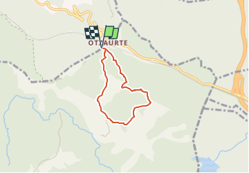

4 km | 7.3 km-effort


Tous les sentiers balisés d’Europe GUIDE+


FREE GPS app for hiking
 SityTrail
IGN / Geographical institutes
SityTrail World
The world is yours!
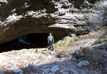
Trail On foot of 4.8 km to be discovered at Autonomous Community of the Basque Country, Gipuzkoa, Zegama. This trail is proposed by SityTrail - itinéraires balisés pédestres.
Trail created by Aizkorri-Aratz Parke Naturala.
On foot

Walking
Walking
Walking

Other activity