![](/images/other/stat-length.png)
![Trail On foot Burgos - Los caminos del agua siguiendo el Arlanzón - Photo](https://media.geolcdn.com/t/1900/400/3d0b8cc9-8bb3-4b91-ba1c-09224488703a.jpeg&format=pjpeg&maxdim=2)
Los caminos del agua siguiendo el Arlanzón
SityTrail - itinéraires balisés pédestres
Tous les sentiers balisés d’Europe GUIDE+
![Length](/images/other/stat-length.png)
Length
5.6 km
![Max alt](https://static1.geolcdn.com/siteimages/upload/files/1508320355ic_sort_altitude_max_24dp.png)
Max alt
877 m
![Uphill gradient](https://static1.geolcdn.com/siteimages/upload/files/1508320355ic_sort_den_pos_24dp.png)
Uphill gradient
72 m
![Km-Effort](/images/other/stat-length.png)
Km-Effort
6.5 km
![Min alt](https://static1.geolcdn.com/siteimages/upload/files/1508320355ic_sort_altitude_min_24dp.png)
Min alt
849 m
![Downhill gradient](https://static1.geolcdn.com/siteimages/upload/files/1508320355ic_sort_den_neg_24dp.png)
Downhill gradient
59 m
![Boucle](https://static1.geolcdn.com/siteimages/upload/files/16400158638029165_repeat_loop_refresh_sync_direction_icon.png)
Boucle
No
Signpost
Creation date :
2022-02-14 14:40:12.613
Updated on :
2022-02-14 14:40:12.613
![On foot](https://static1.geolcdn.com/sitytour/trail-icons/100.png)
1h28
Difficulty : Easy
![Scan this QR Code to open this trail in the SityTrail application](https://capi.geolives.com/qq0zvz2zws4bq2lad0pu/sitytour/trails/3109046/qr.png?size=200)
FREE GPS app for hiking
About
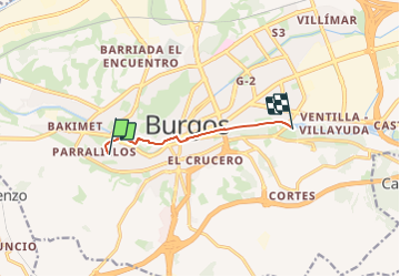
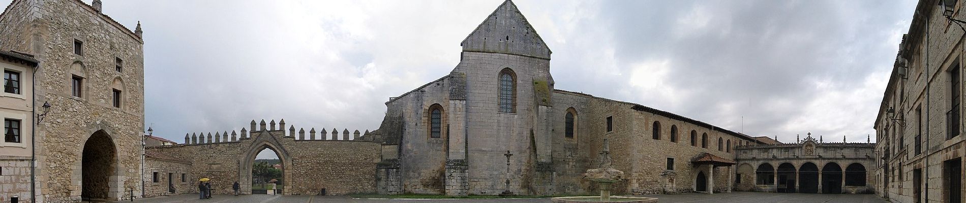
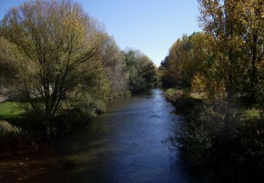
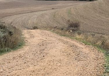
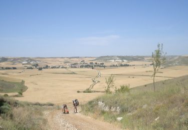
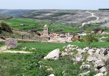
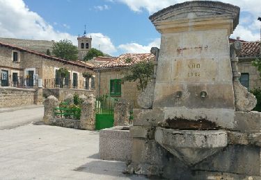
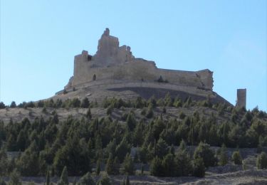
Trail On foot of 5.6 km to be discovered at Castile and León, Burgos, Burgos. This trail is proposed by SityTrail - itinéraires balisés pédestres.
Description
Trail created by Citur.
Website: http://www.aytoburgos.es/archivos/vocab-raw/articulo/documentos/rutas7.pdf
Positioning
Country:
Spain
Region :
Castile and León
Department/Province :
Burgos
Municipality :
Burgos
Location:
Unknown
Start:(Dec)
Start:(UTM)
440599 ; 4687434 (30T) N.
Comments
Trails nearby
![Trail On foot Burgos - Paseos por el Cinturón Verde: La Lora - Cerro de la Galga - Photo](https://media.geolcdn.com/t/375/260/92fe05fc-7cca-45d8-b5d9-2b8e6f7fa533.jpeg&format=jpg&maxdim=2)
![On foot On foot](https://static1.geolcdn.com/sitytour/trail-icons/100.png)
Paseos por el Cinturón Verde: La Lora - Cerro de la Galga
On foot
Easy
Burgos,
Castile and León,
Burgos,
Spain
![](/images/other/stat-length.png)
4.9 km | 6.3 km-effort
1h 25min
![](https://static1.geolcdn.com/siteimages/upload/files/16400158638029165_repeat_loop_refresh_sync_direction_icon.png)
No
![Trail On foot Burgos - Paseos por el Cinturón Verde: Barrio de Villatoro - Monasterio de Fredesval - Photo](https://media.geolcdn.com/t/375/260/2dd871ae-97c2-4528-a54d-7e4d8a7c8c7b.jpeg&format=jpg&maxdim=2)
![On foot On foot](https://static1.geolcdn.com/sitytour/trail-icons/100.png)
Paseos por el Cinturón Verde: Barrio de Villatoro - Monasterio de Fredesval
On foot
Easy
Burgos,
Castile and León,
Burgos,
Spain
![](/images/other/stat-length.png)
11.8 km | 15.2 km-effort
3h 27min
![](https://static1.geolcdn.com/siteimages/upload/files/16400158638029165_repeat_loop_refresh_sync_direction_icon.png)
No
![Trail On foot Burgos - Paseos por el Cinturón Verde: Fábrica de la Moneda y Timbre - Barrio de Villalonquéjar - Photo](https://media.geolcdn.com/t/375/260/16393599-a383-4eb0-b1fc-4fb2608e1bec.jpeg&format=jpg&maxdim=2)
![On foot On foot](https://static1.geolcdn.com/sitytour/trail-icons/100.png)
Paseos por el Cinturón Verde: Fábrica de la Moneda y Timbre - Barrio de Villa...
On foot
Easy
Burgos,
Castile and León,
Burgos,
Spain
![](/images/other/stat-length.png)
9.2 km | 10 km-effort
2h 15min
![](https://static1.geolcdn.com/siteimages/upload/files/16400158638029165_repeat_loop_refresh_sync_direction_icon.png)
Yes
![Trail Walking Burgos - 2023 10 24 CAMINO FRANCES - 32ème étape : Burgos - Tardajos - Rabelais de l’as Calzadas - Hornillos Del Camino - Hontanas - Photo](https://media.geolcdn.com/t/375/260/6e8d28fa-9ac1-457f-8eb4-3d5cbae95068.jpg&format=jpg&maxdim=2)
![Walking Walking](https://static1.geolcdn.com/sitytour/trail-icons/101.png)
2023 10 24 CAMINO FRANCES - 32ème étape : Burgos - Tardajos - Rabelais de l’a...
Walking
Medium
Burgos,
Castile and León,
Burgos,
Spain
![](/images/other/stat-length.png)
32 km | 37 km-effort
6h 30min
![](https://static1.geolcdn.com/siteimages/upload/files/16400158638029165_repeat_loop_refresh_sync_direction_icon.png)
No
![Trail On foot Burgos - Paseos por el Cinturón Verde: Santimia - Photo](https://media.geolcdn.com/t/375/260/8ea25166-dc52-4a6b-b0b5-04265b20cc52.jpeg&format=jpg&maxdim=2)
![On foot On foot](https://static1.geolcdn.com/sitytour/trail-icons/100.png)
Paseos por el Cinturón Verde: Santimia
On foot
Easy
Burgos,
Castile and León,
Burgos,
Spain
![](/images/other/stat-length.png)
3.5 km | 4.6 km-effort
1h 2min
![](https://static1.geolcdn.com/siteimages/upload/files/16400158638029165_repeat_loop_refresh_sync_direction_icon.png)
No
![Walking Walking](https://static1.geolcdn.com/sitytour/trail-icons/101.png)
CC_Frances_CA_13_Burgos_Hontanas_20110704
Walking
Easy
Burgos,
Castile and León,
Burgos,
Spain
![](/images/other/stat-length.png)
31 km | 36 km-effort
7h 0min
![](https://static1.geolcdn.com/siteimages/upload/files/16400158638029165_repeat_loop_refresh_sync_direction_icon.png)
No
![Walking Walking](https://static1.geolcdn.com/sitytour/trail-icons/101.png)
24.04.18 Burgos--Hontanas
Walking
Medium
Burgos,
Castile and León,
Burgos,
Spain
![](/images/other/stat-length.png)
32 km | 37 km-effort
7h 54min
![](https://static1.geolcdn.com/siteimages/upload/files/16400158638029165_repeat_loop_refresh_sync_direction_icon.png)
No
![Trail Walking Burgos - Compostelle 46 - Burgos -> Hornillo/Isar - Photo](https://media.geolcdn.com/t/375/260/ext.jpg?maxdim=2&url=https%3A%2F%2Fservices.sitytrail.com%2FGeolivesWS%2FDownloadMedia.ashx%3FTrailID%3D859311%26Media%3Dfix__20170505145502.jpg)
![Walking Walking](https://static1.geolcdn.com/sitytour/trail-icons/101.png)
Compostelle 46 - Burgos -> Hornillo/Isar
Walking
Easy
Burgos,
Castile and León,
Burgos,
Spain
![](/images/other/stat-length.png)
25 km | 29 km-effort
5h 30min
![](https://static1.geolcdn.com/siteimages/upload/files/16400158638029165_repeat_loop_refresh_sync_direction_icon.png)
No
![Trail Walking Burgos - Mon Compostelle vingt deuxième étape - Photo](https://media.geolcdn.com/t/375/260/ext.jpg?maxdim=2&url=https%3A%2F%2Fservices.sitytrail.com%2FGeolivesWS%2FDownloadMedia.ashx%3FTrailID%3D693210%26Media%3Dd332dc26-33b3-441c-8d14-03bc9c0902d3.jpg)
![Walking Walking](https://static1.geolcdn.com/sitytour/trail-icons/101.png)
Mon Compostelle vingt deuxième étape
Walking
Medium
Burgos,
Castile and León,
Burgos,
Spain
![](/images/other/stat-length.png)
41 km | 47 km-effort
8h 15min
![](https://static1.geolcdn.com/siteimages/upload/files/16400158638029165_repeat_loop_refresh_sync_direction_icon.png)
No