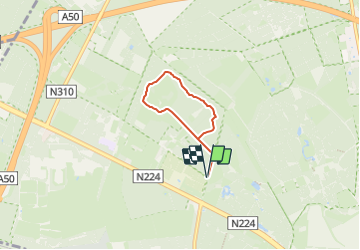
![](/images/other/stat-length.png)
![Trail On foot Arnhem - Westereinde - Photo](https://media.geolcdn.com/t/1900/400/45f9c7f4-aa5d-4ddc-8b51-0461d176d59b.jpeg&format=pjpeg&maxdim=2)
Westereinde
SityTrail - itinéraires balisés pédestres
Tous les sentiers balisés d’Europe GUIDE+
![Length](/images/other/stat-length.png)
![Max alt](https://static1.geolcdn.com/siteimages/upload/files/1508320355ic_sort_altitude_max_24dp.png)
![Uphill gradient](https://static1.geolcdn.com/siteimages/upload/files/1508320355ic_sort_den_pos_24dp.png)
![Km-Effort](/images/other/stat-length.png)
![Min alt](https://static1.geolcdn.com/siteimages/upload/files/1508320355ic_sort_altitude_min_24dp.png)
![Downhill gradient](https://static1.geolcdn.com/siteimages/upload/files/1508320355ic_sort_den_neg_24dp.png)
![Boucle](https://static1.geolcdn.com/siteimages/upload/files/16400158638029165_repeat_loop_refresh_sync_direction_icon.png)
![On foot](https://static1.geolcdn.com/sitytour/trail-icons/100.png)
55m
Difficulty : Easy
![Scan this QR Code to open this trail in the SityTrail application](https://capi.geolives.com/qq0zvz2zws4bq2lad0pu/sitytour/trails/3108759/qr.png?size=200)
FREE GPS app for hiking
About
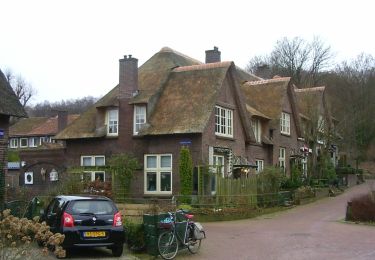
Trail On foot of 3.6 km to be discovered at Gelderland, Unknown, Arnhem. This trail is proposed by SityTrail - itinéraires balisés pédestres.
Description
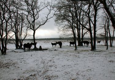
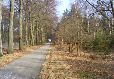
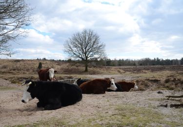
Hoog Erf bestaat uit weilanden, akkers, loofbosjes en singels. Een mooi punt is ‘de ster’. Hier komen zes lanen van het landgoed bij elkaar. Een heerl
Website: https://www.glk.nl/82/locatie/?locatie=128
Positioning
Comments
Trails nearby
![Trail On foot Ede - Oud Reemst - Blauw - Photo](https://media.geolcdn.com/t/375/260/7f30981a-8c7c-4f0d-ac51-6ff256539cde.jpeg&format=jpg&maxdim=2)
![On foot On foot](https://static1.geolcdn.com/sitytour/trail-icons/100.png)
On foot
![](/images/other/stat-length.png)
![](https://static1.geolcdn.com/siteimages/upload/files/16400158638029165_repeat_loop_refresh_sync_direction_icon.png)
![Trail On foot Ede - Buunderkamp - Rode pijl - Photo](https://media.geolcdn.com/t/375/260/968a0081-d191-41d7-a424-5be7a0106691.jpeg&format=jpg&maxdim=2)
![On foot On foot](https://static1.geolcdn.com/sitytour/trail-icons/100.png)
On foot
![](/images/other/stat-length.png)
![](https://static1.geolcdn.com/siteimages/upload/files/16400158638029165_repeat_loop_refresh_sync_direction_icon.png)
![Trail On foot Renkum - Molenbeeksepad - Photo](https://media.geolcdn.com/t/375/260/be8ca94d-f66a-461e-9184-fada35dc0854.jpeg&format=jpg&maxdim=2)
![On foot On foot](https://static1.geolcdn.com/sitytour/trail-icons/100.png)
On foot
![](/images/other/stat-length.png)
![](https://static1.geolcdn.com/siteimages/upload/files/16400158638029165_repeat_loop_refresh_sync_direction_icon.png)
![Trail On foot Renkum - Dorenweertsepad - Photo](https://media.geolcdn.com/t/375/260/b7c380c3-a109-4b9c-9971-85e75dba5716.jpeg&format=jpg&maxdim=2)
![On foot On foot](https://static1.geolcdn.com/sitytour/trail-icons/100.png)
On foot
![](/images/other/stat-length.png)
![](https://static1.geolcdn.com/siteimages/upload/files/16400158638029165_repeat_loop_refresh_sync_direction_icon.png)
![Trail On foot Ede - Oud Reemst - Geel - Photo](https://media.geolcdn.com/t/375/260/25466423-843d-4903-a4c1-99a07e86a578.jpeg&format=jpg&maxdim=2)
![On foot On foot](https://static1.geolcdn.com/sitytour/trail-icons/100.png)
On foot
![](/images/other/stat-length.png)
![](https://static1.geolcdn.com/siteimages/upload/files/16400158638029165_repeat_loop_refresh_sync_direction_icon.png)
![Trail On foot Arnhem - NS-wandeling Warnsborn - Photo](https://media.geolcdn.com/t/375/260/68894f33-5963-49f9-a97e-666a755bcf4a.jpeg&format=jpg&maxdim=2)
![On foot On foot](https://static1.geolcdn.com/sitytour/trail-icons/100.png)
On foot
![](/images/other/stat-length.png)
![](https://static1.geolcdn.com/siteimages/upload/files/16400158638029165_repeat_loop_refresh_sync_direction_icon.png)
![Trail On foot Renkum - NS-wandeling Hemelse Berg - Photo](https://media.geolcdn.com/t/375/260/93ca447f-42ea-4496-8d0a-71e3f7e5f83d.jpeg&format=jpg&maxdim=2)
![On foot On foot](https://static1.geolcdn.com/sitytour/trail-icons/100.png)
On foot
![](/images/other/stat-length.png)
![](https://static1.geolcdn.com/siteimages/upload/files/16400158638029165_repeat_loop_refresh_sync_direction_icon.png)
![Trail On foot Arnhem - Groene Wissel: Arnhem - Photo](https://media.geolcdn.com/t/375/260/ac0c51f6-2192-4fb5-94e9-c2127ec0716b.jpeg&format=jpg&maxdim=2)
![On foot On foot](https://static1.geolcdn.com/sitytour/trail-icons/100.png)
On foot
![](/images/other/stat-length.png)
![](https://static1.geolcdn.com/siteimages/upload/files/16400158638029165_repeat_loop_refresh_sync_direction_icon.png)
![Trail On foot Renkum - Groene Wissel: Oosterbeek 066 - Photo](https://media.geolcdn.com/t/375/260/81498446-d79c-472a-b0ce-1a39418acc87.jpeg&format=jpg&maxdim=2)
![On foot On foot](https://static1.geolcdn.com/sitytour/trail-icons/100.png)
On foot
![](/images/other/stat-length.png)
![](https://static1.geolcdn.com/siteimages/upload/files/16400158638029165_repeat_loop_refresh_sync_direction_icon.png)