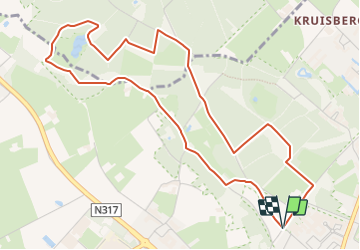
![](/images/other/stat-length.png)
![Trail On foot Doetinchem - Welkom op Hagen! Gele route - Photo](https://media.geolcdn.com/t/1900/400/089bee69-4381-4e79-955f-42cdcaf43b03.jpeg&format=pjpeg&maxdim=2)
Welkom op Hagen! Gele route
SityTrail - itinéraires balisés pédestres
Tous les sentiers balisés d’Europe GUIDE+
![Length](/images/other/stat-length.png)
![Max alt](https://static1.geolcdn.com/siteimages/upload/files/1508320355ic_sort_altitude_max_24dp.png)
![Uphill gradient](https://static1.geolcdn.com/siteimages/upload/files/1508320355ic_sort_den_pos_24dp.png)
![Km-Effort](/images/other/stat-length.png)
![Min alt](https://static1.geolcdn.com/siteimages/upload/files/1508320355ic_sort_altitude_min_24dp.png)
![Downhill gradient](https://static1.geolcdn.com/siteimages/upload/files/1508320355ic_sort_den_neg_24dp.png)
![Boucle](https://static1.geolcdn.com/siteimages/upload/files/16400158638029165_repeat_loop_refresh_sync_direction_icon.png)
![On foot](https://static1.geolcdn.com/sitytour/trail-icons/100.png)
1h16
Difficulty : Easy
![Scan this QR Code to open this trail in the SityTrail application](https://capi.geolives.com/qq0zvz2zws4bq2lad0pu/sitytour/trails/3108584/qr.png?size=200)
FREE GPS app for hiking
About
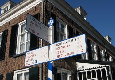
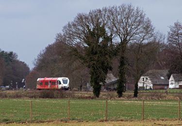
Trail On foot of 5.1 km to be discovered at Gelderland, Unknown, Doetinchem. This trail is proposed by SityTrail - itinéraires balisés pédestres.
Description
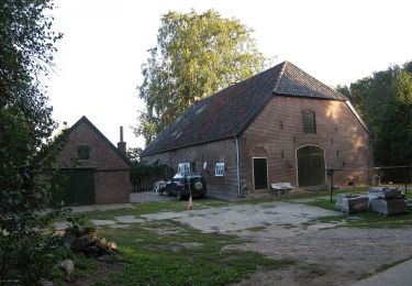
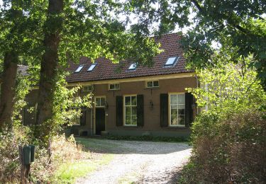
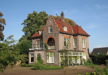
In dit gebied is het fantastisch wandelen. Het heuvelachtige landschap ligt vlak bij Doetinchem. Bossen, lanen, akkers, weilanden, boerderijen, vennen
Website: https://www.glk.nl/82/locatie/?locatie=7
Positioning
Comments
Trails nearby
![Trail On foot Bronckhorst - Um de olden spoorbaan route - Photo](https://media.geolcdn.com/t/375/260/f58de8f1-7535-463c-a610-f26470de493b.jpeg&format=jpg&maxdim=2)
![On foot On foot](https://static1.geolcdn.com/sitytour/trail-icons/100.png)
On foot
![](/images/other/stat-length.png)
![](https://static1.geolcdn.com/siteimages/upload/files/16400158638029165_repeat_loop_refresh_sync_direction_icon.png)
![Trail On foot Bronckhorst - Niet Gedacht route - Photo](https://media.geolcdn.com/t/375/260/ff353e60-3d76-4da2-96cc-1ebbc3ed295f.jpeg&format=jpg&maxdim=2)
![On foot On foot](https://static1.geolcdn.com/sitytour/trail-icons/100.png)
On foot
![](/images/other/stat-length.png)
![](https://static1.geolcdn.com/siteimages/upload/files/16400158638029165_repeat_loop_refresh_sync_direction_icon.png)
![Trail On foot Bronckhorst - De Balen route - Photo](https://media.geolcdn.com/t/375/260/eb77cb94-2ef7-4929-8909-584d5da32a50.jpeg&format=jpg&maxdim=2)
![On foot On foot](https://static1.geolcdn.com/sitytour/trail-icons/100.png)
On foot
![](/images/other/stat-length.png)
![](https://static1.geolcdn.com/siteimages/upload/files/16400158638029165_repeat_loop_refresh_sync_direction_icon.png)
![Trail On foot Bronckhorst - Reuzeroute - Photo](https://media.geolcdn.com/t/375/260/9d5a7619-504f-434c-bf98-97fe6f1849cf.jpeg&format=jpg&maxdim=2)
![On foot On foot](https://static1.geolcdn.com/sitytour/trail-icons/100.png)
On foot
![](/images/other/stat-length.png)
![](https://static1.geolcdn.com/siteimages/upload/files/16400158638029165_repeat_loop_refresh_sync_direction_icon.png)
![Trail On foot Bronckhorst - Kolkenkring - Photo](https://media.geolcdn.com/t/375/260/7f175a07-b288-470d-9a78-70c91519b88c.jpeg&format=jpg&maxdim=2)
![On foot On foot](https://static1.geolcdn.com/sitytour/trail-icons/100.png)
On foot
![](/images/other/stat-length.png)
![](https://static1.geolcdn.com/siteimages/upload/files/16400158638029165_repeat_loop_refresh_sync_direction_icon.png)
![Trail On foot Bronckhorst - Sliekroute - Photo](https://media.geolcdn.com/t/375/260/ff353e60-3d76-4da2-96cc-1ebbc3ed295f.jpeg&format=jpg&maxdim=2)
![On foot On foot](https://static1.geolcdn.com/sitytour/trail-icons/100.png)
On foot
![](/images/other/stat-length.png)
![](https://static1.geolcdn.com/siteimages/upload/files/16400158638029165_repeat_loop_refresh_sync_direction_icon.png)
![Trail On foot Bronckhorst - Enghuizenroute - Photo](https://media.geolcdn.com/t/375/260/232ad94e-45e8-4f1e-a218-77b4e3fd10b1.jpeg&format=jpg&maxdim=2)
![On foot On foot](https://static1.geolcdn.com/sitytour/trail-icons/100.png)
On foot
![](/images/other/stat-length.png)
![](https://static1.geolcdn.com/siteimages/upload/files/16400158638029165_repeat_loop_refresh_sync_direction_icon.png)
![Trail On foot Doetinchem - Dwars door Gelderland (23) - Photo](https://media.geolcdn.com/t/375/260/7519e73c-22c6-40e7-a97c-2f5da3a53aec.jpeg&format=jpg&maxdim=2)
![On foot On foot](https://static1.geolcdn.com/sitytour/trail-icons/100.png)
On foot
![](/images/other/stat-length.png)
![](https://static1.geolcdn.com/siteimages/upload/files/16400158638029165_repeat_loop_refresh_sync_direction_icon.png)
![Trail On foot Doetinchem - Dwars door Gelderland (22) - Photo](https://media.geolcdn.com/t/375/260/41ce4666-c1da-4df0-b985-2fa78a27dabb.jpeg&format=jpg&maxdim=2)
![On foot On foot](https://static1.geolcdn.com/sitytour/trail-icons/100.png)
On foot
![](/images/other/stat-length.png)
![](https://static1.geolcdn.com/siteimages/upload/files/16400158638029165_repeat_loop_refresh_sync_direction_icon.png)