![](/images/other/stat-length.png)
![Trail On foot Baarn - Groene Wissel: Den Dolder - Photo](https://media.geolcdn.com/t/1900/400/dev_850a24b4-5398-4cf4-8038-46aea2d7f167.jpeg&format=pjpeg&maxdim=2)
Groene Wissel: Den Dolder
SityTrail - itinéraires balisés pédestres
Tous les sentiers balisés d’Europe GUIDE+
![Length](/images/other/stat-length.png)
Length
9.4 km
![Max alt](https://static1.geolcdn.com/siteimages/upload/files/1508320355ic_sort_altitude_max_24dp.png)
Max alt
19 m
![Uphill gradient](https://static1.geolcdn.com/siteimages/upload/files/1508320355ic_sort_den_pos_24dp.png)
Uphill gradient
68 m
![Km-Effort](/images/other/stat-length.png)
Km-Effort
10.3 km
![Min alt](https://static1.geolcdn.com/siteimages/upload/files/1508320355ic_sort_altitude_min_24dp.png)
Min alt
1 m
![Downhill gradient](https://static1.geolcdn.com/siteimages/upload/files/1508320355ic_sort_den_neg_24dp.png)
Downhill gradient
73 m
![Boucle](https://static1.geolcdn.com/siteimages/upload/files/16400158638029165_repeat_loop_refresh_sync_direction_icon.png)
Boucle
No
Signpost
Creation date :
2022-02-14 14:22:56.498
Updated on :
2022-02-14 14:22:56.498
![On foot](https://static1.geolcdn.com/sitytour/trail-icons/100.png)
2h20
Difficulty : Easy
![Scan this QR Code to open this trail in the SityTrail application](https://capi.geolives.com/qq0zvz2zws4bq2lad0pu/sitytour/trails/3108395/qr.png?size=200)
FREE GPS app for hiking
About
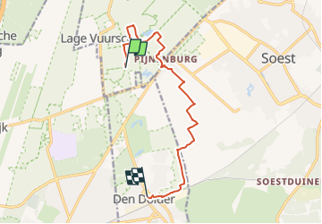
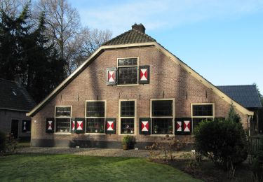
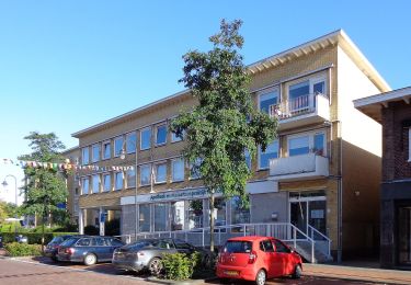
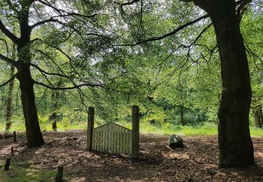
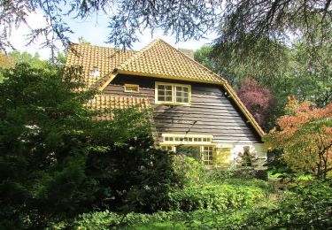
Trail On foot of 9.4 km to be discovered at Utrecht, Unknown, Baarn. This trail is proposed by SityTrail - itinéraires balisés pédestres.
Description
Website: https://www.wandelzoekpagina.nl/groene_wissels/lijst.php
Positioning
Country:
Netherlands
Region :
Utrecht
Department/Province :
Unknown
Municipality :
Baarn
Location:
Unknown
Start:(Dec)
Start:(UTM)
652640 ; 5782545 (31U) N.
Comments
Trails nearby
![Trail On foot Soest - Wandelroute De Paltz - Photo](https://media.geolcdn.com/t/375/260/c32c3301-b885-465e-beab-2c2cd91aa901.jpeg&format=jpg&maxdim=2)
![On foot On foot](https://static1.geolcdn.com/sitytour/trail-icons/100.png)
Wandelroute De Paltz
On foot
Easy
Soest,
Utrecht,
Unknown,
Netherlands
![](/images/other/stat-length.png)
3.2 km | 3.9 km-effort
52min
![](https://static1.geolcdn.com/siteimages/upload/files/16400158638029165_repeat_loop_refresh_sync_direction_icon.png)
Yes
![Trail On foot Soest - Wandelroute Munitiepark - Photo](https://media.geolcdn.com/t/375/260/6d8a7fcd-bd6a-4648-9fd5-54d220069a5f.jpeg&format=jpg&maxdim=2)
![On foot On foot](https://static1.geolcdn.com/sitytour/trail-icons/100.png)
Wandelroute Munitiepark
On foot
Easy
Soest,
Utrecht,
Unknown,
Netherlands
![](/images/other/stat-length.png)
4.3 km | 4.9 km-effort
1h 6min
![](https://static1.geolcdn.com/siteimages/upload/files/16400158638029165_repeat_loop_refresh_sync_direction_icon.png)
Yes
![Trail On foot Hilversum - Groene Wissel: Hilversum Sportpark - Photo](https://media.geolcdn.com/t/375/260/dev_528f4ce4-370c-464d-b32a-5e8b319f87cf.jpeg&format=jpg&maxdim=2)
![On foot On foot](https://static1.geolcdn.com/sitytour/trail-icons/100.png)
Groene Wissel: Hilversum Sportpark
On foot
Easy
Hilversum,
North Holland,
Unknown,
Netherlands
![](/images/other/stat-length.png)
7.2 km | 8 km-effort
1h 48min
![](https://static1.geolcdn.com/siteimages/upload/files/16400158638029165_repeat_loop_refresh_sync_direction_icon.png)
No
![Trail On foot De Bilt - NS-wandeltocht Beukenburg - Photo](https://media.geolcdn.com/t/375/260/dev_8f52ca2c-41df-4198-b97f-ceb9696f4a27.jpeg&format=jpg&maxdim=2)
![On foot On foot](https://static1.geolcdn.com/sitytour/trail-icons/100.png)
NS-wandeltocht Beukenburg
On foot
Easy
De Bilt,
Utrecht,
Unknown,
Netherlands
![](/images/other/stat-length.png)
8.9 km | 9.6 km-effort
2h 10min
![](https://static1.geolcdn.com/siteimages/upload/files/16400158638029165_repeat_loop_refresh_sync_direction_icon.png)
No
![Trail On foot Hilversum - de Zuid, Hilversums Wasmeer - Photo](https://media.geolcdn.com/t/375/260/dev_c475d5d8-782a-4a61-8844-d5ef71b461bf.jpeg&format=jpg&maxdim=2)
![On foot On foot](https://static1.geolcdn.com/sitytour/trail-icons/100.png)
de Zuid, Hilversums Wasmeer
On foot
Easy
Hilversum,
North Holland,
Unknown,
Netherlands
![](/images/other/stat-length.png)
7.7 km | 8.5 km-effort
1h 55min
![](https://static1.geolcdn.com/siteimages/upload/files/16400158638029165_repeat_loop_refresh_sync_direction_icon.png)
Yes
![Trail On foot Hilversum - Hilversums Wasmeer - Photo](https://media.geolcdn.com/t/375/260/dev_e6664ef7-bd3d-4c00-802b-2571cb844ce9.jpeg&format=jpg&maxdim=2)
![On foot On foot](https://static1.geolcdn.com/sitytour/trail-icons/100.png)
Hilversums Wasmeer
On foot
Easy
Hilversum,
North Holland,
Unknown,
Netherlands
![](/images/other/stat-length.png)
5 km | 5.4 km-effort
1h 13min
![](https://static1.geolcdn.com/siteimages/upload/files/16400158638029165_repeat_loop_refresh_sync_direction_icon.png)
Yes
![Trail On foot De Bilt - Rondom Berg en Bosch - Photo](https://media.geolcdn.com/t/375/260/dev_4ef83e84-90f5-45a0-86d1-6c65266f97e1.jpeg&format=jpg&maxdim=2)
![On foot On foot](https://static1.geolcdn.com/sitytour/trail-icons/100.png)
Rondom Berg en Bosch
On foot
Easy
De Bilt,
Utrecht,
Unknown,
Netherlands
![](/images/other/stat-length.png)
3.5 km | 3.9 km-effort
52min
![](https://static1.geolcdn.com/siteimages/upload/files/16400158638029165_repeat_loop_refresh_sync_direction_icon.png)
No
![Trail On foot De Bilt - Natuurpad De Leyen - Photo](https://media.geolcdn.com/t/375/260/dev_aae1b7e7-7922-4385-abb3-d57417f6b90a.jpeg&format=jpg&maxdim=2)
![On foot On foot](https://static1.geolcdn.com/sitytour/trail-icons/100.png)
Natuurpad De Leyen
On foot
Easy
De Bilt,
Utrecht,
Unknown,
Netherlands
![](/images/other/stat-length.png)
3.5 km | 3.8 km-effort
52min
![](https://static1.geolcdn.com/siteimages/upload/files/16400158638029165_repeat_loop_refresh_sync_direction_icon.png)
Yes
![Trail On foot Hilversum - Hoorneboegse Heide - Photo](https://media.geolcdn.com/t/375/260/dev_5bea5ddc-0438-4f77-9d97-60b1c81d18b4.jpeg&format=jpg&maxdim=2)
![On foot On foot](https://static1.geolcdn.com/sitytour/trail-icons/100.png)
Hoorneboegse Heide
On foot
Easy
Hilversum,
North Holland,
Unknown,
Netherlands
![](/images/other/stat-length.png)
6.8 km | 7.7 km-effort
1h 44min
![](https://static1.geolcdn.com/siteimages/upload/files/16400158638029165_repeat_loop_refresh_sync_direction_icon.png)
No