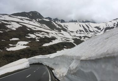

Rifugio Maria Luisa - Bocchetta di Valmaggia
SityTrail - itinéraires balisés pédestres
Tous les sentiers balisés d’Europe GUIDE+

Length
3.8 km

Max alt
2631 m

Uphill gradient
473 m

Km-Effort
8.6 km

Min alt
2156 m

Downhill gradient
7 m
Boucle
No
Signpost
Creation date :
2022-02-14 08:58:30.826
Updated on :
2022-02-28 12:54:41.716
1h56
Difficulty : Easy

FREE GPS app for hiking
About
Trail On foot of 3.8 km to be discovered at Piemont, Verbano-Cusio-Ossola, Formazza. This trail is proposed by SityTrail - itinéraires balisés pédestres.
Description
EVBAG240000 Bivio G20, Rifugio Maria Luisa - Bocchetta di Valmaggia
Positioning
Country:
Italy
Region :
Piemont
Department/Province :
Verbano-Cusio-Ossola
Municipality :
Formazza
Location:
Unknown
Start:(Dec)
Start:(UTM)
456254 ; 5142302 (32T) N.
Comments
Trails nearby

Capanna Corno Gries-Ladstafel


On foot
Easy
Bedretto,
Ticino,
Distretto di Leventina,
Switzerland

4.4 km | 6.8 km-effort
1h 33min
No

ST_nadine


Other activity
Very easy
Obergoms,
Valais/Wallis,
Goms,
Switzerland

28 km | 47 km-effort
10h 34min
No

YHH113 Stans à Ponte (7e jour)


Walking
Difficult
Obergoms,
Valais/Wallis,
Goms,
Switzerland

11.5 km | 21 km-effort
4h 10min
No

Rossbode (Nüfenenpass) - Griessee


Walking
Easy
Obergoms,
Valais/Wallis,
Goms,
Switzerland

5.7 km | 8.5 km-effort
1h 30min
Yes

Griesse_Riale_Formazza_Italy


Other activity
Very easy
Formazza,
Piemont,
Verbano-Cusio-Ossola,
Italy

7.2 km | 9.8 km-effort
Unknown
No

Alpe Devero - Cascate del Toce


Walking
Very easy
Formazza,
Piemont,
Verbano-Cusio-Ossola,
Italy

24 km | 42 km-effort
9h 44min
No

Wallis ins Tessin 4. Tag Route Variante A


Other activity
Very easy
Bedretto,
Ticino,
Distretto di Leventina,
Switzerland

13.1 km | 26 km-effort
Unknown
No

Wallis ins Tessin 3. Tag


Other activity
Very easy
Formazza,
Piemont,
Verbano-Cusio-Ossola,
Italy

16.1 km | 34 km-effort
Unknown
No

TI / val bavona 2. tag


Other activity
Very easy
Cevio,
Ticino,
Distretto di Vallemaggia,
Switzerland

10.9 km | 21 km-effort
Unknown
No


 SityTrail


