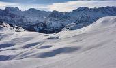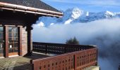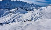

Les Crosets-Sur Cou
SityTrail - itinéraires balisés pédestres
Tous les sentiers balisés d’Europe GUIDE+

Length
3.6 km

Max alt
1684 m

Uphill gradient
16 m

Km-Effort
4.8 km

Min alt
1354 m

Downhill gradient
328 m
Boucle
No
Signpost
Creation date :
2022-02-14 08:47:52.862
Updated on :
2022-02-14 08:47:52.862
1h06
Difficulty : Easy

FREE GPS app for hiking
About
Trail On foot of 3.6 km to be discovered at Valais/Wallis, Monthey, Val-d'Illiez. This trail is proposed by SityTrail - itinéraires balisés pédestres.
Description
Symbol: gelbe Raute
Positioning
Country:
Switzerland
Region :
Valais/Wallis
Department/Province :
Monthey
Municipality :
Val-d'Illiez
Location:
Unknown
Start:(Dec)
Start:(UTM)
332850 ; 5116764 (32T) N.
Comments
Trails nearby
d'Avoriaz aux Mines d'or par le col du Fornet et le col de Cou


Walking
Medium
(1)
Morzine,
Auvergne-Rhône-Alpes,
Upper Savoy,
France

9.6 km | 17.9 km-effort
3h 28min
No
Mont de grange depuis le col de Bassachaux


Walking
Difficult
(2)
Châtel,
Auvergne-Rhône-Alpes,
Upper Savoy,
France

16.5 km | 30 km-effort
6h 7min
Yes

Champéry - Die Galérie Défago


Walking
Very easy
(1)
Champéry,
Valais/Wallis,
Monthey,
Switzerland

10.1 km | 15 km-effort
3h 38min
No
Col de Bassachaux le lac vert 7 juillet 2022


Walking
Very difficult
Abondance,
Auvergne-Rhône-Alpes,
Upper Savoy,
France

13.3 km | 19.9 km-effort
3h 11min
Yes
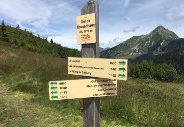
Bassachaux - Aup Couti


Walking
Easy
Abondance,
Auvergne-Rhône-Alpes,
Upper Savoy,
France

4.4 km | 6.6 km-effort
1h 46min
Yes
La Foilleuze - Madzé - Morgins


Snowshoes
Very easy
Troistorrents,
Valais/Wallis,
Monthey,
Switzerland

5.1 km | 7 km-effort
1h 47min
No
Bassachaux- Lac Vert


Walking
Easy
Châtel,
Auvergne-Rhône-Alpes,
Upper Savoy,
France

8.7 km | 13.6 km-effort
4h 10min
No
lindaret lac de la plagne


Mountain bike
Difficult
Montriond,
Auvergne-Rhône-Alpes,
Upper Savoy,
France

24 km | 40 km-effort
4h 14min
Yes


 SityTrail


