

Moulin Jeannottat-Les Pommerats
SityTrail - itinéraires balisés pédestres
Tous les sentiers balisés d’Europe GUIDE+

Length
4.3 km

Max alt
926 m

Uphill gradient
402 m

Km-Effort
8.5 km

Min alt
532 m

Downhill gradient
35 m
Boucle
No
Signpost
Creation date :
2022-02-14 08:46:10.01
Updated on :
2022-02-14 08:46:10.01
1h55
Difficulty : Easy

FREE GPS app for hiking
About
Trail On foot of 4.3 km to be discovered at Jura, District des Franches-Montagnes, Saignelégier. This trail is proposed by SityTrail - itinéraires balisés pédestres.
Description
Moulin Jeannottat-Les Pommerats
Symbol: gelbe Raute
Positioning
Country:
Switzerland
Region :
Jura
Department/Province :
District des Franches-Montagnes
Municipality :
Saignelégier
Location:
Unknown
Start:(Dec)
Start:(UTM)
348247 ; 5239955 (32T) N.
Comments
Trails nearby
Circuit du barrage de la Goule


Walking
Medium
Goumois,
Bourgogne-Franche-Comté,
Doubs,
France

13.8 km | 18.8 km-effort
3h 36min
Yes
Soubey - Les Enfers


On foot
Easy
Soubey,
Jura,
District des Franches-Montagnes,
Switzerland

3.5 km | 8.2 km-effort
1h 52min
No

Soubey - Moulin Jeannottat


On foot
Easy
Soubey,
Jura,
District des Franches-Montagnes,
Switzerland

5.1 km | 7.6 km-effort
1h 43min
No
Les Sommêtres


Walking
Medium
Goumois,
Bourgogne-Franche-Comté,
Doubs,
France

24 km | 37 km-effort
7h 54min
No

Montfaucon - Le Bémont


On foot
Easy
Montfaucon,
Jura,
District des Franches-Montagnes,
Switzerland

3.6 km | 4.2 km-effort
56min
No

Les Enfers - La Bosse


On foot
Easy
Les Enfers,
Jura,
District des Franches-Montagnes,
Switzerland

3.2 km | 3.9 km-effort
52min
No

La Bosse - Montfaucon


On foot
Easy
Le Bémont (JU),
Jura,
District des Franches-Montagnes,
Switzerland

3.6 km | 4.5 km-effort
1h 1min
No
Goumois


Walking
Easy
Goumois,
Bourgogne-Franche-Comté,
Doubs,
France

13.6 km | 19.4 km-effort
5h 42min
Yes
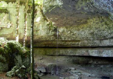
La Chute du Bief de Vautenaivre et le Château Cugny.


Walking
Medium
Goumois,
Bourgogne-Franche-Comté,
Doubs,
France

15.2 km | 23 km-effort
5h 30min
Yes


 SityTrail


