![](/images/other/stat-length.png)
![Trail On foot Remigen - Remigen - Ufem Berg - Photo](https://media.geolcdn.com/t/1900/400/dev_e1048505-e268-4013-88ab-c9e5ae5595de.jpeg&format=pjpeg&maxdim=2)
Remigen - Ufem Berg
SityTrail - itinéraires balisés pédestres
Tous les sentiers balisés d’Europe GUIDE+
![Length](/images/other/stat-length.png)
Length
5.9 km
![Max alt](https://static1.geolcdn.com/siteimages/upload/files/1508320355ic_sort_altitude_max_24dp.png)
Max alt
538 m
![Uphill gradient](https://static1.geolcdn.com/siteimages/upload/files/1508320355ic_sort_den_pos_24dp.png)
Uphill gradient
236 m
![Km-Effort](/images/other/stat-length.png)
Km-Effort
8.5 km
![Min alt](https://static1.geolcdn.com/siteimages/upload/files/1508320355ic_sort_altitude_min_24dp.png)
Min alt
366 m
![Downhill gradient](https://static1.geolcdn.com/siteimages/upload/files/1508320355ic_sort_den_neg_24dp.png)
Downhill gradient
95 m
![Boucle](https://static1.geolcdn.com/siteimages/upload/files/16400158638029165_repeat_loop_refresh_sync_direction_icon.png)
Boucle
No
Signpost
Creation date :
2022-02-14 08:44:22.402
Updated on :
2022-02-14 08:44:22.402
![On foot](https://static1.geolcdn.com/sitytour/trail-icons/100.png)
1h56
Difficulty : Easy
![Scan this QR Code to open this trail in the SityTrail application](https://capi.geolives.com/qq0zvz2zws4bq2lad0pu/sitytour/trails/3105778/qr.png?size=200)
FREE GPS app for hiking
About
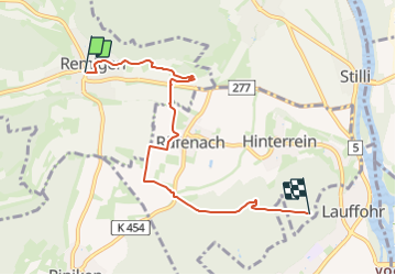
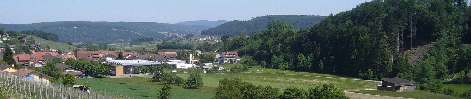
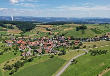
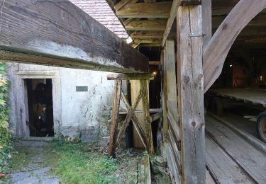
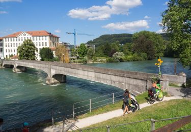
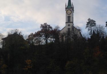
Trail On foot of 5.9 km to be discovered at Aargau, Bezirk Brugg, Remigen. This trail is proposed by SityTrail - itinéraires balisés pédestres.
Description
Remigen - Ufem Berg
Symbol: gelber Diamant (waagrecht)
Positioning
Country:
Switzerland
Region :
Aargau
Department/Province :
Bezirk Brugg
Municipality :
Remigen
Location:
Unknown
Start:(Dec)
Start:(UTM)
438961 ; 5262762 (32T) N.
Comments
Trails nearby
![Trail On foot Untersiggenthal - Ennetturgi Holzbrücke - Steinenbüel - Photo](https://media.geolcdn.com/t/375/260/3e121540-fcae-4f8d-b61e-2fef7935c935.jpeg&format=jpg&maxdim=2)
![On foot On foot](https://static1.geolcdn.com/sitytour/trail-icons/100.png)
Ennetturgi Holzbrücke - Steinenbüel
On foot
Easy
Untersiggenthal,
Aargau,
Bezirk Baden,
Switzerland
![](/images/other/stat-length.png)
3.6 km | 6.2 km-effort
1h 24min
![](https://static1.geolcdn.com/siteimages/upload/files/16400158638029165_repeat_loop_refresh_sync_direction_icon.png)
No
![Trail On foot Remigen - Bürersteig - Mandach - Photo](https://media.geolcdn.com/t/375/260/dev_da9ea82e-77bb-44ef-a8bb-511fe399a72b.jpeg&format=jpg&maxdim=2)
![On foot On foot](https://static1.geolcdn.com/sitytour/trail-icons/100.png)
Bürersteig - Mandach
On foot
Easy
Remigen,
Aargau,
Bezirk Brugg,
Switzerland
![](/images/other/stat-length.png)
4.6 km | 6.3 km-effort
1h 26min
![](https://static1.geolcdn.com/siteimages/upload/files/16400158638029165_repeat_loop_refresh_sync_direction_icon.png)
No
![Trail On foot Böttstein - Böttstein - fixme - Photo](https://media.geolcdn.com/t/375/260/881ebed4-6226-42e9-9492-babe04cae37c.jpeg&format=jpg&maxdim=2)
![On foot On foot](https://static1.geolcdn.com/sitytour/trail-icons/100.png)
Böttstein - fixme
On foot
Easy
Böttstein,
Aargau,
Bezirk Zurzach,
Switzerland
![](/images/other/stat-length.png)
3.8 km | 4.3 km-effort
58min
![](https://static1.geolcdn.com/siteimages/upload/files/16400158638029165_repeat_loop_refresh_sync_direction_icon.png)
No
![Trail On foot Windisch - Unterwiindisch - Turgi - Photo](https://media.geolcdn.com/t/375/260/cf058ad3-8aa4-441c-bd2c-9c0f1141337f.jpeg&format=jpg&maxdim=2)
![On foot On foot](https://static1.geolcdn.com/sitytour/trail-icons/100.png)
Unterwiindisch - Turgi
On foot
Easy
Windisch,
Aargau,
Bezirk Brugg,
Switzerland
![](/images/other/stat-length.png)
3 km | 3.4 km-effort
46min
![](https://static1.geolcdn.com/siteimages/upload/files/16400158638029165_repeat_loop_refresh_sync_direction_icon.png)
No
![Trail On foot Untersiggenthal - Baden - Brücke Stilli - Photo](https://media.geolcdn.com/t/375/260/eb6ae827-95ad-456e-ad5e-545397385a18.jpeg&format=jpg&maxdim=2)
![On foot On foot](https://static1.geolcdn.com/sitytour/trail-icons/100.png)
Baden - Brücke Stilli
On foot
Easy
Untersiggenthal,
Aargau,
Bezirk Baden,
Switzerland
![](/images/other/stat-length.png)
8.6 km | 10 km-effort
2h 16min
![](https://static1.geolcdn.com/siteimages/upload/files/16400158638029165_repeat_loop_refresh_sync_direction_icon.png)
No
![Trail On foot Brugg - Scherz - Brugg - Photo](https://media.geolcdn.com/t/375/260/f68a7939-e02d-46f7-b3f3-362e8d2276d7.jpeg&format=jpg&maxdim=2)
![On foot On foot](https://static1.geolcdn.com/sitytour/trail-icons/100.png)
Scherz - Brugg
On foot
Easy
Brugg,
Aargau,
Bezirk Brugg,
Switzerland
![](/images/other/stat-length.png)
4.3 km | 5.8 km-effort
1h 19min
![](https://static1.geolcdn.com/siteimages/upload/files/16400158638029165_repeat_loop_refresh_sync_direction_icon.png)
No
![Trail On foot Gebenstorf - Brücke Birmenstorf Werd - Gebenstorf Steg - Photo](https://media.geolcdn.com/t/375/260/dd67f23a-de97-4485-a0d7-2040e341f13e.jpeg&format=jpg&maxdim=2)
![On foot On foot](https://static1.geolcdn.com/sitytour/trail-icons/100.png)
Brücke Birmenstorf Werd - Gebenstorf Steg
On foot
Easy
Gebenstorf,
Aargau,
Bezirk Baden,
Switzerland
![](/images/other/stat-length.png)
4.5 km | 5.5 km-effort
1h 14min
![](https://static1.geolcdn.com/siteimages/upload/files/16400158638029165_repeat_loop_refresh_sync_direction_icon.png)
No
![Trail On foot Riniken - Riniken - Vorder Rein - Photo](https://media.geolcdn.com/t/375/260/2b0d6164-370d-476b-8077-e486843b561e.jpeg&format=jpg&maxdim=2)
![On foot On foot](https://static1.geolcdn.com/sitytour/trail-icons/100.png)
Riniken - Vorder Rein
On foot
Easy
Riniken,
Aargau,
Bezirk Brugg,
Switzerland
![](/images/other/stat-length.png)
4.6 km | 6.1 km-effort
1h 23min
![](https://static1.geolcdn.com/siteimages/upload/files/16400158638029165_repeat_loop_refresh_sync_direction_icon.png)
No
![Trail On foot Döttingen - Beznau Steg - Döttingen Brücke - Photo](https://media.geolcdn.com/t/375/260/4abb3af5-071f-49b9-9795-e4217ac9b402.jpeg&format=jpg&maxdim=2)
![On foot On foot](https://static1.geolcdn.com/sitytour/trail-icons/100.png)
Beznau Steg - Döttingen Brücke
On foot
Easy
Döttingen,
Aargau,
Bezirk Zurzach,
Switzerland
![](/images/other/stat-length.png)
3.8 km | 4.4 km-effort
1h 0min
![](https://static1.geolcdn.com/siteimages/upload/files/16400158638029165_repeat_loop_refresh_sync_direction_icon.png)
No