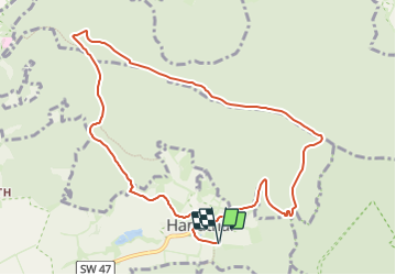
![](/images/other/stat-length.png)
![Trail On foot Oberschwarzach - Rundweg Waldläufer O2 - Photo](https://media.geolcdn.com/t/1900/400/d01c44f3-91c5-4b45-ac95-79ba7cb389b3.jpeg&format=pjpeg&maxdim=2)
Rundweg Waldläufer O2
SityTrail - itinéraires balisés pédestres
Tous les sentiers balisés d’Europe GUIDE+
![Length](/images/other/stat-length.png)
![Max alt](https://static1.geolcdn.com/siteimages/upload/files/1508320355ic_sort_altitude_max_24dp.png)
![Uphill gradient](https://static1.geolcdn.com/siteimages/upload/files/1508320355ic_sort_den_pos_24dp.png)
![Km-Effort](/images/other/stat-length.png)
![Min alt](https://static1.geolcdn.com/siteimages/upload/files/1508320355ic_sort_altitude_min_24dp.png)
![Downhill gradient](https://static1.geolcdn.com/siteimages/upload/files/1508320355ic_sort_den_neg_24dp.png)
![Boucle](https://static1.geolcdn.com/siteimages/upload/files/16400158638029165_repeat_loop_refresh_sync_direction_icon.png)
![On foot](https://static1.geolcdn.com/sitytour/trail-icons/100.png)
3h02
Difficulty : Easy
![Scan this QR Code to open this trail in the SityTrail application](https://capi.geolives.com/qq0zvz2zws4bq2lad0pu/sitytour/trails/3102156/qr.png?size=200)
FREE GPS app for hiking
About
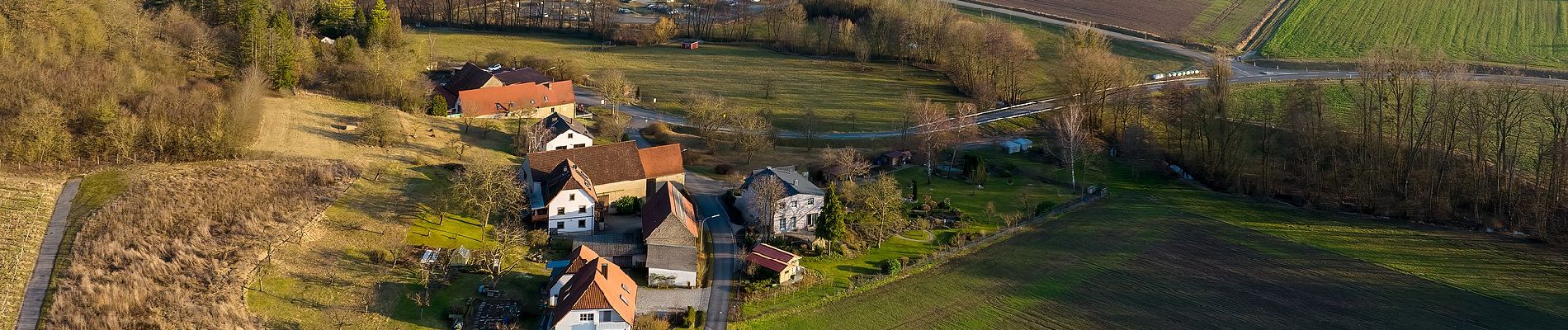
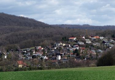
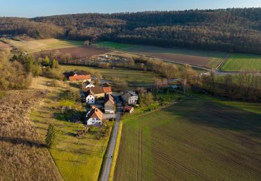
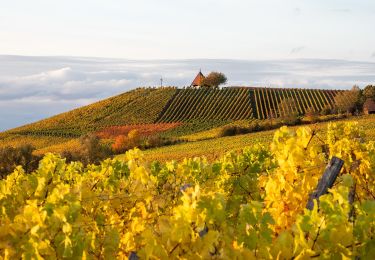
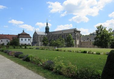
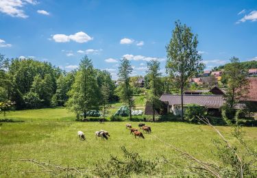
Trail On foot of 10.2 km to be discovered at Bavaria, Landkreis Schweinfurt, Oberschwarzach. This trail is proposed by SityTrail - itinéraires balisés pédestres.
Description
Trail created by Gemeinde Oberschwarzach.
Teilweise auch Markierung "Schwarze O2 auf gelbem Hintergrund"
Symbol: Grüner Wanderer unter stilisiertem Baum auf weißem Hintergrund mit schwarzer Beschriftung "O2"
Positioning
Comments
Trails nearby
![Trail On foot Bürgerwald - Rundweg Michelau M6 - Photo](https://media.geolcdn.com/t/375/260/8dddb9d6-2098-46cc-8c62-50658740efe5.jpeg&format=jpg&maxdim=2)
![On foot On foot](https://static1.geolcdn.com/sitytour/trail-icons/100.png)
On foot
![](/images/other/stat-length.png)
![](https://static1.geolcdn.com/siteimages/upload/files/16400158638029165_repeat_loop_refresh_sync_direction_icon.png)
![Trail On foot Stollbergerforst - Rundweg Oberschwarzach O1 - Photo](https://media.geolcdn.com/t/375/260/d01c44f3-91c5-4b45-ac95-79ba7cb389b3.jpeg&format=jpg&maxdim=2)
![On foot On foot](https://static1.geolcdn.com/sitytour/trail-icons/100.png)
On foot
![](/images/other/stat-length.png)
![](https://static1.geolcdn.com/siteimages/upload/files/16400158638029165_repeat_loop_refresh_sync_direction_icon.png)
![Trail On foot Oberschwarzach - Rundweg Stollburg - Photo](https://media.geolcdn.com/t/375/260/d01c44f3-91c5-4b45-ac95-79ba7cb389b3.jpeg&format=jpg&maxdim=2)
![On foot On foot](https://static1.geolcdn.com/sitytour/trail-icons/100.png)
On foot
![](/images/other/stat-length.png)
![](https://static1.geolcdn.com/siteimages/upload/files/16400158638029165_repeat_loop_refresh_sync_direction_icon.png)
![Trail On foot Oberschwarzach - Rundweg O5 - Photo](https://media.geolcdn.com/t/375/260/d8a1cb9f-7a37-4a27-851a-3b1df85e082c.jpeg&format=jpg&maxdim=2)
![On foot On foot](https://static1.geolcdn.com/sitytour/trail-icons/100.png)
On foot
![](/images/other/stat-length.png)
![](https://static1.geolcdn.com/siteimages/upload/files/16400158638029165_repeat_loop_refresh_sync_direction_icon.png)
![Trail On foot Oberschwarzach - Rundweg Hörnle - Photo](https://media.geolcdn.com/t/375/260/7c130285-0209-4a5e-a0ec-bcbda90efd55.jpeg&format=jpg&maxdim=2)
![On foot On foot](https://static1.geolcdn.com/sitytour/trail-icons/100.png)
On foot
![](/images/other/stat-length.png)
![](https://static1.geolcdn.com/siteimages/upload/files/16400158638029165_repeat_loop_refresh_sync_direction_icon.png)
![Trail On foot Geiersberg - Rundweg Oberschwarzach O4 - Photo](https://media.geolcdn.com/t/375/260/49154601-850b-43bb-9b48-b34ba75c0f3a.jpeg&format=jpg&maxdim=2)
![On foot On foot](https://static1.geolcdn.com/sitytour/trail-icons/100.png)
On foot
![](/images/other/stat-length.png)
![](https://static1.geolcdn.com/siteimages/upload/files/16400158638029165_repeat_loop_refresh_sync_direction_icon.png)
![Trail On foot Ebrach - Rundweg E 6 - Photo](https://media.geolcdn.com/t/375/260/01437351-9703-4caf-b7ca-9a8a52aa6410.jpeg&format=jpg&maxdim=2)
![On foot On foot](https://static1.geolcdn.com/sitytour/trail-icons/100.png)
On foot
![](/images/other/stat-length.png)
![](https://static1.geolcdn.com/siteimages/upload/files/16400158638029165_repeat_loop_refresh_sync_direction_icon.png)
![Trail On foot Ebrach - Wanderweg Grüner Tropfen - Photo](https://media.geolcdn.com/t/375/260/5a4fd179-fb89-492a-b9e1-8de4527efff3.jpeg&format=jpg&maxdim=2)
![On foot On foot](https://static1.geolcdn.com/sitytour/trail-icons/100.png)
On foot
![](/images/other/stat-length.png)
![](https://static1.geolcdn.com/siteimages/upload/files/16400158638029165_repeat_loop_refresh_sync_direction_icon.png)
![Trail On foot Ebrach - Rundweg](https://media.geolcdn.com/t/375/260/96edf94f-2937-4db8-ba6c-5094fb597450.jpeg&format=jpg&maxdim=2)
![On foot On foot](https://static1.geolcdn.com/sitytour/trail-icons/100.png)
On foot
![](/images/other/stat-length.png)
![](https://static1.geolcdn.com/siteimages/upload/files/16400158638029165_repeat_loop_refresh_sync_direction_icon.png)