


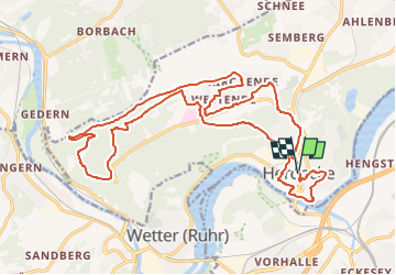

17.7 km | 24 km-effort
![Trail On foot Herdecke - [H6] Waldgebiete - Photo](https://media.geolcdn.com/t/1900/400/fc184e54-a300-4080-bfb1-ee5af7544b8a.jpeg&format=pjpeg&maxdim=2)

Tous les sentiers balisés d’Europe GUIDE+


FREE GPS app for hiking
 SityTrail
IGN / Geographical institutes
SityTrail World
The world is yours!
Trail On foot of 22 km to be discovered at North Rhine-Westphalia, Ennepe-Ruhr-Kreis, Herdecke. This trail is proposed by SityTrail - itinéraires balisés pédestres.
Trail created by Sauerländischer Gebirgsverein.
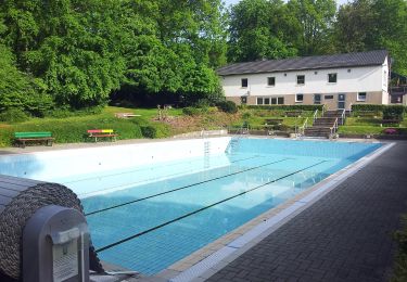
![Trail On foot Herdecke - [H6] Waldgebiete - Photo 1](https://media.geolcdn.com/t/2048/auto/fc184e54-a300-4080-bfb1-ee5af7544b8a.jpeg&format=jpg&maxdim=0 "Trail On foot Herdecke - [H6] Waldgebiete - Photo 1")
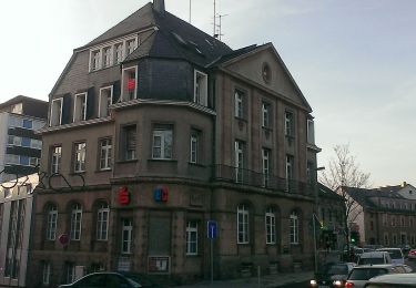
![Trail On foot Herdecke - [H6] Waldgebiete - Photo 2](https://media.geolcdn.com/t/2048/auto/d013cfce-eb57-4747-ae96-cd2341d803b1.jpeg&format=jpg&maxdim=0 "Trail On foot Herdecke - [H6] Waldgebiete - Photo 2")
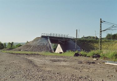
![Trail On foot Herdecke - [H6] Waldgebiete - Photo 3](https://media.geolcdn.com/t/2048/auto/1a148d1c-95e2-43ed-bee8-bb698ccdc6b4.jpeg&format=jpg&maxdim=0 "Trail On foot Herdecke - [H6] Waldgebiete - Photo 3")
![Trail On foot Herdecke - [H6] Waldgebiete - Photo 4](https://media.geolcdn.com/t/2048/auto/35c18f16-33cc-4dd3-9634-b5b18362260b.jpeg&format=jpg&maxdim=0 "Trail On foot Herdecke - [H6] Waldgebiete - Photo 4")
![Trail On foot Herdecke - [H6] Waldgebiete - Photo 5](https://media.geolcdn.com/t/2048/auto/9e26fe4e-ac4d-448a-a9d5-eb30bced0fb8.jpeg&format=jpg&maxdim=0 "Trail On foot Herdecke - [H6] Waldgebiete - Photo 5")
![Trail On foot Herdecke - [H6] Waldgebiete - Photo 6](https://media.geolcdn.com/t/2048/auto/4cbfc089-d3c5-41af-9f79-f906e28c082b.jpeg&format=jpg&maxdim=0 "Trail On foot Herdecke - [H6] Waldgebiete - Photo 6")
![Trail On foot Herdecke - [H6] Waldgebiete - Photo 7](https://media.geolcdn.com/t/2048/auto/03b8680f-a216-42f4-b768-10007627a4fa.jpeg&format=jpg&maxdim=0 "Trail On foot Herdecke - [H6] Waldgebiete - Photo 7")
![Trail On foot Herdecke - [H6] Waldgebiete - Photo 8](https://media.geolcdn.com/t/2048/auto/f2cbd443-1d91-43f3-bf1f-ecd6b8aad373.jpeg&format=jpg&maxdim=0 "Trail On foot Herdecke - [H6] Waldgebiete - Photo 8")
![Trail On foot Herdecke - [H6] Waldgebiete - Photo 9](https://media.geolcdn.com/t/2048/auto/2ac1126f-b8ab-40ab-9103-a862993f2233.jpeg&format=jpg&maxdim=0 "Trail On foot Herdecke - [H6] Waldgebiete - Photo 9")
![Trail On foot Herdecke - [H6] Waldgebiete - Photo 10](https://media.geolcdn.com/t/2048/auto/1d57ea3d-c693-4eaf-ab16-727d0605792c.jpeg&format=jpg&maxdim=0 "Trail On foot Herdecke - [H6] Waldgebiete - Photo 10")
![Trail On foot Herdecke - [H5] Westende - Kirchende - Ostende - Photo](https://media.geolcdn.com/t/375/260/a4190d68-4b9d-4b0c-86e3-91419be4a223.jpeg&format=jpg&maxdim=2)
On foot
![Trail On foot Herdecke - [H3] Hengsteysee und Teufelskanzel - Photo](https://media.geolcdn.com/t/375/260/48a0ef8e-3704-4b57-a4cf-02a57ebc2595.jpeg&format=jpg&maxdim=2)
On foot
![Trail On foot Herdecke - [H2] Ruhrtal zum Hickenstein - Photo](https://media.geolcdn.com/t/375/260/47dfa9a4-572d-4f34-b111-ae10e112c377.jpeg&format=jpg&maxdim=2)
On foot
![Trail On foot Herdecke - [H1] Viadukt und Nacken - Photo](https://media.geolcdn.com/t/375/260/0816fcff-a194-4a3a-b211-f59c276124fc.jpeg&format=jpg&maxdim=2)
On foot
On foot
On foot
On foot
On foot
![Trail On foot Unknown - [-] Höhenweg Wehringhausen - Herdecke - Photo](https://media.geolcdn.com/t/375/260/4387e361-0797-400d-87e7-45695bb9bdc7.jpeg&format=jpg&maxdim=2)
On foot